The takeoff experience from Kathmandu—with unobstructed views of the Himalayan peaks and the dramatic valley geography—outweighs the landing views. The Himalayas are more visually striking and geographically significant than the Aegean coastal approach to Izmir.
Flown KTM to ADB? Did we get it right?
Flight Path
Kathmandu to Izmir is 3,395 miles (5,464 km), a flight of about 5 hours 15 minutes.
The flight path crosses the Indo-Gangetic Plain (visible as flat, hazy agricultural terrain), then transitions over the Thar Desert region of northwest India and Pakistan. The Indus River valley and the Hindu Kush foothills appear in the distance as the aircraft approaches Turkish airspace. The Anatolian Plateau dominates the latter half of the flight, with sparse settlements and dry terrain visible until descent toward the Aegean coast.
Great circle distance and headings ›

Phase by phase
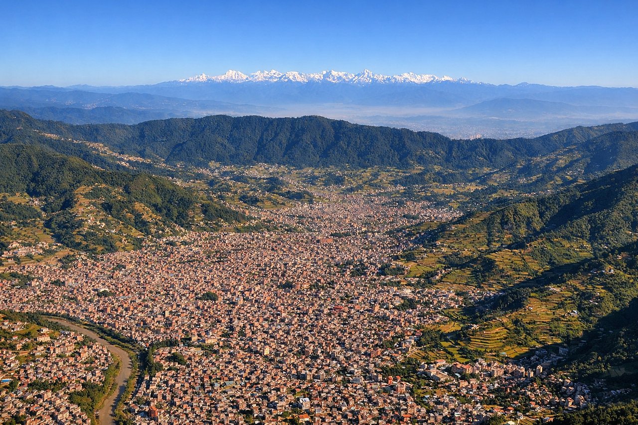
Takeoff from KTM
LEFTLeft side offers immediate views of the Kathmandu Valley rim and the snow-capped Himalayan peaks to the north and northeast, including Langtang Lirung and Gaurishankar. The aircraft climbs northwestward initially, positioning left-side passengers for the best perspective of these mountains as they recede.
Landing at ADB
RIGHTRight side provides views of the Aegean coastline, the Izmir Gulf, and the city of Izmir itself during the descent and approach. The aircraft descends from the east-northeast, making right-side seats ideal for seeing the coastal geography and urban sprawl of Izmir before touchdown.
Will your flight be in sunlight?
Pick a date and time in the Sun Map to watch the sun move across your whole flight.
About This Route
Which side of the plane should I sit on flying from Tribhuvan International (KTM) to Adnan Menderes (ADB)?
Sit on the Left side of the plane for the best views on flights from Kathmandu to Izmir. The takeoff experience from Kathmandu—with unobstructed views of the Himalayan peaks and the dramatic valley geography—outweighs the landing views. The Himalayas are more visually striking and geographically significant than the Aegean coastal approach to Izmir.
What can I see during takeoff from Tribhuvan International in Kathmandu?
During takeoff from Tribhuvan International (KTM), sit on the Left side for the best views. Left side offers immediate views of the Kathmandu Valley rim and the snow-capped Himalayan peaks to the north and northeast, including Langtang Lirung and Gaurishankar. The aircraft climbs northwestward initially, positioning left-side passengers for the best perspective of these mountains as they recede. Notable sights include: Kathmandu Valley urban sprawl, Langtang Lirung (23,711 ft), Gaurishankar (20,299 ft), Shivapuri Ridge.
What can I see when landing at Adnan Menderes in Izmir?
When landing at Adnan Menderes (ADB), sit on the Right side for the best views. Right side provides views of the Aegean coastline, the Izmir Gulf, and the city of Izmir itself during the descent and approach. The aircraft descends from the east-northeast, making right-side seats ideal for seeing the coastal geography and urban sprawl of Izmir before touchdown. Notable sights include: Izmir Gulf, Aegean Sea coastline, Mount Pagus (Alsancak district), Izmir city waterfront.
How long is the flight from Kathmandu to Izmir?
The flight from Tribhuvan International (KTM) to Adnan Menderes (ADB) takes about 5 hours 15 minutes. The shortest flight path between them is 3,395 miles (5,464 km); winds and air traffic control usually add a few percent.
What does the Kathmandu to Izmir flight path pass over?
The flight path crosses the Indo-Gangetic Plain (visible as flat, hazy agricultural terrain), then transitions over the Thar Desert region of northwest India and Pakistan. The Indus River valley and the Hindu Kush foothills appear in the distance as the aircraft approaches Turkish airspace. The Anatolian Plateau dominates the latter half of the flight, with sparse settlements and dry terrain visible until descent toward the Aegean coast.