Kathmandu to Banjarmasin is 2,908 miles (4,680 km), a flight of about 6 hours 5 minutes.
Right-side seats capture the dramatic Kathmandu Valley departure and the Himalayan foothills during climb. While the landing approach favors the left, the takeoff experience over Nepal's mountain terrain is more visually distinctive than the flat delta approach to Banjarmasin.
Flight Path
The flight path crosses the Indo-Gangetic Plain and enters Southeast Asia over northern India and Bangladesh. Notable features include the Ganges River system (visible as a broad, meandering river with extensive floodplain), the transition from Himalayan foothills to flat alluvial plains, and the dense agricultural landscape of the Bengal region. As the aircraft approaches Borneo, the terrain transitions to tropical lowlands with increasing river systems and wetlands. The Rajang River system in Sarawak may be visible on southern routing variants. Throughout the descent into Banjarmasin, extensive peatland forests and river deltas become increasingly prominent.
Great circle distance and headings ›
.jpg?width=600)
Phase by phase
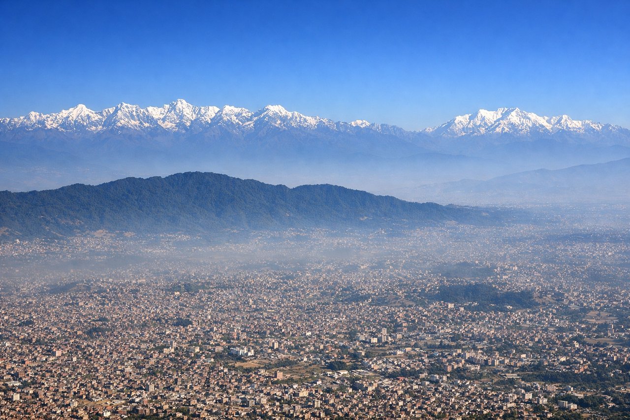
Takeoff from KTM
RIGHTKTM typically departs runway 02 (northbound) or 20 (southbound). Right-side seats offer views of the Kathmandu Valley's eastern rim and the Mahabharat Range as the aircraft climbs. The valley floor and surrounding ridges are most prominent on the right during initial climb.
Landing at BDJ
LEFTBDJ typically uses runway 07 or 25. Approaching from the northwest (standard routing from KTM), left-side seats provide views of the Barito River delta and the Banjarmasin wetland landscape during descent. The river system and surrounding peatland are most visible on the left approach.
Landmarks on this routeAll landmarks →
Will your flight be in sunlight?
Pick a date and time in the Sun Map to watch the sun move across your whole flight.
About This Route
Which side of the plane should I sit on flying from Tribhuvan International (KTM) to Syamsudin Noor International Airport (BDJ)?
Sit on the Right side of the plane for the best views on flights from Kathmandu to Banjarmasin. Right-side seats capture the dramatic Kathmandu Valley departure and the Himalayan foothills during climb. While the landing approach favors the left, the takeoff experience over Nepal's mountain terrain is more visually distinctive than the flat delta approach to Banjarmasin.
What can I see during takeoff from Tribhuvan International in Kathmandu?
During takeoff from Tribhuvan International (KTM), sit on the Right side for the best views. KTM typically departs runway 02 (northbound) or 20 (southbound). Right-side seats offer views of the Kathmandu Valley's eastern rim and the Mahabharat Range as the aircraft climbs. The valley floor and surrounding ridges are most prominent on the right during initial climb. Notable sights include: Kathmandu Valley floor with city sprawl, Mahabharat Range (eastern ridgeline), Nagarjun Hill, Shivapuri Lekh ridge.
What can I see when landing at Syamsudin Noor International Airport in Banjarmasin?
When landing at Syamsudin Noor International Airport (BDJ), sit on the Left side for the best views. BDJ typically uses runway 07 or 25. Approaching from the northwest (standard routing from KTM), left-side seats provide views of the Barito River delta and the Banjarmasin wetland landscape during descent. The river system and surrounding peatland are most visible on the left approach. Notable sights include: Barito River delta with multiple channels, Banjarmasin city and harbor, peatland wetlands, Martapura River confluence.
How long is the flight from Kathmandu to Banjarmasin?
The flight from Tribhuvan International (KTM) to Syamsudin Noor International Airport (BDJ) takes about 6 hours 5 minutes. The shortest flight path between them is 2,908 miles (4,680 km); winds and air traffic control usually add a few percent.
What does the Kathmandu to Banjarmasin flight path pass over?
The flight path crosses the Indo-Gangetic Plain and enters Southeast Asia over northern India and Bangladesh. Notable features include the Ganges River system (visible as a broad, meandering river with extensive floodplain), the transition from Himalayan foothills to flat alluvial plains, and the dense agricultural landscape of the Bengal region. As the aircraft approaches Borneo, the terrain transitions to tropical lowlands with increasing river systems and wetlands. The Rajang River system in Sarawak may be visible on southern routing variants. Throughout the descent into Banjarmasin, extensive peatland forests and river deltas become increasingly prominent.