The right side dominates the takeoff phase with excellent Kathmandu Valley and Mahabharat Range views, and while the left side wins on landing, the longer takeoff and climb-out period provides more sustained scenic value on the right.
Flight Path
The flight path crosses the Mahabharat Range and transitions from the Kathmandu Valley's higher elevation (1,300 m) to the Terai plains (200 m). Notable midpoint features include the Rapti River system, the Siwalik Range foothills, and the dramatic topographic drop from the inner Himalayan foothills to the flat alluvial plains. The terrain becomes progressively lower and flatter moving southwest toward Bhairahawa.
Great circle distance and headings ›Phase by phase
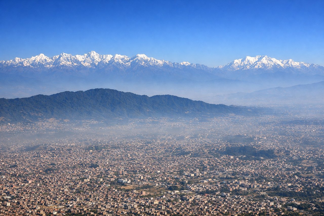
Takeoff from KTM
RIGHTClimbing out of Kathmandu heading southwest, the right side offers immediate views of the Kathmandu Valley rim and the Mahabharat Range foothills. The left side faces back toward the city and northern terrain with less dramatic relief.
Landing at BWA
LEFTApproaching Bhairahawa from the northeast, the left side captures the Siwalik Range and the dramatic terrain transition from the Terai plains. The right side faces back toward the Mahabharat Range with less visual interest on final approach.
Landmarks on this routeAll landmarks →
Will your flight be in sunlight?
See exactly which side of the plane gets sun and shade at your departure time.
About This Route
Which side of the plane should I sit on flying from Tribhuvan International (KTM) to Bhairahawa (BWA)?
Sit on the Right side of the plane for the best views on flights from Kathmandu to Bhairawa. The right side dominates the takeoff phase with excellent Kathmandu Valley and Mahabharat Range views, and while the left side wins on landing, the longer takeoff and climb-out period provides more sustained scenic value on the right.
What can I see during takeoff from Tribhuvan International in Kathmandu?
During takeoff from Tribhuvan International (KTM), sit on the Right side for the best views. Climbing out of Kathmandu heading southwest, the right side offers immediate views of the Kathmandu Valley rim and the Mahabharat Range foothills. The left side faces back toward the city and northern terrain with less dramatic relief. Notable sights include: Kathmandu Valley urban sprawl, Mahabharat Range foothills to the south, Bagmati River valley system, Shivapuri Lekh ridge to the north.
What can I see when landing at Bhairahawa in Bhairawa?
When landing at Bhairahawa (BWA), sit on the Left side for the best views. Approaching Bhairahawa from the northeast, the left side captures the Siwalik Range and the dramatic terrain transition from the Terai plains. The right side faces back toward the Mahabharat Range with less visual interest on final approach. Notable sights include: Siwalik Range foothills, Terai plains agricultural grid, Rapti River valley, Bhairahawa city and surrounding lowland terrain.
How long is the flight from Kathmandu to Bhairawa?
The flight from Tribhuvan International (KTM) to Bhairahawa (BWA) takes Approximately 45-55 minutes.
What does the Kathmandu to Bhairawa flight path pass over?
The flight path crosses the Mahabharat Range and transitions from the Kathmandu Valley's higher elevation (1,300 m) to the Terai plains (200 m). Notable midpoint features include the Rapti River system, the Siwalik Range foothills, and the dramatic topographic drop from the inner Himalayan foothills to the flat alluvial plains. The terrain becomes progressively lower and flatter moving southwest toward Bhairahawa.