Kathmandu to Dhaka is 411 miles (662 km), a flight of about 1 hour 25 minutes.
While the takeoff offers excellent Himalayan foothills views on the left, the landing approach on the right provides more sustained and visually dramatic scenery—the Brahmaputra delta system and floodplain are geographically more impressive and distinctive than the departure valley.
Flight Path
The flight path crosses the Indo-Gangetic Plain from northwest to southeast. Notable features include the Ganges River valley (visible as a wide, meandering river corridor with extensive agricultural land), the transition from Nepal's hilly terrain to Bangladesh's flat alluvial plains, and scattered towns and cities across the northern Indian plains including areas near the India-Nepal border region. The Brahmaputra River system becomes increasingly visible as the aircraft approaches Bangladesh.
Great circle distance and headings ›Phase by phase
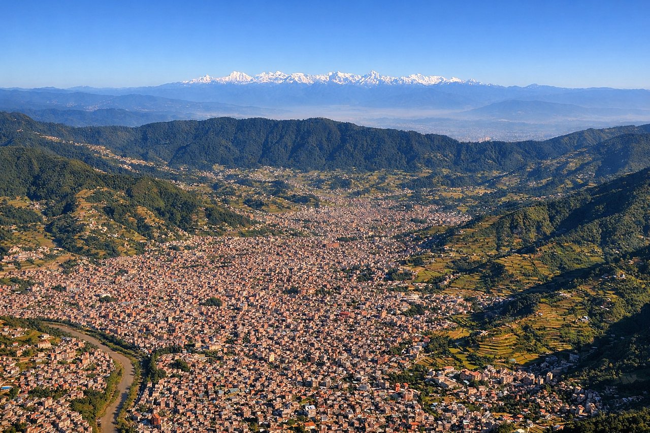
Takeoff from KTM
LEFTLeft side offers immediate views of the Kathmandu Valley floor and the surrounding Mahabharat Range ridgelines as the aircraft climbs eastward. The right side faces the steep southern escarpment with less distinctive visual separation.
Landing at DAC
RIGHTRight side provides views of the Brahmaputra River delta and the Ganges-Brahmaputra floodplain as the aircraft descends toward Dhaka from the northwest. The left side faces the interior plains with fewer distinctive landmarks.
Will your flight be in sunlight?
Pick a date and time in the Sun Map to watch the sun move across your whole flight.
About This Route
Which side of the plane should I sit on flying from Tribhuvan International (KTM) to Hazrat Shahjalal International Airport (DAC)?
Sit on the Right side of the plane for the best views on flights from Kathmandu to Dhaka. While the takeoff offers excellent Himalayan foothills views on the left, the landing approach on the right provides more sustained and visually dramatic scenery—the Brahmaputra delta system and floodplain are geographically more impressive and distinctive than the departure valley.
What can I see during takeoff from Tribhuvan International in Kathmandu?
During takeoff from Tribhuvan International (KTM), sit on the Left side for the best views. Left side offers immediate views of the Kathmandu Valley floor and the surrounding Mahabharat Range ridgelines as the aircraft climbs eastward. The right side faces the steep southern escarpment with less distinctive visual separation. Notable sights include: Kathmandu Valley urban sprawl, Mahabharat Range foothills, Bagmati River valley, Shivapuri Nagarjun National Park ridge.
What can I see when landing at Hazrat Shahjalal International Airport in Dhaka?
When landing at Hazrat Shahjalal International Airport (DAC), sit on the Right side for the best views. Right side provides views of the Brahmaputra River delta and the Ganges-Brahmaputra floodplain as the aircraft descends toward Dhaka from the northwest. The left side faces the interior plains with fewer distinctive landmarks. Notable sights include: Brahmaputra River delta channels, Ganges-Brahmaputra floodplain, Dhaka urban sprawl, Sundarbans mangrove forest (distant).
How long is the flight from Kathmandu to Dhaka?
The flight from Tribhuvan International (KTM) to Hazrat Shahjalal International Airport (DAC) takes about 1 hour 25 minutes. The shortest flight path between them is 411 miles (662 km); winds and air traffic control usually add a few percent.
What does the Kathmandu to Dhaka flight path pass over?
The flight path crosses the Indo-Gangetic Plain from northwest to southeast. Notable features include the Ganges River valley (visible as a wide, meandering river corridor with extensive agricultural land), the transition from Nepal's hilly terrain to Bangladesh's flat alluvial plains, and scattered towns and cities across the northern Indian plains including areas near the India-Nepal border region. The Brahmaputra River system becomes increasingly visible as the aircraft approaches Bangladesh.