While takeoff offers good valley views from the right, the landing approach from the left provides more dramatic and varied scenery—the northern coastline, extensive rice terraces, and the iconic silhouette of Mount Agung make the left side the stronger choice for the overall journey.
Flown KTM to DPS? Did we get it right?
Flight Path
Kathmandu to Denpasar is 3,211 miles (5,168 km), a flight of about 6 hours 35 minutes.
The flight path crosses the Bay of Bengal and Andaman Sea, passing over the Irrawaddy Delta region of Myanmar (visible as a broad, flat deltaic plain with river channels), then continues southeast over the Andaman Sea. The Andaman Islands may be visible as small dark specks on the horizon during the central portion of the flight if conditions are clear. The aircraft then approaches Bali from the north, with the Java Sea visible as the final water crossing before descent.
Great circle distance and headings ›

Phase by phase
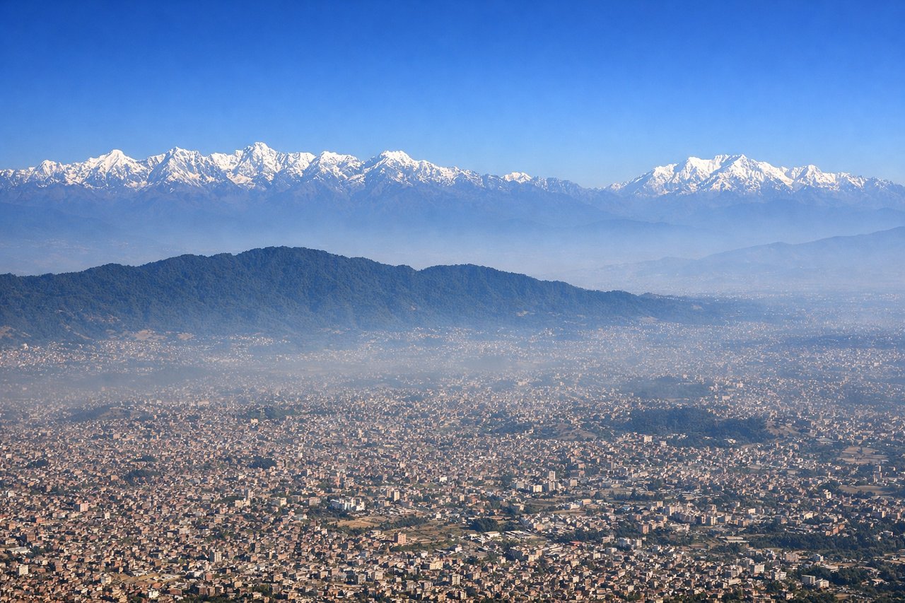
Takeoff from KTM
RIGHTRight-side seats offer views of the Kathmandu Valley's eastern rim and the Himalayan foothills as the aircraft climbs southeastward. The valley floor and surrounding ridge systems are immediately visible during the initial climb-out.
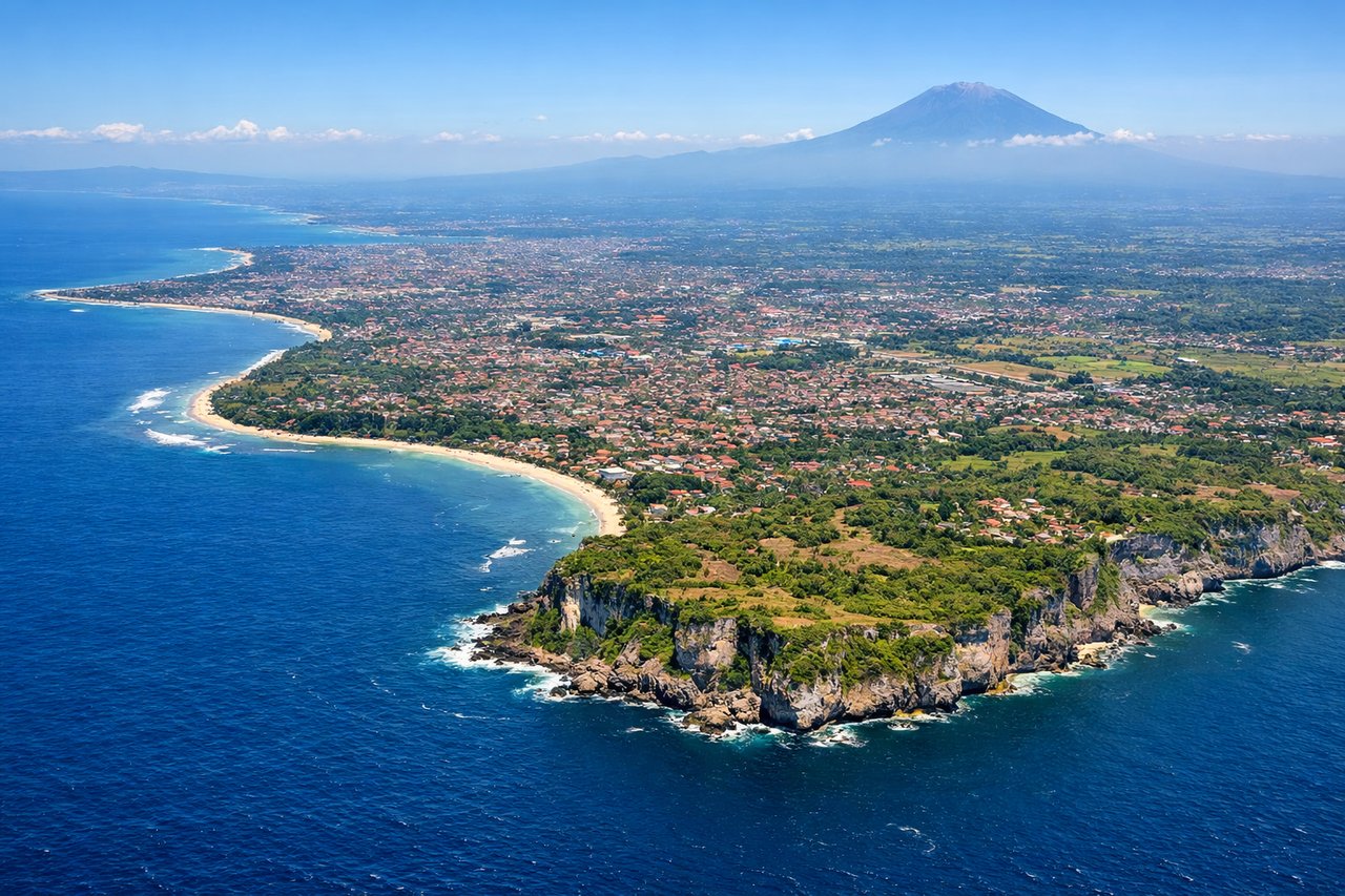
Landing at DPS
LEFTLeft-side seats provide views of Bali's northern coastline, rice terraces, and Mount Agung as the aircraft descends from the north toward Denpasar. The volcanic landscape and coastal approach are more visually distinctive from this angle.
Will your flight be in sunlight?
Pick a date and time in the Sun Map to watch the sun move across your whole flight.
About This Route
Which side of the plane should I sit on flying from Tribhuvan International (KTM) to Denpasar I Gusti Ngurah Rai International Airport (DPS)?
Sit on the Left side of the plane for the best views on flights from Kathmandu to Denpasar. While takeoff offers good valley views from the right, the landing approach from the left provides more dramatic and varied scenery—the northern coastline, extensive rice terraces, and the iconic silhouette of Mount Agung make the left side the stronger choice for the overall journey.
What can I see during takeoff from Tribhuvan International in Kathmandu?
During takeoff from Tribhuvan International (KTM), sit on the Right side for the best views. Right-side seats offer views of the Kathmandu Valley's eastern rim and the Himalayan foothills as the aircraft climbs southeastward. The valley floor and surrounding ridge systems are immediately visible during the initial climb-out. Notable sights include: Kathmandu Valley floor with Bagmati River, Shivapuri Lekh ridge to the north, Chandragiri Hills to the southwest, Nagarjun Hill to the northwest.
What can I see when landing at Denpasar I Gusti Ngurah Rai International Airport in Denpasar?
When landing at Denpasar I Gusti Ngurah Rai International Airport (DPS), sit on the Left side for the best views. Left-side seats provide views of Bali's northern coastline, rice terraces, and Mount Agung as the aircraft descends from the north toward Denpasar. The volcanic landscape and coastal approach are more visually distinctive from this angle. Notable sights include: Mount Agung (3,142 m, visible as a distant peak), Bali's northern rice terraces and agricultural plains, Bali Strait coastline, Denpasar urban area.
How long is the flight from Kathmandu to Denpasar?
The flight from Tribhuvan International (KTM) to Denpasar I Gusti Ngurah Rai International Airport (DPS) takes about 6 hours 35 minutes. The shortest flight path between them is 3,211 miles (5,168 km); winds and air traffic control usually add a few percent.
What does the Kathmandu to Denpasar flight path pass over?
The flight path crosses the Bay of Bengal and Andaman Sea, passing over the Irrawaddy Delta region of Myanmar (visible as a broad, flat deltaic plain with river channels), then continues southeast over the Andaman Sea. The Andaman Islands may be visible as small dark specks on the horizon during the central portion of the flight if conditions are clear. The aircraft then approaches Bali from the north, with the Java Sea visible as the final water crossing before descent.