Right side scores higher due to superior landing approach scenery featuring the Ganges River's dramatic meanders and Varanasi's sacred riverfront, combined with a strong takeoff from the Kathmandu Valley with Himalayan foothills. Left side offers only flat Indo-Gangetic plains with minimal visual interest for most of the flight.
Flown KTM to VNS? Did we get it right?
Flight Path
Kathmandu to Varanasi is 219 miles (352 km), a flight of about 1 hour 15 minutes.
Transition from Himalayan foothills to the Indo-Gangetic Plain; the Mahabharat Range (lower Himalayan foothills) visible in the middle section; agricultural plains of southern Nepal and northern India; the Rapti River valley in the descent phase toward Varanasi
Great circle distance and headings ›Phase by phase
Takeoff from KTM
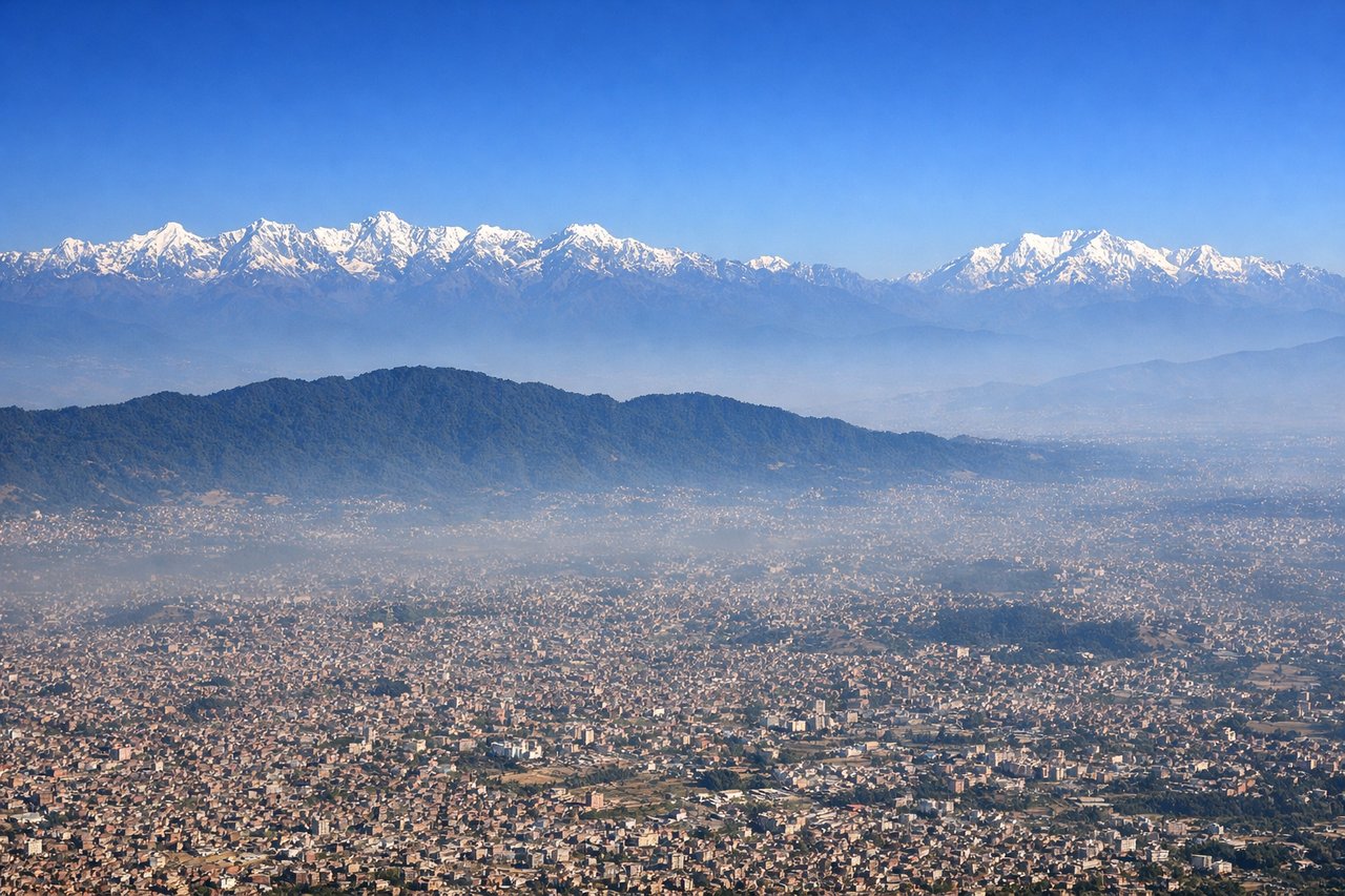
RIGHTRight side captures the dramatic Kathmandu Valley departure with the Himalayan foothills rising immediately north and east. The valley floor with Kathmandu city and surrounding settlements is visible during initial climb, providing urban context before transitioning to mountain terrain.
Landing at VNS
RIGHTRight side provides superior approach views into Varanasi. The Ganges River becomes increasingly prominent during descent, with the river's distinctive meanders and the sacred ghats of Varanasi visible on the final approach. The river's oxbow bends and the urban density along its banks create strong visual landmarks.
Will your flight be in sunlight?
Pick a date and time in the Sun Map to watch the sun move across your whole flight.
About This Route
Which side of the plane should I sit on flying from Tribhuvan International (KTM) to Lal Bahadur Shastri International Airport (VNS)?
Sit on the Right side of the plane for the best views on flights from Kathmandu to Varanasi. Right side scores higher due to superior landing approach scenery featuring the Ganges River's dramatic meanders and Varanasi's sacred riverfront, combined with a strong takeoff from the Kathmandu Valley with Himalayan foothills. Left side offers only flat Indo-Gangetic plains with minimal visual interest for most of the flight.
What can I see during takeoff from Tribhuvan International in Kathmandu?
During takeoff from Tribhuvan International (KTM), sit on the Right side for the best views. Right side captures the dramatic Kathmandu Valley departure with the Himalayan foothills rising immediately north and east. The valley floor with Kathmandu city and surrounding settlements is visible during initial climb, providing urban context before transitioning to mountain terrain. Notable sights include: Kathmandu city and Pashupatinath temple area, Shivapuri Lekh ridge to the north, Bhaktapur settlements to the east, Himalayan foothills receding northward.
What can I see when landing at Lal Bahadur Shastri International Airport in Varanasi?
When landing at Lal Bahadur Shastri International Airport (VNS), sit on the Right side for the best views. Right side provides superior approach views into Varanasi. The Ganges River becomes increasingly prominent during descent, with the river's distinctive meanders and the sacred ghats of Varanasi visible on the final approach. The river's oxbow bends and the urban density along its banks create strong visual landmarks. Notable sights include: Ganges River with characteristic meanders, Varanasi city ghats and temples along the riverbank, Assi Ghat area, agricultural plains of the Ganges valley.
How long is the flight from Kathmandu to Varanasi?
The flight from Tribhuvan International (KTM) to Lal Bahadur Shastri International Airport (VNS) takes about 1 hour 15 minutes. The shortest flight path between them is 219 miles (352 km); winds and air traffic control usually add a few percent.
What does the Kathmandu to Varanasi flight path pass over?
Transition from Himalayan foothills to the Indo-Gangetic Plain; the Mahabharat Range (lower Himalayan foothills) visible in the middle section; agricultural plains of southern Nepal and northern India; the Rapti River valley in the descent phase toward Varanasi