Both sides face long stretches of open water over the Andaman Sea and Bay of Bengal, but the right side edges ahead thanks to the Kuala Lumpur skyline at departure and the plateau relief with Nandi Hills near Bangalore on arrival, while the left side offers mostly featureless ocean and flat plantation terrain.
Flown KUL to BLR? Did we get it right?
Flight Path
Kuala Lumpur to Bangalore is 1,792 miles (2,884 km), a flight of about 4 hours 15 minutes.
Strait of Malacca, northern tip of Sumatra, Andaman Sea, open Bay of Bengal, Indian coastline near the Coromandel coast before crossing into the Deccan plateau
Great circle distance and headings ›Phase by phase
Takeoff from KUL
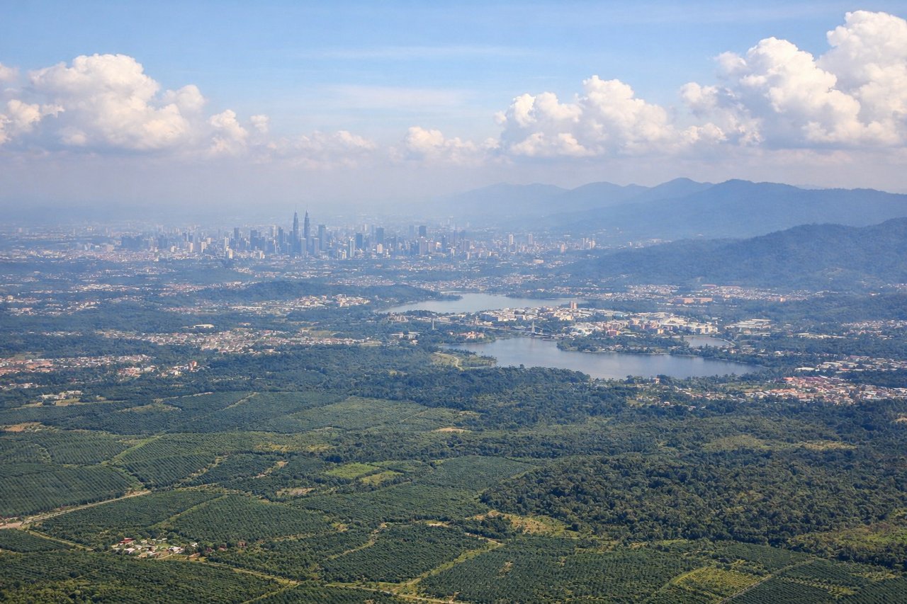
RIGHTDeparting KUL to the northwest, the right side offers a brief view back over the Klang Valley and Kuala Lumpur's skyline, including the Petronas Towers area, before the aircraft climbs out over the Strait of Malacca. The left side mostly shows flat palm-oil plantations and haze with little variation.
Landing at BLR
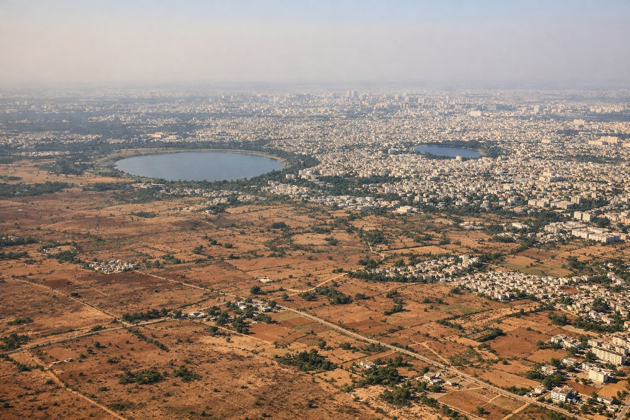
RIGHTOn approach into BLR from the east, the right side of the aircraft faces north toward the granite outcrops and rolling terrain near Nandi Hills before the final turn onto the runway, giving a bit of topographic relief compared to the flatter plateau views on the left. The city's tech-corridor development and reservoirs are also more visible from this side during the turn.
Will your flight be in sunlight?
Pick a date and time in the Sun Map to watch the sun move across your whole flight.
About This Route
Which side of the plane should I sit on flying from Kuala Lumpur International (KUL) to Kempegowda International Airport Bengaluru (BLR)?
Sit on the Right side of the plane for the best views on flights from Kuala Lumpur to Bangalore. Both sides face long stretches of open water over the Andaman Sea and Bay of Bengal, but the right side edges ahead thanks to the Kuala Lumpur skyline at departure and the plateau relief with Nandi Hills near Bangalore on arrival, while the left side offers mostly featureless ocean and flat plantation terrain.
What can I see during takeoff from Kuala Lumpur International in Kuala Lumpur?
During takeoff from Kuala Lumpur International (KUL), sit on the Right side for the best views. Departing KUL to the northwest, the right side offers a brief view back over the Klang Valley and Kuala Lumpur's skyline, including the Petronas Towers area, before the aircraft climbs out over the Strait of Malacca. The left side mostly shows flat palm-oil plantations and haze with little variation. Notable sights include: Kuala Lumpur skyline, Petronas Towers area, Klang Valley, Strait of Malacca.
What can I see when landing at Kempegowda International Airport Bengaluru in Bangalore?
When landing at Kempegowda International Airport Bengaluru (BLR), sit on the Right side for the best views. On approach into BLR from the east, the right side of the aircraft faces north toward the granite outcrops and rolling terrain near Nandi Hills before the final turn onto the runway, giving a bit of topographic relief compared to the flatter plateau views on the left. The city's tech-corridor development and reservoirs are also more visible from this side during the turn. Notable sights include: Nandi Hills foothills, Deccan plateau granite outcrops, Bangalore's eastern IT corridor, scattered reservoirs.
How long is the flight from Kuala Lumpur to Bangalore?
The flight from Kuala Lumpur International (KUL) to Kempegowda International Airport Bengaluru (BLR) takes about 4 hours 15 minutes. The shortest flight path between them is 1,792 miles (2,884 km); winds and air traffic control usually add a few percent.
What does the Kuala Lumpur to Bangalore flight path pass over?
Strait of Malacca, northern tip of Sumatra, Andaman Sea, open Bay of Bengal, Indian coastline near the Coromandel coast before crossing into the Deccan plateau