Right-side seats capture the most dramatic scenery: the Klang Valley and KL departure, then the entire flight path down the Strait of Malacca and across the Sunda Strait region offers consistent water and island views. Left seats see mostly ocean on the long southern crossing with limited landmarks until final approach.
Flown KUL to BNE? Did we get it right?
Flight Path
Kuala Lumpur to Brisbane is 4,001 miles (6,440 km), a flight of about 8 hours 5 minutes.
Strait of Malacca (narrow waterway between Malaysia and Sumatra with shipping traffic visible), Sunda Strait (between Sumatra and Java), Java Sea, scattered Indonesian islands including parts of Sumatra's west coast and Java's northern coast. The flight typically cruises at 35,000+ feet over open ocean for the majority of the journey, making individual landmarks difficult to distinguish. Occasional thunderstorm clouds may be visible below. The Timor Sea crossing offers minimal distinctive features—mostly open water.
Great circle distance and headings ›Phase by phase
Takeoff from KUL
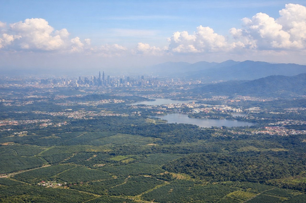
RIGHTRight-side seats offer views of the Klang Valley and Kuala Lumpur's urban sprawl during the initial climb-out heading southeast. You'll see the city grid and surrounding palm oil plantations clearly before the aircraft banks toward the southern route.
Landing at BNE
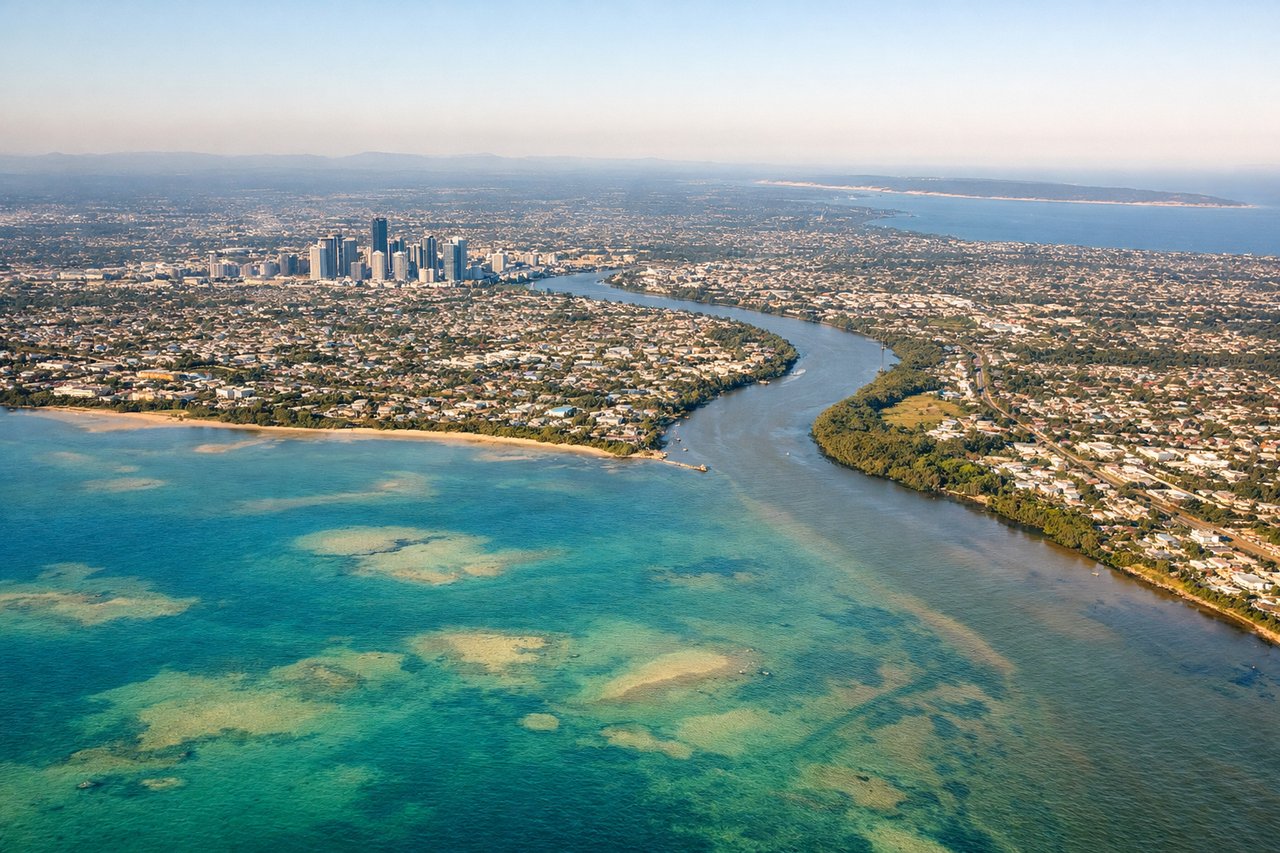
LEFTLeft-side seats provide views of Moreton Bay and Brisbane's geography during approach from the east. You'll see the bay's islands, the Brisbane River's distinctive loops, and the city skyline as you descend toward the runway.
Will your flight be in sunlight?
Pick a date and time in the Sun Map to watch the sun move across your whole flight.
About This Route
Which side of the plane should I sit on flying from Kuala Lumpur International (KUL) to Brisbane International (BNE)?
Sit on the Right side of the plane for the best views on flights from Kuala Lumpur to Brisbane. Right-side seats capture the most dramatic scenery: the Klang Valley and KL departure, then the entire flight path down the Strait of Malacca and across the Sunda Strait region offers consistent water and island views. Left seats see mostly ocean on the long southern crossing with limited landmarks until final approach.
What can I see during takeoff from Kuala Lumpur International in Kuala Lumpur?
During takeoff from Kuala Lumpur International (KUL), sit on the Right side for the best views. Right-side seats offer views of the Klang Valley and Kuala Lumpur's urban sprawl during the initial climb-out heading southeast. You'll see the city grid and surrounding palm oil plantations clearly before the aircraft banks toward the southern route. Notable sights include: Kuala Lumpur city center and Petronas Twin Towers area, Klang River valley, surrounding palm oil plantation grid, Titiwangsa Mountains to the east (distant).
What can I see when landing at Brisbane International in Brisbane?
When landing at Brisbane International (BNE), sit on the Left side for the best views. Left-side seats provide views of Moreton Bay and Brisbane's geography during approach from the east. You'll see the bay's islands, the Brisbane River's distinctive loops, and the city skyline as you descend toward the runway. Notable sights include: Moreton Bay and its islands (North Stradbroke, Moreton Island), Brisbane River with its characteristic meanders, Brisbane CBD skyline, Lamington National Park (distant, southwest).
How long is the flight from Kuala Lumpur to Brisbane?
The flight from Kuala Lumpur International (KUL) to Brisbane International (BNE) takes about 8 hours 5 minutes. The shortest flight path between them is 4,001 miles (6,440 km); winds and air traffic control usually add a few percent.
What does the Kuala Lumpur to Brisbane flight path pass over?
Strait of Malacca (narrow waterway between Malaysia and Sumatra with shipping traffic visible), Sunda Strait (between Sumatra and Java), Java Sea, scattered Indonesian islands including parts of Sumatra's west coast and Java's northern coast. The flight typically cruises at 35,000+ feet over open ocean for the majority of the journey, making individual landmarks difficult to distinguish. Occasional thunderstorm clouds may be visible below. The Timor Sea crossing offers minimal distinctive features—mostly open water.