The Las Vegas takeoff view is brief and quickly gives way to hours of open ocean, but the Kona approach delivers a dramatic, sustained volcanic landscape—lava fields, Hualalai, and Mauna Loa—that leaves a stronger overall impression, tipping the balance to the left side.
Flight Path
The majority of the route crosses open Pacific Ocean with no landmasses visible; the coast of Southern California briefly recedes behind shortly after departure, and no further land appears until the Hawaiian Islands emerge near the end of the flight.
Great circle distance and headings ›


Phase by phase
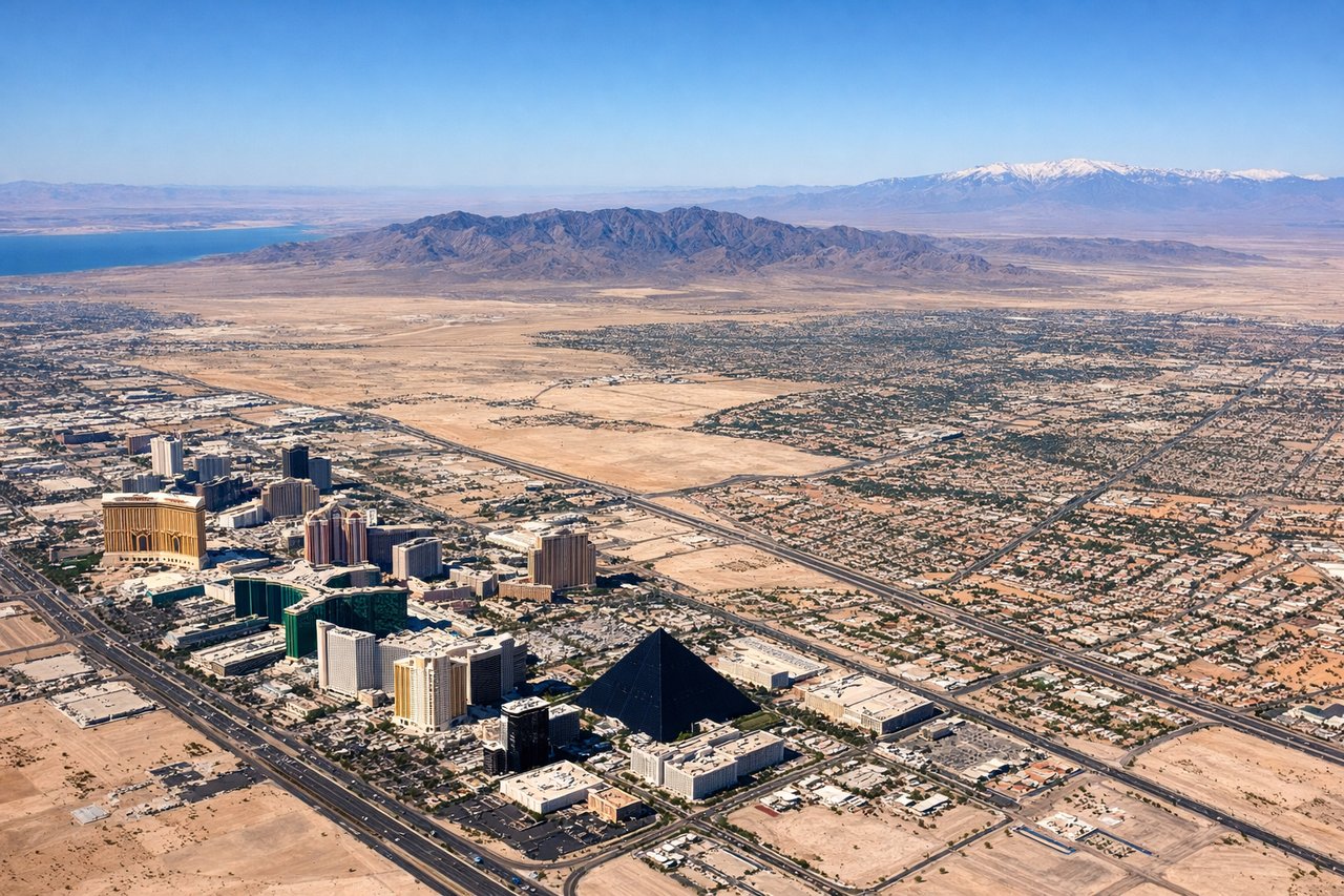
Takeoff from LAS
RIGHTDeparting LAS on the south-facing runways (01L/01R), the initial climb puts the Las Vegas Strip and downtown skyline on the right side of the aircraft before the turn toward California. Red Rock Canyon's red sandstone cliffs are also visible to the northwest on this side during the climb-out.
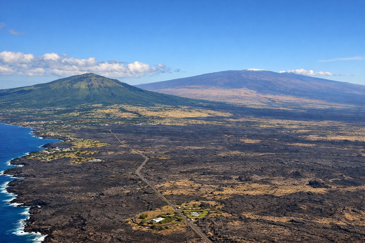
Landing at KOA
LEFTOn the approach into KOA using runway 17 (north-to-south alignment), the aircraft descends along the Kona coast with Hualalai volcano's lava-covered slopes visible on the left side, along with the dark aa lava fields that dominate this stretch of coastline. Mauna Loa's massive shield profile can also be seen inland on this side during the final descent.
Landmarks on this routeAll landmarks →
Will your flight be in sunlight?
See exactly which side of the plane gets sun and shade at your departure time.
About This Route
Which side of the plane should I sit on flying from Mc Carran International (LAS) to Kona International At Keahole (KOA)?
Sit on the Left side of the plane for the best views on flights from Las Vegas to Kona. The Las Vegas takeoff view is brief and quickly gives way to hours of open ocean, but the Kona approach delivers a dramatic, sustained volcanic landscape—lava fields, Hualalai, and Mauna Loa—that leaves a stronger overall impression, tipping the balance to the left side.
What can I see during takeoff from Mc Carran International in Las Vegas?
During takeoff from Mc Carran International (LAS), sit on the Right side for the best views. Departing LAS on the south-facing runways (01L/01R), the initial climb puts the Las Vegas Strip and downtown skyline on the right side of the aircraft before the turn toward California. Red Rock Canyon's red sandstone cliffs are also visible to the northwest on this side during the climb-out. Notable sights include: Las Vegas Strip, downtown Las Vegas skyline, Red Rock Canyon, Spring Mountains.
What can I see when landing at Kona International At Keahole in Kona?
When landing at Kona International At Keahole (KOA), sit on the Left side for the best views. On the approach into KOA using runway 17 (north-to-south alignment), the aircraft descends along the Kona coast with Hualalai volcano's lava-covered slopes visible on the left side, along with the dark aa lava fields that dominate this stretch of coastline. Mauna Loa's massive shield profile can also be seen inland on this side during the final descent. Notable sights include: Hualalai volcano, black lava fields, Kona coastline, Mauna Loa (distant).
How long is the flight from Las Vegas to Kona?
The flight from Mc Carran International (LAS) to Kona International At Keahole (KOA) takes 5h 35m.
What does the Las Vegas to Kona flight path pass over?
The majority of the route crosses open Pacific Ocean with no landmasses visible; the coast of Southern California briefly recedes behind shortly after departure, and no further land appears until the Hawaiian Islands emerge near the end of the flight.