La Coruna to London is 689 miles (1,110 km), a flight of about 2 hours 15 minutes.
Right side offers superior scenery on departure with coastal views, while left side on arrival captures the Thames estuary drama. Right edges out left slightly due to the extended beauty of the Galician coast during the longer climb phase.
Flight Path
The flight path crosses the Bay of Biscay at altitude, offering open ocean views with occasional cloud formations. As you approach the English Channel, the Cornish and Devon coastlines become visible on the left (north side of the channel). The Channel itself presents a narrow strip of water between the UK and France, typically around 20,000-25,000 feet altitude. The Cotswolds and Thames Valley appear as you descend toward London, with the river becoming increasingly prominent as a silvery thread through the green and grey landscape.
Great circle distance and headings ›
.jpeg?width=600)
Phase by phase
Takeoff from LCG
RIGHTRight side seats offer views of the Galician coastline and Ría de A Coruña as the aircraft climbs northeastward. You'll see the Atlantic coast receding and the distinctive inlet system that characterizes this region.
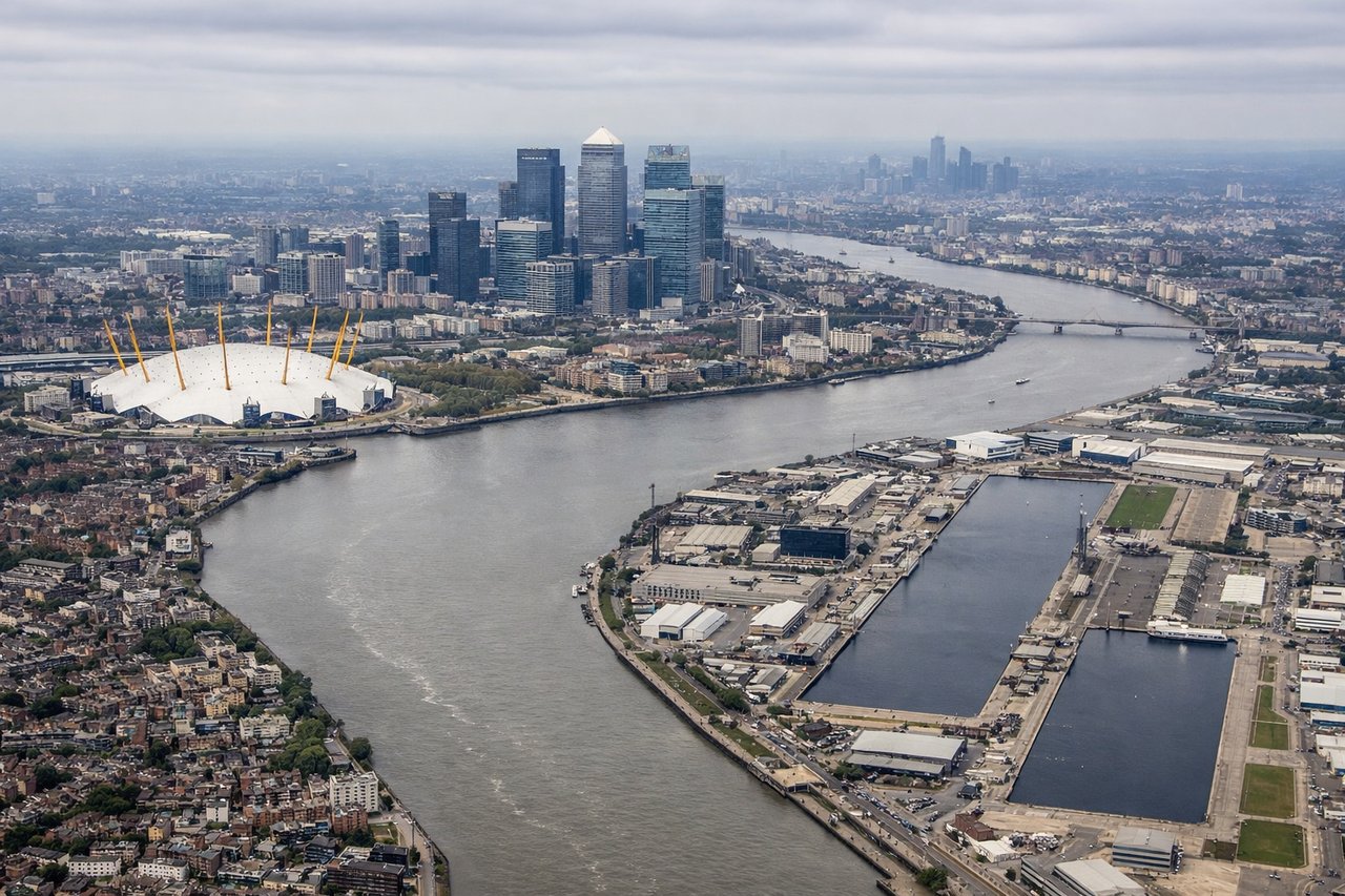
Landing at LCY
LEFTLeft side seats provide excellent views during descent into London City. You'll see the Thames estuary, the distinctive meanders of the river as it approaches the airport, and the urban sprawl of East London and the Docklands.
Landmarks on this routeAll landmarks →
Will your flight be in sunlight?
Pick a date and time in the Sun Map to watch the sun move across your whole flight.
About This Route
Which side of the plane should I sit on flying from A Coruna (LCG) to City (LCY)?
Sit on the Right side of the plane for the best views on flights from La Coruna to London. Right side offers superior scenery on departure with coastal views, while left side on arrival captures the Thames estuary drama. Right edges out left slightly due to the extended beauty of the Galician coast during the longer climb phase.
What can I see during takeoff from A Coruna in La Coruna?
During takeoff from A Coruna (LCG), sit on the Right side for the best views. Right side seats offer views of the Galician coastline and Ría de A Coruña as the aircraft climbs northeastward. You'll see the Atlantic coast receding and the distinctive inlet system that characterizes this region. Notable sights include: Ría de A Coruña (coastal inlet), Atlantic Ocean, Galician coastal cliffs, Torre de Hércules (lighthouse on peninsula).
What can I see when landing at City in London?
When landing at City (LCY), sit on the Left side for the best views. Left side seats provide excellent views during descent into London City. You'll see the Thames estuary, the distinctive meanders of the river as it approaches the airport, and the urban sprawl of East London and the Docklands. Notable sights include: River Thames and its meanders, Thames Estuary, Canary Wharf and Docklands skyline, East London urban grid.
How long is the flight from La Coruna to London?
The flight from A Coruna (LCG) to City (LCY) takes about 2 hours 15 minutes. The shortest flight path between them is 689 miles (1,110 km); winds and air traffic control usually add a few percent.
What does the La Coruna to London flight path pass over?
The flight path crosses the Bay of Biscay at altitude, offering open ocean views with occasional cloud formations. As you approach the English Channel, the Cornish and Devon coastlines become visible on the left (north side of the channel). The Channel itself presents a narrow strip of water between the UK and France, typically around 20,000-25,000 feet altitude. The Cotswolds and Thames Valley appear as you descend toward London, with the river becoming increasingly prominent as a silvery thread through the green and grey landscape.