Right-side seats capture the dramatic Andes departure from Lima and offer reasonable views during the cruise phase over northern Peru and Ecuador. However, left seats win decisively on arrival into Cartagena. Right edges out left overall due to the superior takeoff experience and the flight's northbound trajectory along the Andes.
Flight Path
The flight path crosses the Andes cordillera (visible as a continuous mountain range running north-south, with peaks typically 12,000-16,000 feet), the Ecuadorian highlands and valleys, and approaches the Caribbean coast near the Colombia-Venezuela border. The Cauca and Magdalena river valleys become visible as you descend into Colombian airspace. Cloud cover over the Andes is common; clear days reveal the snow-capped peaks of Nevado del Ruiz and Nevado del Huila in the distance.
Great circle distance and headings ›


Phase by phase

Takeoff from LIM
RIGHTJorge Chavez typically departs to the south (Runway 03) or north (Runway 21). Right-side seats offer the best view of the Andes foothills rising inland and the Pacific coastline receding westward as you climb. Left seats face the city and industrial areas.
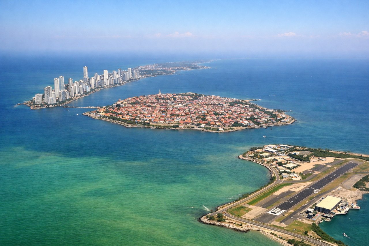
Landing at CTG
LEFTRafael Nunez approaches from the north or northeast (Runway 01 or 19). Left-side seats provide excellent views of the Caribbean coastline, the Magdalena River delta, and Cartagena's colonial walled city as you descend. Right seats face inland swamps and less distinctive terrain.
Landmarks on this routeAll landmarks →
Will your flight be in sunlight?
See exactly which side of the plane gets sun and shade at your departure time.
About This Route
Which side of the plane should I sit on flying from Jorge Chávez International Airport (LIM) to Rafael Nunez (CTG)?
Sit on the Right side of the plane for the best views on flights from Lima to Cartagena. Right-side seats capture the dramatic Andes departure from Lima and offer reasonable views during the cruise phase over northern Peru and Ecuador. However, left seats win decisively on arrival into Cartagena. Right edges out left overall due to the superior takeoff experience and the flight's northbound trajectory along the Andes.
What can I see during takeoff from Jorge Chávez International Airport in Lima?
During takeoff from Jorge Chávez International Airport (LIM), sit on the Right side for the best views. Jorge Chavez typically departs to the south (Runway 03) or north (Runway 21). Right-side seats offer the best view of the Andes foothills rising inland and the Pacific coastline receding westward as you climb. Left seats face the city and industrial areas. Notable sights include: Pacific Ocean (west), Andes eastern foothills (east), Lima urban sprawl (south and inland), Callao port district (north).
What can I see when landing at Rafael Nunez in Cartagena?
When landing at Rafael Nunez (CTG), sit on the Left side for the best views. Rafael Nunez approaches from the north or northeast (Runway 01 or 19). Left-side seats provide excellent views of the Caribbean coastline, the Magdalena River delta, and Cartagena's colonial walled city as you descend. Right seats face inland swamps and less distinctive terrain. Notable sights include: Caribbean Sea (north and west), Magdalena River delta (south and inland), Cartagena walled old city (visible as dense grid near coast), mangrove wetlands (interior).
How long is the flight from Lima to Cartagena?
The flight from Jorge Chávez International Airport (LIM) to Rafael Nunez (CTG) takes Approximately 3 hours 15 minutes.
What does the Lima to Cartagena flight path pass over?
The flight path crosses the Andes cordillera (visible as a continuous mountain range running north-south, with peaks typically 12,000-16,000 feet), the Ecuadorian highlands and valleys, and approaches the Caribbean coast near the Colombia-Venezuela border. The Cauca and Magdalena river valleys become visible as you descend into Colombian airspace. Cloud cover over the Andes is common; clear days reveal the snow-capped peaks of Nevado del Ruiz and Nevado del Huila in the distance.