Right-side seats capture the most dramatic geography: the Andes departure from Lima and the Caribbean reef approach to Cancun. The westward ocean views during climb-out and the turquoise water views during descent make right consistently superior for this route.
Flown LIM to CUN? Did we get it right?
Flight Path
Lima to Cancun is 2,379 miles (3,828 km), a flight of about 5 hours.
The flight path crosses the Yucatan Peninsula's interior (flat, forested limestone terrain with cenote lakes), passes over the Gulf of Mexico's open waters, and skirts the western edge of the Caribbean. Notable midpoint geography includes the Petén region of Guatemala (dense jungle, visible as dark green terrain if flying low enough), the Campeche Bay, and the transition from the Pacific drainage basin to the Caribbean. At cruise altitude (35,000 feet), individual landmarks become difficult to distinguish, but the curvature of the Yucatan Peninsula and the color contrast between the Gulf and Caribbean remain visible on clear days.
Great circle distance and headings ›

Phase by phase

Takeoff from LIM
RIGHTLima typically departs runway 03 (northbound) or 15 (southbound). Right-side seats offer views of the Pacific coastline and the Andes foothills rising inland. The western exposure captures the ocean's meeting with Peru's coastal desert and the dramatic escarpment of the Western Cordillera.
Landing at CUN
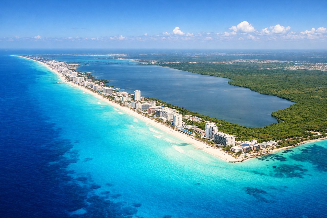
LEFTCancun approaches typically use runways 07 or 25. Left-side seats during descent offer views of the Yucatan Peninsula's Caribbean coastline, the turquoise shallow waters of the Mesoamerican Reef, and the lagoon system. The contrast between the reef's brilliant blue and the darker open Caribbean is striking from altitude.
Will your flight be in sunlight?
Pick a date and time in the Sun Map to watch the sun move across your whole flight.
About This Route
Which side of the plane should I sit on flying from Jorge Chávez International Airport (LIM) to Cancun International (CUN)?
Sit on the Right side of the plane for the best views on flights from Lima to Cancun. Right-side seats capture the most dramatic geography: the Andes departure from Lima and the Caribbean reef approach to Cancun. The westward ocean views during climb-out and the turquoise water views during descent make right consistently superior for this route.
What can I see during takeoff from Jorge Chávez International Airport in Lima?
During takeoff from Jorge Chávez International Airport (LIM), sit on the Right side for the best views. Lima typically departs runway 03 (northbound) or 15 (southbound). Right-side seats offer views of the Pacific coastline and the Andes foothills rising inland. The western exposure captures the ocean's meeting with Peru's coastal desert and the dramatic escarpment of the Western Cordillera. Notable sights include: Pacific Ocean (immediate west), Lima urban sprawl (south and southeast), Andes Western Cordillera (east, snow-capped peaks visible on clear days), Callao port district (south).
What can I see when landing at Cancun International in Cancun?
When landing at Cancun International (CUN), sit on the Left side for the best views. Cancun approaches typically use runways 07 or 25. Left-side seats during descent offer views of the Yucatan Peninsula's Caribbean coastline, the turquoise shallow waters of the Mesoamerican Reef, and the lagoon system. The contrast between the reef's brilliant blue and the darker open Caribbean is striking from altitude. Notable sights include: Caribbean Sea (turquoise shallow waters), Mesoamerican Reef system (visible as color gradation), Cancun Lagoon (Laguna de Nichupté), Yucatan Peninsula limestone terrain (pale, flat landscape).
How long is the flight from Lima to Cancun?
The flight from Jorge Chávez International Airport (LIM) to Cancun International (CUN) takes about 5 hours. The shortest flight path between them is 2,379 miles (3,828 km); winds and air traffic control usually add a few percent.
What does the Lima to Cancun flight path pass over?
The flight path crosses the Yucatan Peninsula's interior (flat, forested limestone terrain with cenote lakes), passes over the Gulf of Mexico's open waters, and skirts the western edge of the Caribbean. Notable midpoint geography includes the Petén region of Guatemala (dense jungle, visible as dark green terrain if flying low enough), the Campeche Bay, and the transition from the Pacific drainage basin to the Caribbean. At cruise altitude (35,000 feet), individual landmarks become difficult to distinguish, but the curvature of the Yucatan Peninsula and the color contrast between the Gulf and Caribbean remain visible on clear days.