Right-side seats capture the most dramatic scenery: the Andes Mountains during departure are visually striking and sustained for several hours as the flight tracks northeastward. While left-side landing views into Washington are notable, the extended mountain views on the right during the majority of the flight make it the superior choice overall.
Flown LIM to DCA? Did we get it right?
Flight Path
Lima to Washington is 3,515 miles (5,657 km), a flight of about 5 hours 45 minutes.
The flight path crosses the Caribbean Sea and passes over or near the Yucatan Peninsula, then continues over the Gulf of Mexico and southeastern United States. Notable features include the Yucatan's limestone platform and cenote formations (visible as subtle topographic variations), the Gulf of Mexico's open water, and the Mississippi River delta region as the aircraft approaches the continental interior. The Appalachian Mountains become visible on the eastern horizon during the final descent phase into Washington.
Great circle distance and headings ›

Phase by phase

Takeoff from LIM
RIGHTRight-side seats offer views of the Andes Mountains as the aircraft climbs southeastward from Lima. The western cordillera rises dramatically inland, providing clear sightlines during the initial climb-out phase.
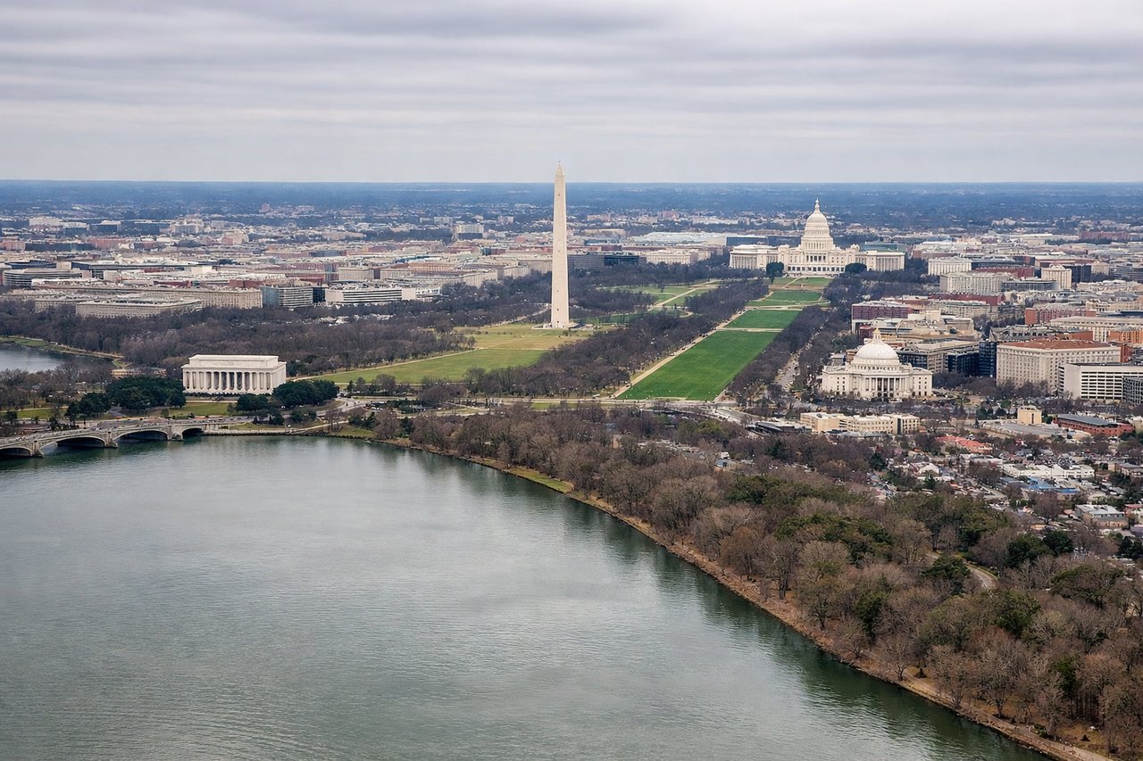
Landing at DCA
LEFTLeft-side seats provide excellent views during the descent approach into DCA. The Potomac River, Washington Monument, and the National Mall are visible on the left as the aircraft descends from the northwest, following the standard approach corridor.
Will your flight be in sunlight?
Pick a date and time in the Sun Map to watch the sun move across your whole flight.
About This Route
Which side of the plane should I sit on flying from Jorge Chávez International Airport (LIM) to Ronald Reagan Washington National (DCA)?
Sit on the Right side of the plane for the best views on flights from Lima to Washington. Right-side seats capture the most dramatic scenery: the Andes Mountains during departure are visually striking and sustained for several hours as the flight tracks northeastward. While left-side landing views into Washington are notable, the extended mountain views on the right during the majority of the flight make it the superior choice overall.
What can I see during takeoff from Jorge Chávez International Airport in Lima?
During takeoff from Jorge Chávez International Airport (LIM), sit on the Right side for the best views. Right-side seats offer views of the Andes Mountains as the aircraft climbs southeastward from Lima. The western cordillera rises dramatically inland, providing clear sightlines during the initial climb-out phase. Notable sights include: Andes Mountains (western cordillera), Pacific Ocean coastline, Lima urban sprawl, Callao port district.
What can I see when landing at Ronald Reagan Washington National in Washington?
When landing at Ronald Reagan Washington National (DCA), sit on the Left side for the best views. Left-side seats provide excellent views during the descent approach into DCA. The Potomac River, Washington Monument, and the National Mall are visible on the left as the aircraft descends from the northwest, following the standard approach corridor. Notable sights include: Potomac River, Washington Monument and National Mall, Arlington National Cemetery, Dulles corridor urban sprawl.
How long is the flight from Lima to Washington?
The flight from Jorge Chávez International Airport (LIM) to Ronald Reagan Washington National (DCA) takes about 5 hours 45 minutes. The shortest flight path between them is 3,515 miles (5,657 km); winds and air traffic control usually add a few percent.
What does the Lima to Washington flight path pass over?
The flight path crosses the Caribbean Sea and passes over or near the Yucatan Peninsula, then continues over the Gulf of Mexico and southeastern United States. Notable features include the Yucatan's limestone platform and cenote formations (visible as subtle topographic variations), the Gulf of Mexico's open water, and the Mississippi River delta region as the aircraft approaches the continental interior. The Appalachian Mountains become visible on the eastern horizon during the final descent phase into Washington.