Takeoff from Lima offers more dramatic and varied scenery—the Pacific, coastal desert, and Andes all visible within the first 30 minutes. Landing at Melbourne is suburban and less distinctive. Left seats capture the superior departure experience.
Flown LIM to MEL? Did we get it right?
Flight Path
Lima to Melbourne is 8,059 miles (12,970 km), a flight of about 14 hours.
The flight crosses the South Pacific for roughly 8,000 nautical miles. Notable features include the Andes receding inland within 1 hour of departure, then open Pacific for 10+ hours. Around the midpoint (near 120°W, 25°S), you may see scattered cumulus clouds and the occasional atoll or island group, though most of the Pacific crossing is featureless ocean. As you approach Australia, the Tasman Sea gradually gives way to the Australian coast near Sydney or further south, depending on routing. The final approach into Melbourne crosses the southeastern Australian coast and Port Phillip Bay.
Great circle distance and headings ›Phase by phase
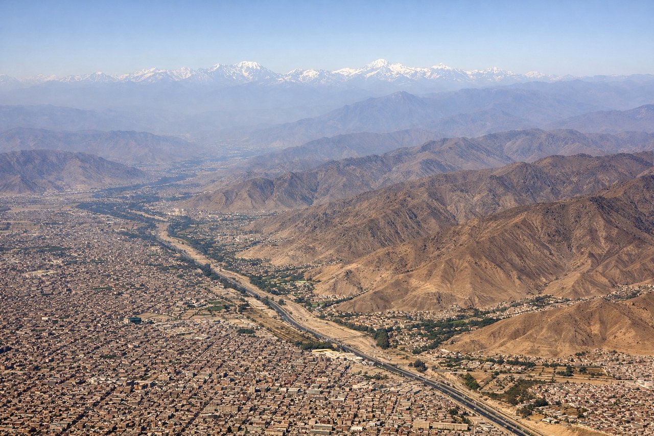
Takeoff from LIM
LEFTLIM typically departs runway 03 (northbound) or 15 (southbound). Left seats face west over the Pacific and the Andes foothills rising inland. You'll see the coastal desert transition and the western cordillera clearly.
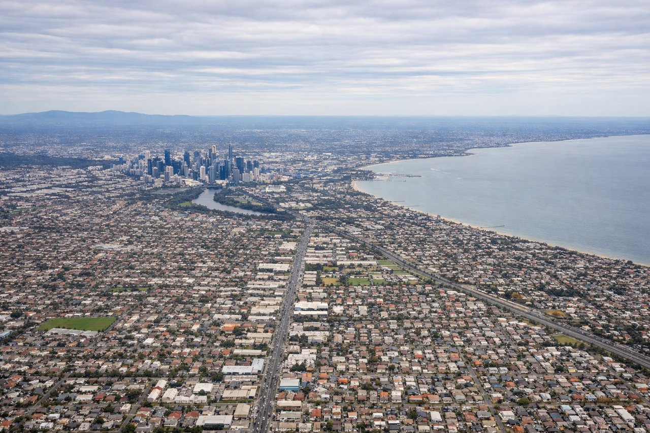
Landing at MEL
RIGHTMEL typically lands runway 27 (westbound) or 09 (eastbound). Right seats on approach from the north or northwest will show Port Phillip Bay, the Dandenong Ranges to the east, and the city grid. Runway 27 approaches offer the best right-side views of the bay and suburban sprawl.
Will your flight be in sunlight?
Pick a date and time in the Sun Map to watch the sun move across your whole flight.
About This Route
Which side of the plane should I sit on flying from Jorge Chávez International Airport (LIM) to Melbourne International (MEL)?
Sit on the Left side of the plane for the best views on flights from Lima to Melbourne. Takeoff from Lima offers more dramatic and varied scenery—the Pacific, coastal desert, and Andes all visible within the first 30 minutes. Landing at Melbourne is suburban and less distinctive. Left seats capture the superior departure experience.
What can I see during takeoff from Jorge Chávez International Airport in Lima?
During takeoff from Jorge Chávez International Airport (LIM), sit on the Left side for the best views. LIM typically departs runway 03 (northbound) or 15 (southbound). Left seats face west over the Pacific and the Andes foothills rising inland. You'll see the coastal desert transition and the western cordillera clearly. Notable sights include: Pacific Ocean (immediate west), Lima urban sprawl (south and southeast), Andes western slopes (east, rising to 10,000+ ft), Callao port district (south).
What can I see when landing at Melbourne International in Melbourne?
When landing at Melbourne International (MEL), sit on the Right side for the best views. MEL typically lands runway 27 (westbound) or 09 (eastbound). Right seats on approach from the north or northwest will show Port Phillip Bay, the Dandenong Ranges to the east, and the city grid. Runway 27 approaches offer the best right-side views of the bay and suburban sprawl. Notable sights include: Port Phillip Bay (large enclosed water body, southwest of airport), Dandenong Ranges (forested ridgeline, east and southeast), Melbourne CBD skyline (north, distant), Yarra River (snaking through suburbs, north).
How long is the flight from Lima to Melbourne?
The flight from Jorge Chávez International Airport (LIM) to Melbourne International (MEL) takes about 14 hours. The shortest flight path between them is 8,059 miles (12,970 km); winds and air traffic control usually add a few percent.
What does the Lima to Melbourne flight path pass over?
The flight crosses the South Pacific for roughly 8,000 nautical miles. Notable features include the Andes receding inland within 1 hour of departure, then open Pacific for 10+ hours. Around the midpoint (near 120°W, 25°S), you may see scattered cumulus clouds and the occasional atoll or island group, though most of the Pacific crossing is featureless ocean. As you approach Australia, the Tasman Sea gradually gives way to the Australian coast near Sydney or further south, depending on routing. The final approach into Melbourne crosses the southeastern Australian coast and Port Phillip Bay.