Right-side seats win overall because the takeoff view of the Andes is more visually distinctive than the landing approach, and right seats maintain better views during the northbound cruise leg along Peru's coast before turning inland toward Mexico.
Flown LIM to MEX? Did we get it right?
Flight Path
Lima to Mexico City is 2,638 miles (4,245 km), a flight of about 5 hours.
The flight path crosses the Pacific coastal region of Peru and Ecuador, then inland over the Andes foothills and Central American highlands. Notable features include the Peruvian coastal desert (visible early in flight as tan, featureless terrain), the Andes Mountains running north-south (visible on the right/east side during cruise), Lake Titicaca region (if visible during the northern leg), and the transition into Central American terrain with increasing vegetation and volcanic peaks as you approach Mexico. The Gulf of Mexico becomes visible on the left during final approach descent.
Great circle distance and headings ›

Phase by phase

Takeoff from LIM
RIGHTJorge Chavez typically departs to the south over the Pacific Ocean before turning north. Right-side seats capture the Andes Mountains rising inland to the east, with the coastal plain and Pacific stretching westward. The contrast between ocean and mountains is dramatic from altitude.
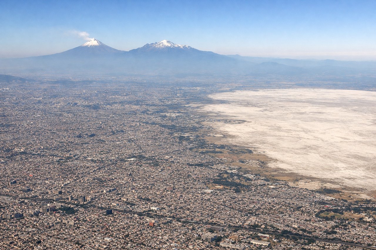
Landing at MEX
LEFTApproaching Mexico City from the southeast, left-side seats offer views of the Valley of Mexico's geography. You'll see Lake Texcoco (now mostly drained but visible as a flat basin), the surrounding mountains, and the city's sprawling layout before descent into the valley. The terrain transition is visually striking.
Will your flight be in sunlight?
Pick a date and time in the Sun Map to watch the sun move across your whole flight.
About This Route
Which side of the plane should I sit on flying from Jorge Chávez International Airport (LIM) to Licenciado Benito Juarez International (MEX)?
Sit on the Right side of the plane for the best views on flights from Lima to Mexico City. Right-side seats win overall because the takeoff view of the Andes is more visually distinctive than the landing approach, and right seats maintain better views during the northbound cruise leg along Peru's coast before turning inland toward Mexico.
What can I see during takeoff from Jorge Chávez International Airport in Lima?
During takeoff from Jorge Chávez International Airport (LIM), sit on the Right side for the best views. Jorge Chavez typically departs to the south over the Pacific Ocean before turning north. Right-side seats capture the Andes Mountains rising inland to the east, with the coastal plain and Pacific stretching westward. The contrast between ocean and mountains is dramatic from altitude. Notable sights include: Pacific Ocean (immediate west), Andes Mountains (eastern horizon), Lima urban sprawl (directly below during initial climb), Callao port district (southwest).
What can I see when landing at Licenciado Benito Juarez International in Mexico City?
When landing at Licenciado Benito Juarez International (MEX), sit on the Left side for the best views. Approaching Mexico City from the southeast, left-side seats offer views of the Valley of Mexico's geography. You'll see Lake Texcoco (now mostly drained but visible as a flat basin), the surrounding mountains, and the city's sprawling layout before descent into the valley. The terrain transition is visually striking. Notable sights include: Lake Texcoco basin (center-left during approach), Sierra Madre Oriental mountains (eastern horizon), Mexico City urban grid (foreground during final descent), Popocatépetl volcano (distant southeast on clear days).
How long is the flight from Lima to Mexico City?
The flight from Jorge Chávez International Airport (LIM) to Licenciado Benito Juarez International (MEX) takes about 5 hours. The shortest flight path between them is 2,638 miles (4,245 km); winds and air traffic control usually add a few percent.
What does the Lima to Mexico City flight path pass over?
The flight path crosses the Pacific coastal region of Peru and Ecuador, then inland over the Andes foothills and Central American highlands. Notable features include the Peruvian coastal desert (visible early in flight as tan, featureless terrain), the Andes Mountains running north-south (visible on the right/east side during cruise), Lake Titicaca region (if visible during the northern leg), and the transition into Central American terrain with increasing vegetation and volcanic peaks as you approach Mexico. The Gulf of Mexico becomes visible on the left during final approach descent.