Madrid to Bristol is 753 miles (1,213 km), a flight of about 2 hours 15 minutes.
Right seats capture the Sierra de Guadarrama on departure and the Severn Estuary and Mendip Hills on arrival. While left has the initial Madrid mountains, right provides more sustained visual interest across the flight, especially the dramatic Avon Gorge and water features on approach.
Flight Path
The flight crosses the Bay of Biscay and English Channel. Notable landmarks en route include the Pyrenees (far south, not directly on route), the Loire Valley region of France (visible as agricultural patchwork at cruise altitude), and the English Channel coast near Normandy and Devon. At cruise altitude (around 25,000-30,000 feet), the curvature of the Earth and distance compress these features; the Channel appears as a narrow water band between two landmasses. The flight path roughly follows a great-circle route northwest from Madrid, passing south of Paris airspace.
Great circle distance and headings ›Phase by phase
Takeoff from MAD
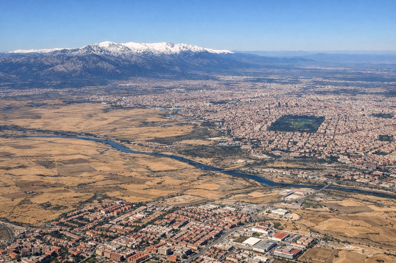
LEFTMadrid-Barajas typically departs runways 32L/R heading northwest. Left seats face toward the Sierra de Guadarrama mountain range and the northern Madrid sprawl, offering immediate terrain contrast. Right seats see the flat southern plains toward Toledo.
Landing at BRS
RIGHTApproach to Bristol typically uses runway 27 (westerly heading) or 09 (easterly heading). For westerly approaches, right seats face north toward the Cotswolds and Severn Estuary. For easterly approaches, right seats see the Somerset Levels and Mendip Hills. Either way, right offers more dramatic topography than left.
Landmarks on this routeAll landmarks →
Will your flight be in sunlight?
Pick a date and time in the Sun Map to watch the sun move across your whole flight.
About This Route
Which side of the plane should I sit on flying from Barajas (MAD) to Bristol (BRS)?
Sit on the Right side of the plane for the best views on flights from Madrid to Bristol. Right seats capture the Sierra de Guadarrama on departure and the Severn Estuary and Mendip Hills on arrival. While left has the initial Madrid mountains, right provides more sustained visual interest across the flight, especially the dramatic Avon Gorge and water features on approach.
What can I see during takeoff from Barajas in Madrid?
During takeoff from Barajas (MAD), sit on the Left side for the best views. Madrid-Barajas typically departs runways 32L/R heading northwest. Left seats face toward the Sierra de Guadarrama mountain range and the northern Madrid sprawl, offering immediate terrain contrast. Right seats see the flat southern plains toward Toledo. Notable sights include: Sierra de Guadarrama (snow-capped in winter, visible 30 miles north), Madrid city grid and Retiro Park district, Tagus River valley to the south, Alcalá de Henares urban area to the northeast.
What can I see when landing at Bristol in Bristol?
When landing at Bristol (BRS), sit on the Right side for the best views. Approach to Bristol typically uses runway 27 (westerly heading) or 09 (easterly heading). For westerly approaches, right seats face north toward the Cotswolds and Severn Estuary. For easterly approaches, right seats see the Somerset Levels and Mendip Hills. Either way, right offers more dramatic topography than left. Notable sights include: Severn Estuary (wide tidal mudflats and water), Cotswolds escarpment (rolling hills north of Bristol), Mendip Hills (limestone plateau southeast), Bristol city center and Avon Gorge.
How long is the flight from Madrid to Bristol?
The flight from Barajas (MAD) to Bristol (BRS) takes about 2 hours 15 minutes. The shortest flight path between them is 753 miles (1,213 km); winds and air traffic control usually add a few percent.
What does the Madrid to Bristol flight path pass over?
The flight crosses the Bay of Biscay and English Channel. Notable landmarks en route include the Pyrenees (far south, not directly on route), the Loire Valley region of France (visible as agricultural patchwork at cruise altitude), and the English Channel coast near Normandy and Devon. At cruise altitude (around 25,000-30,000 feet), the curvature of the Earth and distance compress these features; the Channel appears as a narrow water band between two landmasses. The flight path roughly follows a great-circle route northwest from Madrid, passing south of Paris airspace.