While Madrid's departure offers modest urban and foothill scenery (3.5), Salt Lake City's arrival dominates the flight with the Wasatch Range's dramatic alpine peaks, the Great Salt Lake, and the valley's striking geography (2.5 left + 3.5 right = 3.0 right average vs 3.5 left + 1.5 right = 2.5 left average). The right side captures the most visually distinctive segment of the entire journey—the approach into one of North America's most geographically dramatic valleys. Recommend right side for the superior landing experience.
Flown MAD to SLC? Did we get it right?
Flight Path
Madrid to Salt Lake City is 5,249 miles (8,448 km), a flight of about 10 hours 15 minutes.
The flight crosses the Atlantic at high altitude (minimal surface detail visible), then enters North American airspace over Newfoundland and Labrador. Cruise phase passes over the Canadian Shield (boreal forest, lakes, and rivers—subtle texture from altitude), then the Great Lakes region (Lake Superior visible as a massive dark rectangle), the Upper Midwest plains (flat, agricultural), and finally the Rocky Mountain chain as the aircraft descends toward Utah. The Continental Divide and the Wasatch Range become prominent in the final descent phase. No major volcanic features, fjords, or dramatic coastlines are visible on this routing—the scenery is primarily continental with mountain ranges bookending the journey.
Great circle distance and headings ›Phase by phase
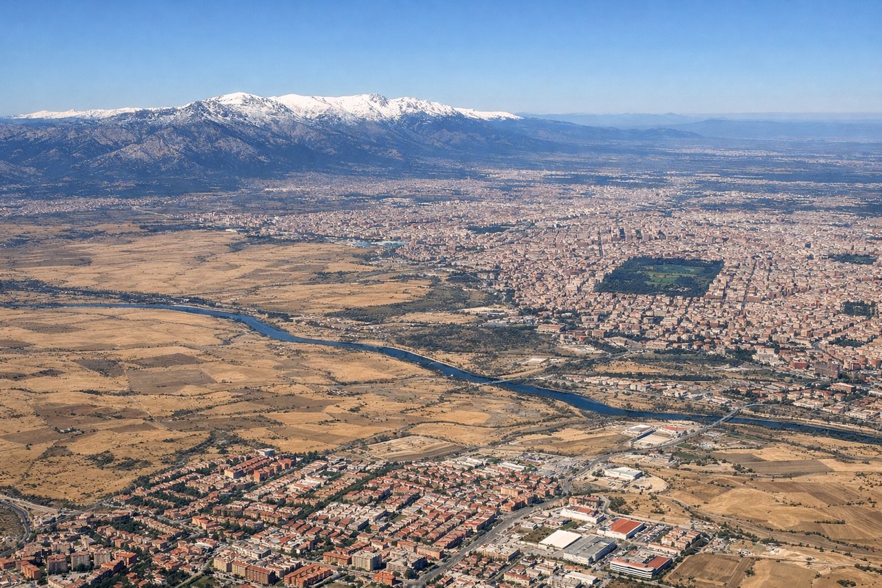
Takeoff from MAD
LEFTMadrid's departure to the northwest offers views of the city sprawl and the Sierra de Guadarrama foothills. Right side faces open plains with minimal visual interest during climb-out.
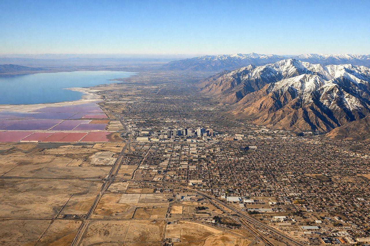
Landing at SLC
RIGHTSalt Lake City's approach from the north or south reveals the Wasatch Range dramatically to the east, the Great Salt Lake to the west, and the valley floor. Right-side passengers see the Wasatch peaks rising steeply from the valley during descent and approach. Left side faces the Oquirrh Range and open desert to the west—less dramatic.
Will your flight be in sunlight?
Pick a date and time in the Sun Map to watch the sun move across your whole flight.
About This Route
Which side of the plane should I sit on flying from Barajas (MAD) to Salt Lake City International (SLC)?
Sit on the Right side of the plane for the best views on flights from Madrid to Salt Lake City. While Madrid's departure offers modest urban and foothill scenery (3.5), Salt Lake City's arrival dominates the flight with the Wasatch Range's dramatic alpine peaks, the Great Salt Lake, and the valley's striking geography (2.5 left + 3.5 right = 3.0 right average vs 3.5 left + 1.5 right = 2.5 left average). The right side captures the most visually distinctive segment of the entire journey—the approach into one of North America's most geographically dramatic valleys. Recommend right side for the superior landing experience.
What can I see during takeoff from Barajas in Madrid?
During takeoff from Barajas (MAD), sit on the Left side for the best views. Madrid's departure to the northwest offers views of the city sprawl and the Sierra de Guadarrama foothills. Right side faces open plains with minimal visual interest during climb-out. Notable sights include: Madrid city center and suburbs, Sierra de Guadarrama (distant northern horizon), Tagus River valley.
What can I see when landing at Salt Lake City International in Salt Lake City?
When landing at Salt Lake City International (SLC), sit on the Right side for the best views. Salt Lake City's approach from the north or south reveals the Wasatch Range dramatically to the east, the Great Salt Lake to the west, and the valley floor. Right-side passengers see the Wasatch peaks rising steeply from the valley during descent and approach. Left side faces the Oquirrh Range and open desert to the west—less dramatic. Notable sights include: Wasatch Range (east side of valley), Great Salt Lake (western shore), Salt Lake City downtown and grid pattern, Utah Valley to the south.
How long is the flight from Madrid to Salt Lake City?
The flight from Barajas (MAD) to Salt Lake City International (SLC) takes about 10 hours 15 minutes. The shortest flight path between them is 5,249 miles (8,448 km); winds and air traffic control usually add a few percent.
What does the Madrid to Salt Lake City flight path pass over?
The flight crosses the Atlantic at high altitude (minimal surface detail visible), then enters North American airspace over Newfoundland and Labrador. Cruise phase passes over the Canadian Shield (boreal forest, lakes, and rivers—subtle texture from altitude), then the Great Lakes region (Lake Superior visible as a massive dark rectangle), the Upper Midwest plains (flat, agricultural), and finally the Rocky Mountain chain as the aircraft descends toward Utah. The Continental Divide and the Wasatch Range become prominent in the final descent phase. No major volcanic features, fjords, or dramatic coastlines are visible on this routing—the scenery is primarily continental with mountain ranges bookending the journey.