The left side wins both the dramatic departure over Manchester and the Peak District, and the standout arrival past Dubai's coastal skyline and Palm Jumeirah, while also catching glimpses of the Black Sea coast and Caucasus foothills during cruise. The right side offers only distant Alpine glimpses and largely featureless desert on approach.
Flight Path
The great-circle route crosses central Europe near the Austrian-Hungarian border, then passes over the Black Sea coast of northern Turkey and the Anatolian plateau before continuing over northern Iraq and the Arabian interior toward the Gulf.
Great circle distance and headings ›
.jpg?width=600)


_and_the_Dubai_skyline_(25781049892).jpg?width=600)
.jpg?width=600)
Phase by phase
Takeoff from MAN
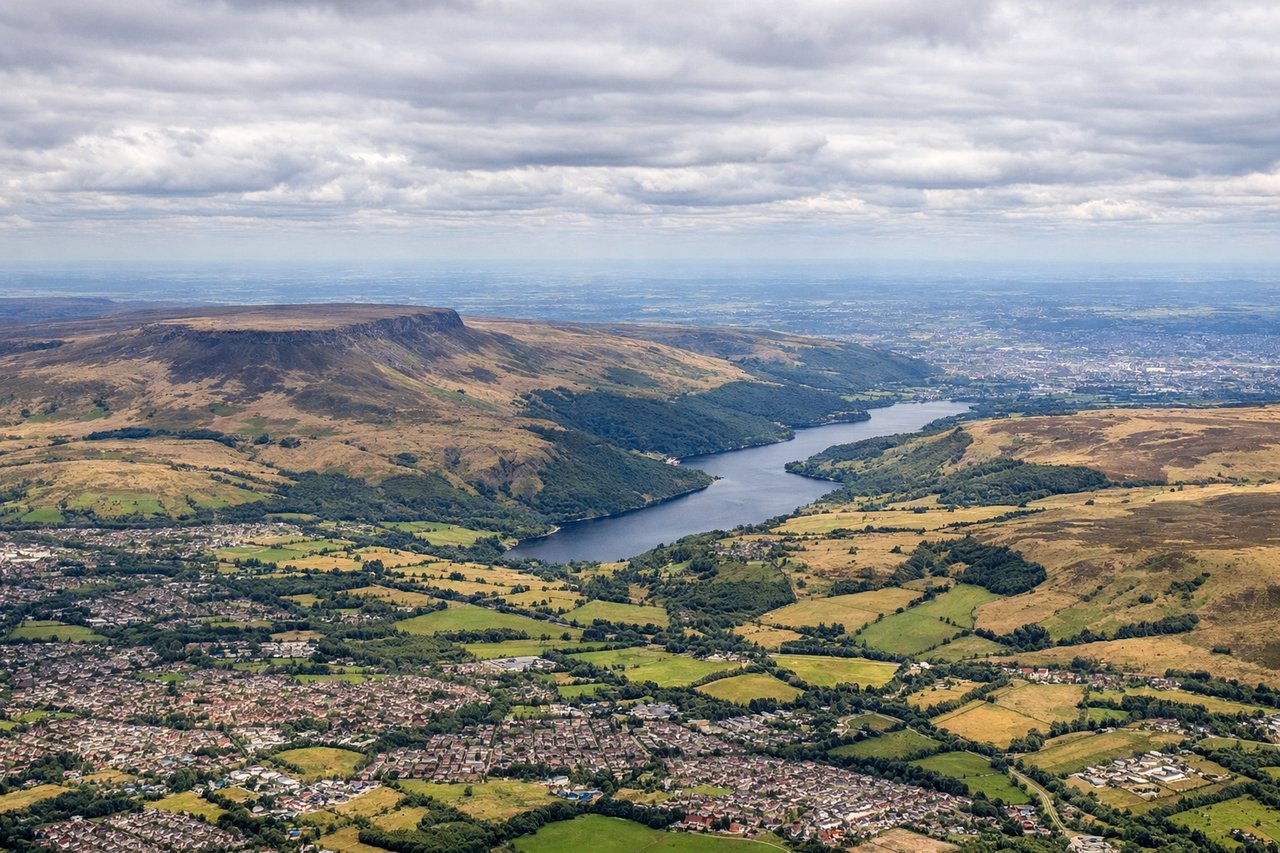
LEFTDeparting Manchester on runway 23, the eastbound routing to the Gulf requires a looping left turn back over Greater Manchester, putting the city center and the Peak District's Pennine hills on the left side as the aircraft climbs. The right side mostly shows the flatter Cheshire Plain fading into haze.
Landing at DXB
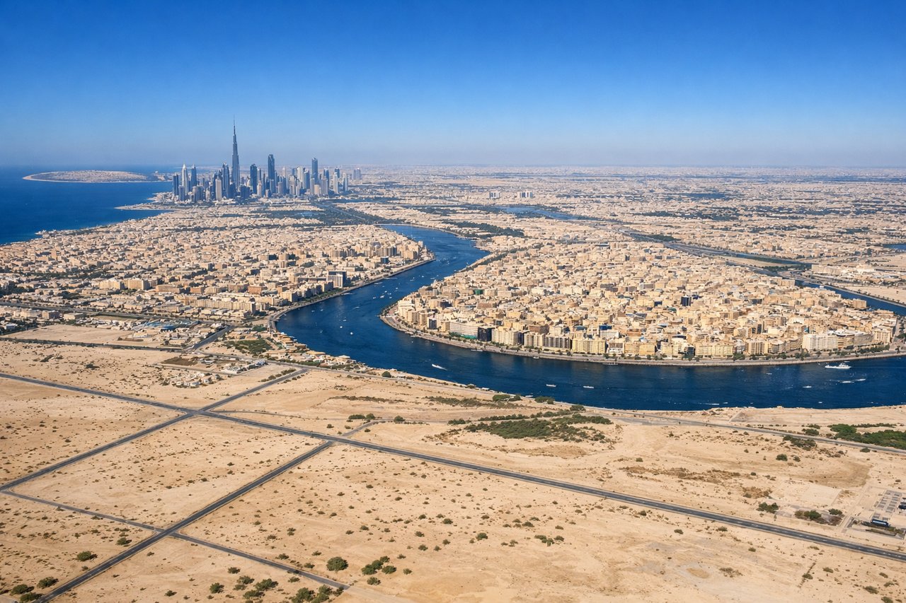
LEFTOn the common southeast-facing approach into DXB (runway 12), the flight path passes just south of the coast, putting Dubai's skyline, Palm Jumeirah, and the turquoise Gulf waters on the left side of the aircraft. The right side over the desert interior is comparatively featureless.
Landmarks on this routeAll landmarks →
Will your flight be in sunlight?
See exactly which side of the plane gets sun and shade at your departure time.
About This Route
Which side of the plane should I sit on flying from Manchester (MAN) to Dubai International (DXB)?
Sit on the Left side of the plane for the best views on flights from Manchester to Dubai. The left side wins both the dramatic departure over Manchester and the Peak District, and the standout arrival past Dubai's coastal skyline and Palm Jumeirah, while also catching glimpses of the Black Sea coast and Caucasus foothills during cruise. The right side offers only distant Alpine glimpses and largely featureless desert on approach.
What can I see during takeoff from Manchester in Manchester?
During takeoff from Manchester (MAN), sit on the Left side for the best views. Departing Manchester on runway 23, the eastbound routing to the Gulf requires a looping left turn back over Greater Manchester, putting the city center and the Peak District's Pennine hills on the left side as the aircraft climbs. The right side mostly shows the flatter Cheshire Plain fading into haze. Notable sights include: Manchester city center and skyline, Peak District hills, Pennine foothills, Etherow/Goyt valley farmland.
What can I see when landing at Dubai International in Dubai?
When landing at Dubai International (DXB), sit on the Left side for the best views. On the common southeast-facing approach into DXB (runway 12), the flight path passes just south of the coast, putting Dubai's skyline, Palm Jumeirah, and the turquoise Gulf waters on the left side of the aircraft. The right side over the desert interior is comparatively featureless. Notable sights include: Burj Khalifa and Downtown Dubai skyline, Palm Jumeirah, Dubai Marina towers, Arabian Gulf coastline.
How long is the flight from Manchester to Dubai?
The flight from Manchester (MAN) to Dubai International (DXB) takes 7h 05m.
What does the Manchester to Dubai flight path pass over?
The great-circle route crosses central Europe near the Austrian-Hungarian border, then passes over the Black Sea coast of northern Turkey and the Anatolian plateau before continuing over northern Iraq and the Arabian interior toward the Gulf.