Both sides score equally at 2.0 due to the predominantly flat terrain across the entire route. However, left side edges ahead for takeoff scenery with Orlando's urban definition and Lake Apopka providing more visual interest than the immediate inland plains on the right. The flight crosses the Great Plains with minimal elevation change, mountains, or dramatic landmarks on either side. Right side gains points during landing with the Missouri River valley, but takeoff advantage gives left the overall edge.
Flown MCO to OMA? Did we get it right?
Flight Path
Orlando to Omaha is 1,211 miles (1,949 km), a flight of about 3 hours 15 minutes.
Georgia-Tennessee border region (Appalachian foothills to the east, not visible from cruise altitude on this route); Kentucky and Indiana farmland; Ohio River valley near Cincinnati (south of direct route); Illinois prairie and Mississippi River valley; Missouri River valley approaching Omaha. The flight path crosses primarily flat to gently rolling terrain with no significant mountain ranges or dramatic geographic features visible from cruise altitude.
Great circle distance and headings ›

Phase by phase
Takeoff from MCO
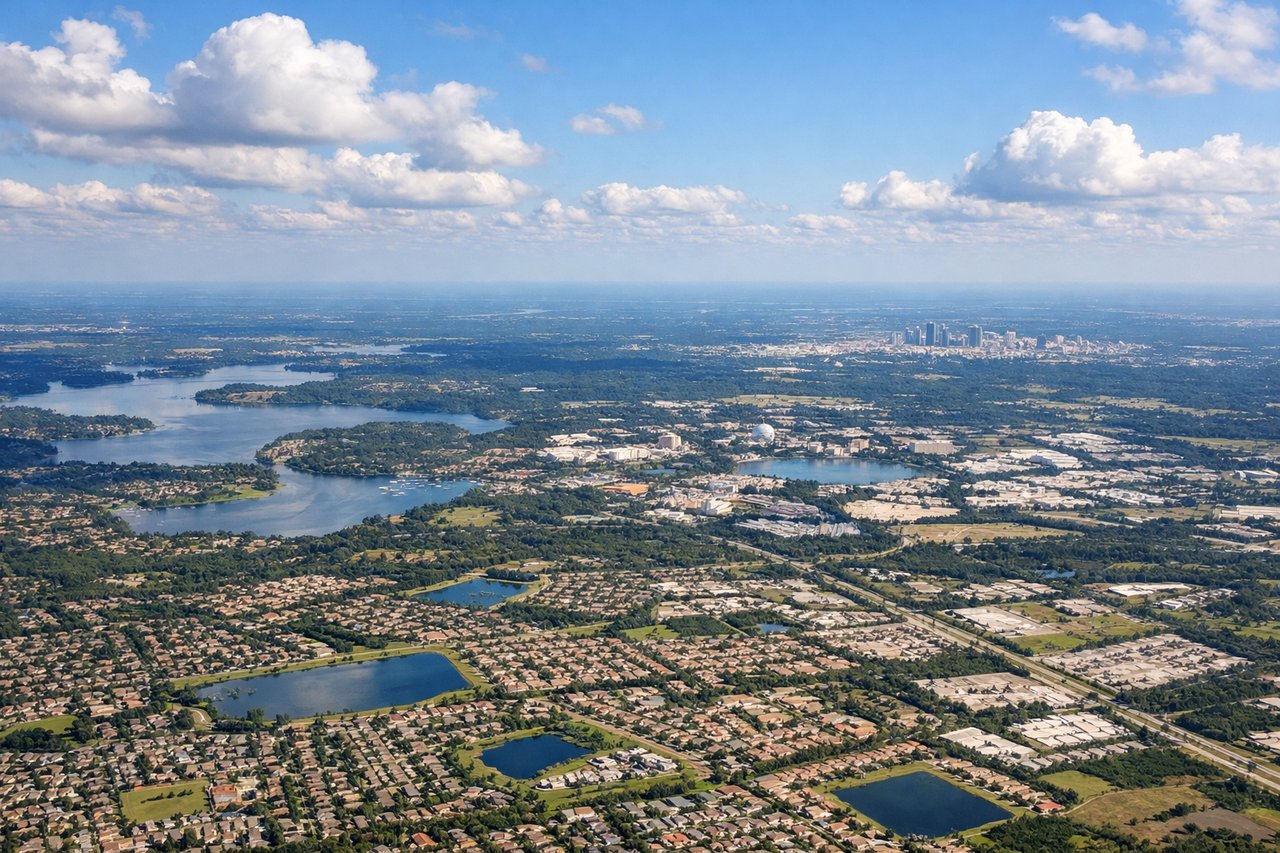
LEFTLeft side captures Orlando's urban sprawl and the transition from coastal Florida flatlands toward inland terrain. Right side faces inland immediately with minimal urban definition.
Landing at OMA
RIGHTRight side offers views of the Missouri River valley and Omaha's urban landscape during approach. Left side remains over flat agricultural plains with minimal visual interest.
Will your flight be in sunlight?
Pick a date and time in the Sun Map to watch the sun move across your whole flight.
About This Route
Which side of the plane should I sit on flying from Orlando International (MCO) to Eppley Afld (OMA)?
Sit on the Left side of the plane for the best views on flights from Orlando to Omaha. Both sides score equally at 2.0 due to the predominantly flat terrain across the entire route. However, left side edges ahead for takeoff scenery with Orlando's urban definition and Lake Apopka providing more visual interest than the immediate inland plains on the right. The flight crosses the Great Plains with minimal elevation change, mountains, or dramatic landmarks on either side. Right side gains points during landing with the Missouri River valley, but takeoff advantage gives left the overall edge.
What can I see during takeoff from Orlando International in Orlando?
During takeoff from Orlando International (MCO), sit on the Left side for the best views. Left side captures Orlando's urban sprawl and the transition from coastal Florida flatlands toward inland terrain. Right side faces inland immediately with minimal urban definition. Notable sights include: Orlando downtown skyline, Lake Apopka (large freshwater lake east of the city), Florida's flat coastal plain extending toward the Atlantic.
What can I see when landing at Eppley Afld in Omaha?
When landing at Eppley Afld (OMA), sit on the Right side for the best views. Right side offers views of the Missouri River valley and Omaha's urban landscape during approach. Left side remains over flat agricultural plains with minimal visual interest. Notable sights include: Missouri River (major geographic divider between Nebraska and Iowa), Omaha skyline and downtown riverfront, Eppley Airfield runways aligned with river valley.
How long is the flight from Orlando to Omaha?
The flight from Orlando International (MCO) to Eppley Afld (OMA) takes about 3 hours 15 minutes. The shortest flight path between them is 1,211 miles (1,949 km); winds and air traffic control usually add a few percent.
What does the Orlando to Omaha flight path pass over?
Georgia-Tennessee border region (Appalachian foothills to the east, not visible from cruise altitude on this route); Kentucky and Indiana farmland; Ohio River valley near Cincinnati (south of direct route); Illinois prairie and Mississippi River valley; Missouri River valley approaching Omaha. The flight path crosses primarily flat to gently rolling terrain with no significant mountain ranges or dramatic geographic features visible from cruise altitude.