While takeoff favors the right for Florida's coastal geography, the landing view on the left—featuring the Panama Canal, Gatun Lake, and the dramatic isthmus geography—is the more geographically significant and visually distinctive segment of this route. The canal approach is a once-in-a-lifetime view for most passengers.
Flown MCO to PTY? Did we get it right?
Flight Path
Orlando to Panama City is 1,343 miles (2,162 km), a flight of about 3 hours 30 minutes.
The flight path crosses the Caribbean Sea south of Cuba and Jamaica, passing over the Yucatan Channel and then the open Caribbean. At cruise altitude (around 30,000-35,000 feet), you'll see scattered cumulus cloud formations typical of tropical maritime air, but little distinctive land. The coast of Honduras or the Bay Islands may be visible off the left wing roughly 90 minutes into the flight, depending on exact routing. The approach to Panama brings you over the Caribbean coast of Costa Rica and Panama, with rainforest visible beneath the clouds as you descend into the approach corridor.
Great circle distance and headings ›


Phase by phase

Takeoff from MCO
RIGHTRight side captures the Atlantic coast and the sprawl of greater Orlando as you climb out. MCO typically departs eastbound or southeastbound, and right-side seats give you the clearest view of the coastal geography that defines the first 10 minutes of climb.
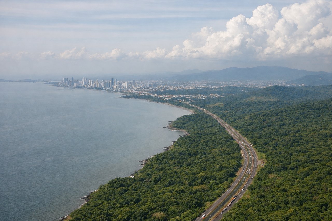
Landing at PTY
LEFTLeft side gives you the Panama Canal approach and the geography of Panama City's location on the Caribbean coast. PTY typically uses runways aligned roughly east-west, and left-side seats on descent capture the canal, Gatun Lake, and the urban sprawl of Panama City as you descend into the approach corridor.
Will your flight be in sunlight?
Pick a date and time in the Sun Map to watch the sun move across your whole flight.
About This Route
Which side of the plane should I sit on flying from Orlando International (MCO) to Tocumen International (PTY)?
Sit on the Left side of the plane for the best views on flights from Orlando to Panama City. While takeoff favors the right for Florida's coastal geography, the landing view on the left—featuring the Panama Canal, Gatun Lake, and the dramatic isthmus geography—is the more geographically significant and visually distinctive segment of this route. The canal approach is a once-in-a-lifetime view for most passengers.
What can I see during takeoff from Orlando International in Orlando?
During takeoff from Orlando International (MCO), sit on the Right side for the best views. Right side captures the Atlantic coast and the sprawl of greater Orlando as you climb out. MCO typically departs eastbound or southeastbound, and right-side seats give you the clearest view of the coastal geography that defines the first 10 minutes of climb. Notable sights include: Atlantic Ocean (immediate east), Indian River Lagoon system (barrier island chain running north-south), Lake Apopka (large freshwater lake west of downtown, visible as you bank), downtown Orlando skyline (small but distinct cluster on the horizon to the west-southwest).
What can I see when landing at Tocumen International in Panama City?
When landing at Tocumen International (PTY), sit on the Left side for the best views. Left side gives you the Panama Canal approach and the geography of Panama City's location on the Caribbean coast. PTY typically uses runways aligned roughly east-west, and left-side seats on descent capture the canal, Gatun Lake, and the urban sprawl of Panama City as you descend into the approach corridor. Notable sights include: Panama Canal (the actual waterway and cut through the isthmus, visible as a distinct linear feature), Gatun Lake (large artificial reservoir north of the canal, appearing as a substantial blue body of water), Panama City skyline (modern high-rise district on the Pacific side), Colón city area (Caribbean-side port city visible to the north across the isthmus).
How long is the flight from Orlando to Panama City?
The flight from Orlando International (MCO) to Tocumen International (PTY) takes about 3 hours 30 minutes. The shortest flight path between them is 1,343 miles (2,162 km); winds and air traffic control usually add a few percent.
What does the Orlando to Panama City flight path pass over?
The flight path crosses the Caribbean Sea south of Cuba and Jamaica, passing over the Yucatan Channel and then the open Caribbean. At cruise altitude (around 30,000-35,000 feet), you'll see scattered cumulus cloud formations typical of tropical maritime air, but little distinctive land. The coast of Honduras or the Bay Islands may be visible off the left wing roughly 90 minutes into the flight, depending on exact routing. The approach to Panama brings you over the Caribbean coast of Costa Rica and Panama, with rainforest visible beneath the clouds as you descend into the approach corridor.