While the Melbourne departure favors the left side with its bay and city views, the right side wins overall thanks to the dramatic Margalla Hills and foothill scenery during the Islamabad approach, which offers more sustained topographic interest than the flat outback and plains seen elsewhere on the route.
Flight Path
Central Australian outback (Great Sandy Desert region), Indonesian archipelago including Java and Sumatra, Bay of Bengal, and the Indo-Gangetic plain of northern India before crossing into Pakistan
Great circle distance and headings ›

Phase by phase
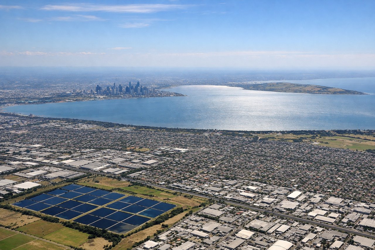
Takeoff from MEL
LEFTDeparting Melbourne, the initial climb offers a clear view over Port Phillip Bay and the city's coastline before the aircraft turns inland toward the outback. The right side mostly shows the flatter eastern suburbs and the low Dandenong Ranges, less visually striking than the bay.
Landing at ISB
RIGHTOn approach into Islamabad from the east, the descent path passes north of the Margalla Hills, giving right-side passengers a dramatic view of these forested foothills backing the city, with the higher peaks of the Murree Hills visible beyond. The left side mostly shows the flat Punjab plains without similar relief.
Landmarks on this routeAll landmarks →
Will your flight be in sunlight?
See exactly which side of the plane gets sun and shade at your departure time.
About This Route
Which side of the plane should I sit on flying from Melbourne International (MEL) to Islamabad International Airport (ISB)?
Sit on the Right side of the plane for the best views on flights from Melbourne to Islamabad. While the Melbourne departure favors the left side with its bay and city views, the right side wins overall thanks to the dramatic Margalla Hills and foothill scenery during the Islamabad approach, which offers more sustained topographic interest than the flat outback and plains seen elsewhere on the route.
What can I see during takeoff from Melbourne International in Melbourne?
During takeoff from Melbourne International (MEL), sit on the Left side for the best views. Departing Melbourne, the initial climb offers a clear view over Port Phillip Bay and the city's coastline before the aircraft turns inland toward the outback. The right side mostly shows the flatter eastern suburbs and the low Dandenong Ranges, less visually striking than the bay. Notable sights include: Port Phillip Bay, Melbourne CBD skyline, Bellarine Peninsula, You Yangs Range.
What can I see when landing at Islamabad International Airport in Islamabad?
When landing at Islamabad International Airport (ISB), sit on the Right side for the best views. On approach into Islamabad from the east, the descent path passes north of the Margalla Hills, giving right-side passengers a dramatic view of these forested foothills backing the city, with the higher peaks of the Murree Hills visible beyond. The left side mostly shows the flat Punjab plains without similar relief. Notable sights include: Margalla Hills, Murree Hills foothills, Islamabad's grid-planned sectors, Rawal Lake.
How long is the flight from Melbourne to Islamabad?
The flight from Melbourne International (MEL) to Islamabad International Airport (ISB) takes 11h 15m.
What does the Melbourne to Islamabad flight path pass over?
Central Australian outback (Great Sandy Desert region), Indonesian archipelago including Java and Sumatra, Bay of Bengal, and the Indo-Gangetic plain of northern India before crossing into Pakistan