The right side delivers the most dramatic scenery on both legs: the Sierra Madre during climb-out (visible to the left initially, but the right side clears faster for unobstructed views northward), and the Rocky Mountains during descent are a genuine highlight. The landing approach with mountain views outweighs the takeoff advantage.
Flown MEX to YYC? Did we get it right?
Flight Path
Mexico City to Calgary is 2,336 miles (3,759 km), a flight of about 4 hours 15 minutes.
The flight passes over the Sierra Madre Occidental in northern Mexico (visible from both sides depending on altitude and exact routing), the high plateau of Chihuahua and Durango states, the Rio Grande valley marking the US-Mexico border, the New Mexico and Colorado high desert terrain, and the transition into the Great Plains of Texas and Oklahoma before reaching the Canadian prairies. The Sangre de Cristo Mountains and San Juan Mountains may be visible to the right during the northern US portion of the flight.
Great circle distance and headings ›


Phase by phase
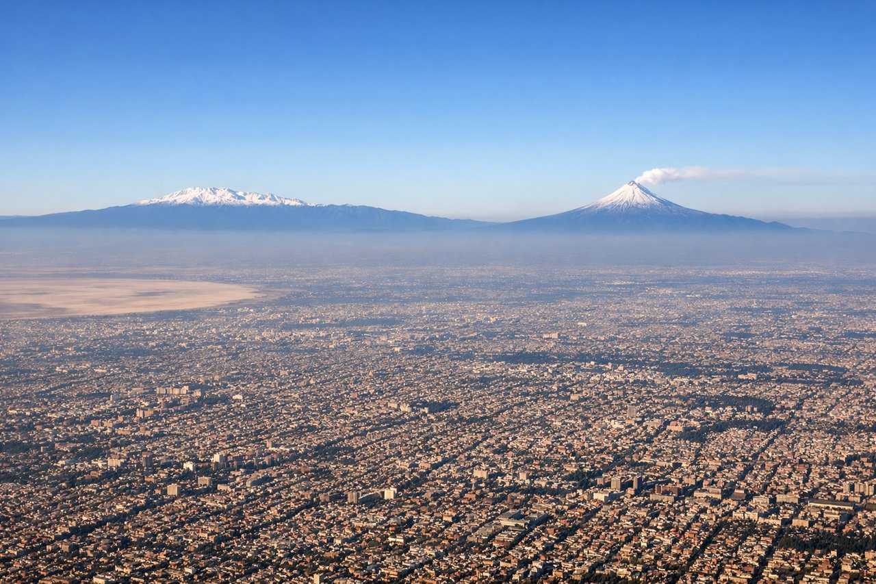
Takeoff from MEX
LEFTLeft side captures the Sierra Madre Oriental as the aircraft climbs northwest out of Mexico City. The mountain range rises dramatically to the left (east) of the departure corridor, creating a striking backdrop during the initial climb.
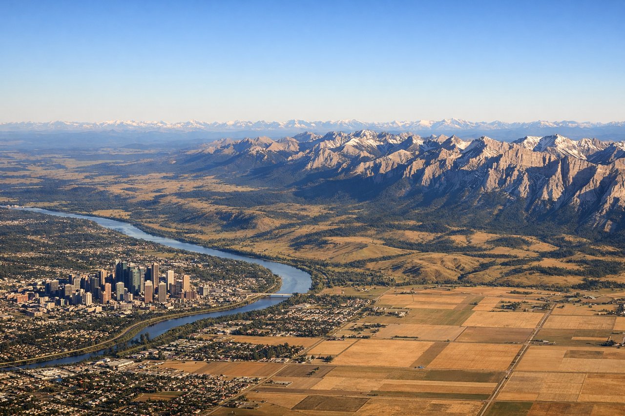
Landing at YYC
RIGHTRight side offers the best view during approach to Calgary. The Rocky Mountains dominate the western horizon as the aircraft descends from the northeast, and the right window captures the front range peaks and the transition from prairie to foothills.
Will your flight be in sunlight?
Pick a date and time in the Sun Map to watch the sun move across your whole flight.
About This Route
Which side of the plane should I sit on flying from Licenciado Benito Juarez International (MEX) to Calgary International (YYC)?
Sit on the Right side of the plane for the best views on flights from Mexico City to Calgary. The right side delivers the most dramatic scenery on both legs: the Sierra Madre during climb-out (visible to the left initially, but the right side clears faster for unobstructed views northward), and the Rocky Mountains during descent are a genuine highlight. The landing approach with mountain views outweighs the takeoff advantage.
What can I see during takeoff from Licenciado Benito Juarez International in Mexico City?
During takeoff from Licenciado Benito Juarez International (MEX), sit on the Left side for the best views. Left side captures the Sierra Madre Oriental as the aircraft climbs northwest out of Mexico City. The mountain range rises dramatically to the left (east) of the departure corridor, creating a striking backdrop during the initial climb. Notable sights include: Sierra Madre Oriental, Lake Texcoco (shrunk but visible as a pale water body beneath the city), Mexico City urban sprawl extending south and east, Popocatépetl volcano (visible on clear days to the southeast, but secondary to the immediate Sierra Madre view).
What can I see when landing at Calgary International in Calgary?
When landing at Calgary International (YYC), sit on the Right side for the best views. Right side offers the best view during approach to Calgary. The Rocky Mountains dominate the western horizon as the aircraft descends from the northeast, and the right window captures the front range peaks and the transition from prairie to foothills. Notable sights include: Canadian Rocky Mountains (front range peaks including Mount Rundle and Cascade Mountain visible on clear days), Bow River valley cutting through the landscape, Calgary's downtown core and sprawling suburbs, Foothills transition zone between prairie and mountains.
How long is the flight from Mexico City to Calgary?
The flight from Licenciado Benito Juarez International (MEX) to Calgary International (YYC) takes about 4 hours 15 minutes. The shortest flight path between them is 2,336 miles (3,759 km); winds and air traffic control usually add a few percent.
What does the Mexico City to Calgary flight path pass over?
The flight passes over the Sierra Madre Occidental in northern Mexico (visible from both sides depending on altitude and exact routing), the high plateau of Chihuahua and Durango states, the Rio Grande valley marking the US-Mexico border, the New Mexico and Colorado high desert terrain, and the transition into the Great Plains of Texas and Oklahoma before reaching the Canadian prairies. The Sangre de Cristo Mountains and San Juan Mountains may be visible to the right during the northern US portion of the flight.