Right-side seats win overall because the takeoff view of the Canadian Rockies is more dramatic and sustained than the landing view. The mountains dominate the first 30-45 minutes of flight, whereas the Mexico City approach is shorter and more urban-focused. If you prioritize the landing volcanoes, choose left, but right offers better total viewing time.
Flown YYC to MEX? Did we get it right?
Flight Path
Calgary to Mexico City is 2,336 miles (3,759 km), a flight of about 4 hours 30 minutes.
The flight path crosses the U.S. Great Plains (Kansas, Oklahoma, Texas panhandle) with minimal dramatic features at cruise altitude. Around the Texas-Mexico border, the Sierra Madre Oriental mountains become visible to the east (left side) as a low, distant ridge. As you approach Mexico, the landscape transitions from high desert scrub to the volcanic plateau surrounding Mexico City. The descent into the Mexico City valley is the most visually interesting segment after takeoff.
Great circle distance and headings ›


Phase by phase
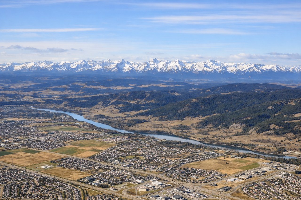
Takeoff from YYC
RIGHTRight-side seats capture the Canadian Rockies during the initial climb-out heading southeast. The mountains rise dramatically to the west and southwest of YYC, and a right-side window frames them perfectly as you gain altitude over the first 10-15 minutes of flight.
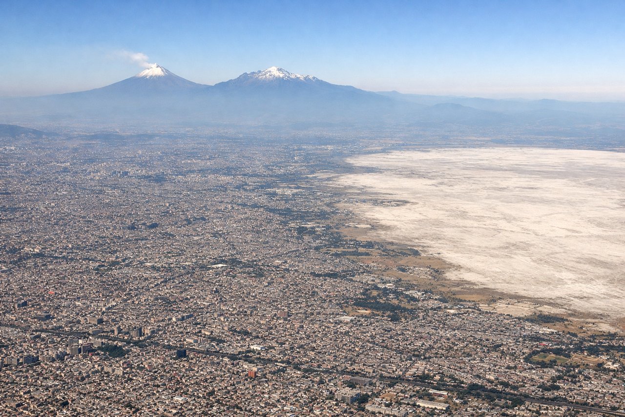
Landing at MEX
LEFTLeft-side seats offer the best view during approach to MEX. Depending on runway assignment (typically 05L/05R or 09L/09R), a left-side window captures the Mexico City metropolitan area, the surrounding volcanic peaks, and Lake Texcoco as you descend into the valley.
Will your flight be in sunlight?
Pick a date and time in the Sun Map to watch the sun move across your whole flight.
About This Route
Which side of the plane should I sit on flying from Calgary International (YYC) to Licenciado Benito Juarez International (MEX)?
Sit on the Right side of the plane for the best views on flights from Calgary to Mexico City. Right-side seats win overall because the takeoff view of the Canadian Rockies is more dramatic and sustained than the landing view. The mountains dominate the first 30-45 minutes of flight, whereas the Mexico City approach is shorter and more urban-focused. If you prioritize the landing volcanoes, choose left, but right offers better total viewing time.
What can I see during takeoff from Calgary International in Calgary?
During takeoff from Calgary International (YYC), sit on the Right side for the best views. Right-side seats capture the Canadian Rockies during the initial climb-out heading southeast. The mountains rise dramatically to the west and southwest of YYC, and a right-side window frames them perfectly as you gain altitude over the first 10-15 minutes of flight. Notable sights include: Canadian Rockies (peaks visible 40-60 miles southwest), Bow River valley (threading through the foothills below), Lake Louise area (distant, high altitude), Elbow River confluence near downtown Calgary (visible during initial climb).
What can I see when landing at Licenciado Benito Juarez International in Mexico City?
When landing at Licenciado Benito Juarez International (MEX), sit on the Left side for the best views. Left-side seats offer the best view during approach to MEX. Depending on runway assignment (typically 05L/05R or 09L/09R), a left-side window captures the Mexico City metropolitan area, the surrounding volcanic peaks, and Lake Texcoco as you descend into the valley. Notable sights include: Popocatépetl and Iztaccíhuatl volcanoes (visible to the southeast on clear days), Lake Texcoco (shallow remnant lake in the valley floor), Mexico City's urban sprawl (dense grid of buildings and streets), Sierra de Guadalupe mountains (northern rim of the valley).
How long is the flight from Calgary to Mexico City?
The flight from Calgary International (YYC) to Licenciado Benito Juarez International (MEX) takes about 4 hours 30 minutes. The shortest flight path between them is 2,336 miles (3,759 km); winds and air traffic control usually add a few percent.
What does the Calgary to Mexico City flight path pass over?
The flight path crosses the U.S. Great Plains (Kansas, Oklahoma, Texas panhandle) with minimal dramatic features at cruise altitude. Around the Texas-Mexico border, the Sierra Madre Oriental mountains become visible to the east (left side) as a low, distant ridge. As you approach Mexico, the landscape transitions from high desert scrub to the volcanic plateau surrounding Mexico City. The descent into the Mexico City valley is the most visually interesting segment after takeoff.