Miami to Barinas is 1,359 miles (2,187 km), a flight of about 3 hours 45 minutes.
The right side delivers the spectacular Miami Beach and Biscayne Bay departure, then tracks the Cuban coastline at distance, and crosses the Caribbean with views of the Venezuelan coast on approach. The left side has the Andes advantage on landing but is otherwise over open water and flat terrain for most of the flight.
Flight Path
The flight tracks south-southeast across the Straits of Florida, passing Cuba to the east (right side may glimpse the eastern Cuban highlands near Guantánamo), then crosses the Caribbean Sea. The Venezuelan coast near Coro and the Paraguaná Peninsula may be visible on descent. The dramatic transition from the flat Llanos to the Andes foothills occurs in the final 30 minutes of flight.
Great circle distance and headings ›Phase by phase
Takeoff from MIA
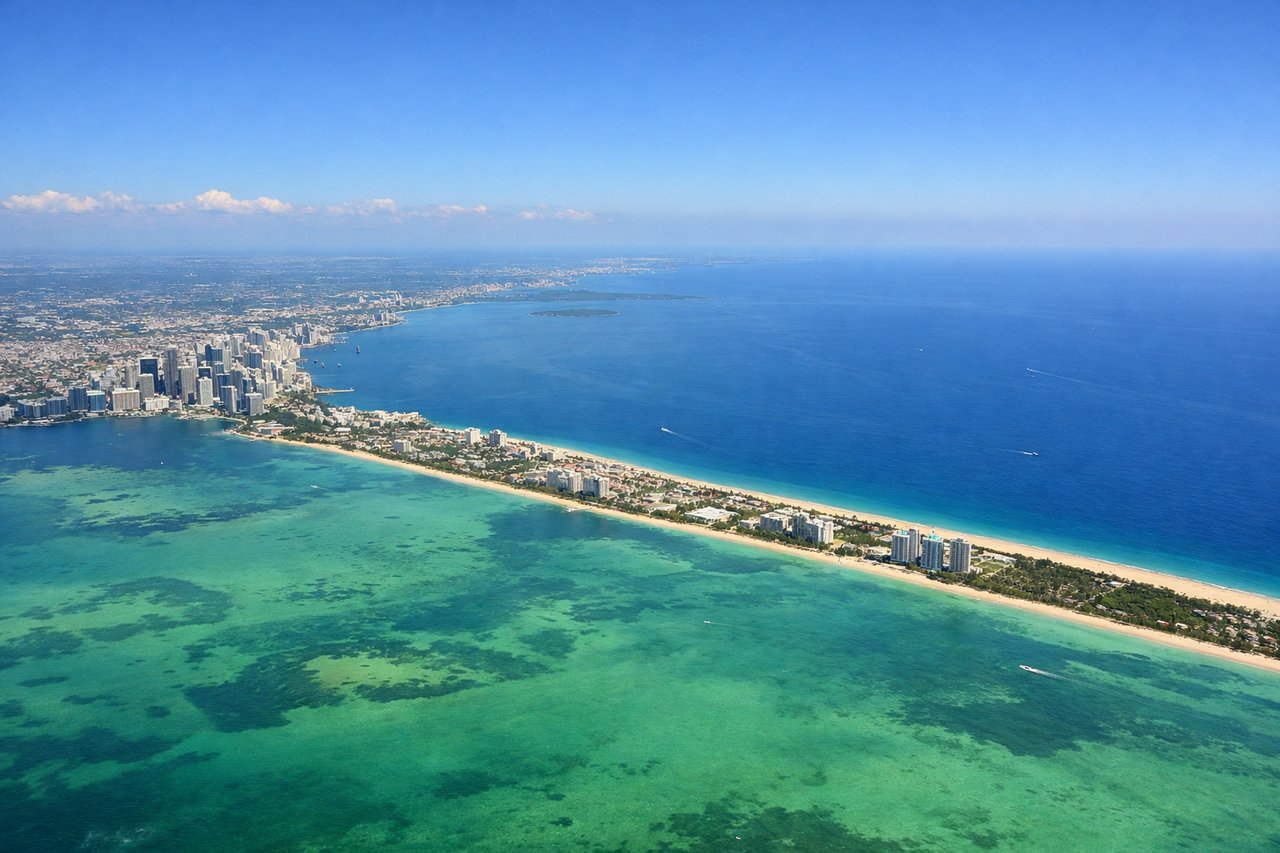
RIGHTMIA typically departs east on runway 08R/09, then turns south over Biscayne Bay before heading southeast. Right side gives you the Miami Beach barrier island, the turquoise shallows of Biscayne Bay, and the Florida Keys chain stretching southwest. Left side faces inland toward the Everglades which is flat and featureless at this stage.
Landing at BNS
LEFTBarinas Airport (BNS) sits at the foot of the Andes, with the Cordillera de Mérida rising dramatically to the west and southwest. Approaching from the north, the left side faces west toward the Andes foothills and the city of Barinas itself. The right side looks east over the flat Llanos plains, which are visually monotonous.
Landmarks on this routeAll landmarks →
Will your flight be in sunlight?
Pick a date and time in the Sun Map to watch the sun move across your whole flight.
About This Route
Which side of the plane should I sit on flying from Miami International (MIA) to Barinas (BNS)?
Sit on the Right side of the plane for the best views on flights from Miami to Barinas. The right side delivers the spectacular Miami Beach and Biscayne Bay departure, then tracks the Cuban coastline at distance, and crosses the Caribbean with views of the Venezuelan coast on approach. The left side has the Andes advantage on landing but is otherwise over open water and flat terrain for most of the flight.
What can I see during takeoff from Miami International in Miami?
During takeoff from Miami International (MIA), sit on the Right side for the best views. MIA typically departs east on runway 08R/09, then turns south over Biscayne Bay before heading southeast. Right side gives you the Miami Beach barrier island, the turquoise shallows of Biscayne Bay, and the Florida Keys chain stretching southwest. Left side faces inland toward the Everglades which is flat and featureless at this stage. Notable sights include: Miami Beach and South Beach shoreline, Biscayne Bay shallow flats, Virginia Key and Key Biscayne, the beginning of the Florida Keys chain.
What can I see when landing at Barinas in Barinas?
When landing at Barinas (BNS), sit on the Left side for the best views. Barinas Airport (BNS) sits at the foot of the Andes, with the Cordillera de Mérida rising dramatically to the west and southwest. Approaching from the north, the left side faces west toward the Andes foothills and the city of Barinas itself. The right side looks east over the flat Llanos plains, which are visually monotonous. Notable sights include: Cordillera de Mérida Andean foothills, the city of Barinas urban grid, the Apure River system threading through the Llanos, the abrupt transition from flat plains to mountain terrain.
How long is the flight from Miami to Barinas?
The flight from Miami International (MIA) to Barinas (BNS) takes about 3 hours 45 minutes. The shortest flight path between them is 1,359 miles (2,187 km); winds and air traffic control usually add a few percent.
What does the Miami to Barinas flight path pass over?
The flight tracks south-southeast across the Straits of Florida, passing Cuba to the east (right side may glimpse the eastern Cuban highlands near Guantánamo), then crosses the Caribbean Sea. The Venezuelan coast near Coro and the Paraguaná Peninsula may be visible on descent. The dramatic transition from the flat Llanos to the Andes foothills occurs in the final 30 minutes of flight.