Miami to Panama City is 437 miles (704 km), a flight of about 1 hour 15 minutes.
While takeoff offers good Biscayne Bay views on the right, the landing approach on the left provides more dramatic and varied scenery—St. Andrew Bay, barrier islands, and coastal wetlands are more visually distinctive than the Miami departure corridor.
Flight Path
The flight path crosses the Gulf of Mexico heading northwest. Notable features include the Florida west coast (Big Bend area with shallow coastal waters and marshlands), the Panhandle's coastal geography, and numerous small barrier islands and bays along the Gulf shoreline. The Gulf itself appears as open water with occasional shipping traffic visible as small dots. No major mountain ranges or dramatic terrain—the entire route is over flat coastal and marine geography with maximum elevation changes under 500 feet.
Great circle distance and headings ›Phase by phase
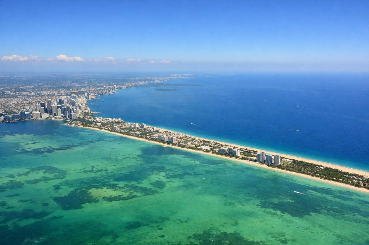
Takeoff from MIA
RIGHTRight-side seats offer views of Biscayne Bay and the Miami coastline as the aircraft climbs northwestward. You'll see the barrier islands, shallow turquoise waters, and the Miami urban sprawl receding below.
Landing at PAM
LEFTLeft-side seats provide views during descent into Tyndall AFB. You'll see the Florida Panhandle coastline, St. Andrew Bay, and the approach over coastal marshlands and barrier islands before landing.
Landmarks on this routeAll landmarks →
Will your flight be in sunlight?
Pick a date and time in the Sun Map to watch the sun move across your whole flight.
About This Route
Which side of the plane should I sit on flying from Miami International (MIA) to Tyndall Afb (PAM)?
Sit on the Left side of the plane for the best views on flights from Miami to Panama City. While takeoff offers good Biscayne Bay views on the right, the landing approach on the left provides more dramatic and varied scenery—St. Andrew Bay, barrier islands, and coastal wetlands are more visually distinctive than the Miami departure corridor.
What can I see during takeoff from Miami International in Miami?
During takeoff from Miami International (MIA), sit on the Right side for the best views. Right-side seats offer views of Biscayne Bay and the Miami coastline as the aircraft climbs northwestward. You'll see the barrier islands, shallow turquoise waters, and the Miami urban sprawl receding below. Notable sights include: Biscayne Bay, Miami Beach barrier islands, Port of Miami container terminals, Atlantic Ocean horizon.
What can I see when landing at Tyndall Afb in Panama City?
When landing at Tyndall Afb (PAM), sit on the Left side for the best views. Left-side seats provide views during descent into Tyndall AFB. You'll see the Florida Panhandle coastline, St. Andrew Bay, and the approach over coastal marshlands and barrier islands before landing. Notable sights include: St. Andrew Bay, Shell Island barrier island, Panama City Beach, Tyndall AFB runway approach over coastal wetlands.
How long is the flight from Miami to Panama City?
The flight from Miami International (MIA) to Tyndall Afb (PAM) takes about 1 hour 15 minutes. The shortest flight path between them is 437 miles (704 km); winds and air traffic control usually add a few percent.
What does the Miami to Panama City flight path pass over?
The flight path crosses the Gulf of Mexico heading northwest. Notable features include the Florida west coast (Big Bend area with shallow coastal waters and marshlands), the Panhandle's coastal geography, and numerous small barrier islands and bays along the Gulf shoreline. The Gulf itself appears as open water with occasional shipping traffic visible as small dots. No major mountain ranges or dramatic terrain—the entire route is over flat coastal and marine geography with maximum elevation changes under 500 feet.