The right side offers a richer visual sequence: Miami's coastline and bay at departure, glimpses of the Bahamian and Turks and Caicos island chains during cruise, and a dramatic harbor-side approach into St. Thomas, while the left side faces mostly open Atlantic water with fewer landmarks.
Flight Path
Bahamian island chain (Andros and Exuma vicinity), Turks and Caicos banks, open Atlantic waters north of Puerto Rico
Great circle distance and headings ›Phase by phase
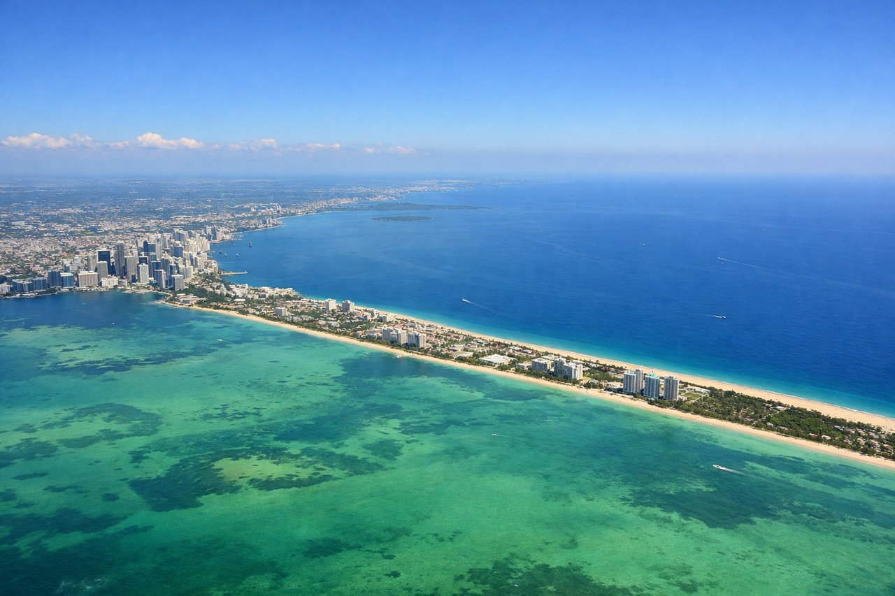
Takeoff from MIA
RIGHTDepartures from MIA heading toward the Caribbean typically turn south after liftoff, putting Miami's downtown skyline, Biscayne Bay, and Key Biscayne on the right side of the aircraft as it climbs out over the coast before heading offshore.
Landing at STT
RIGHTThe approach into STT on Runway 10 requires maneuvering over Charlotte Amalie harbor to avoid the hills near the threshold, giving passengers on the right side a close view of the harbor, cruise ships, and colorful hillside town before touchdown.
Landmarks on this routeAll landmarks →
Will your flight be in sunlight?
See exactly which side of the plane gets sun and shade at your departure time.
About This Route
Which side of the plane should I sit on flying from Miami International (MIA) to Cyril E King (STT)?
Sit on the Right side of the plane for the best views on flights from Miami to St. Thomas. The right side offers a richer visual sequence: Miami's coastline and bay at departure, glimpses of the Bahamian and Turks and Caicos island chains during cruise, and a dramatic harbor-side approach into St. Thomas, while the left side faces mostly open Atlantic water with fewer landmarks.
What can I see during takeoff from Miami International in Miami?
During takeoff from Miami International (MIA), sit on the Right side for the best views. Departures from MIA heading toward the Caribbean typically turn south after liftoff, putting Miami's downtown skyline, Biscayne Bay, and Key Biscayne on the right side of the aircraft as it climbs out over the coast before heading offshore. Notable sights include: Miami downtown skyline, Biscayne Bay, Key Biscayne, Miami Beach coastline.
What can I see when landing at Cyril E King in St. Thomas?
When landing at Cyril E King (STT), sit on the Right side for the best views. The approach into STT on Runway 10 requires maneuvering over Charlotte Amalie harbor to avoid the hills near the threshold, giving passengers on the right side a close view of the harbor, cruise ships, and colorful hillside town before touchdown. Notable sights include: Charlotte Amalie harbor, St. Thomas hillside town, Caribbean Sea, Water Island.
How long is the flight from Miami to St. Thomas?
The flight from Miami International (MIA) to Cyril E King (STT) takes 2h 40m.
What does the Miami to St. Thomas flight path pass over?
Bahamian island chain (Andros and Exuma vicinity), Turks and Caicos banks, open Atlantic waters north of Puerto Rico