Miami to Valparaiso is 499 miles (802 km), a flight of about 1 hour 5 minutes.
Right side edges ahead due to superior takeoff experience. Miami's urban waterfront, Biscayne Bay, and port facilities provide more concentrated scenic interest during departure than the landing approach offers. Both sides score equally on the cruise phase—a short 1-hour flight over flat, featureless central Florida with minimal landmarks. The landing at VPS is comparable on both sides, but the dramatic Miami departure gives right the overall advantage.
Flight Path
Central Florida flatlands with scattered lakes, low-density residential development, and pine forests. No significant mountains, rivers, or urban centers visible during cruise. The flight path crosses the Florida peninsula from southeast to northwest at approximately 25,000 feet, offering minimal scenic variation—mostly uniform terrain with occasional small lakes and agricultural patches.
Great circle distance and headings ›Phase by phase
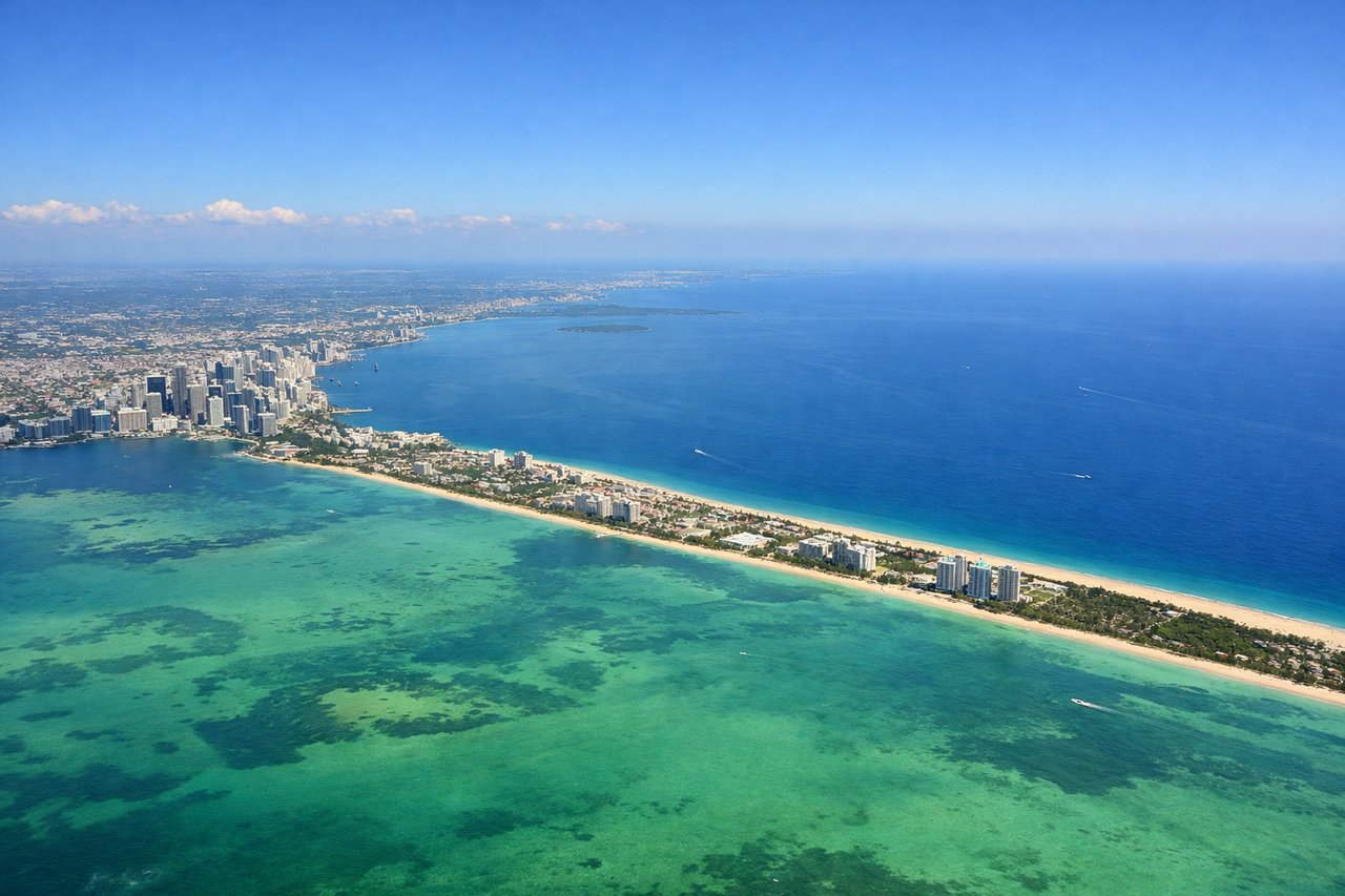
Takeoff from MIA
RIGHTRight side captures Miami's urban waterfront and Biscayne Bay during initial climb. Departures typically use eastward runways (08/09), turning northwest toward the Gulf, giving right-side passengers a clear view of downtown Miami, the port, and barrier islands before heading inland.
Landing at VPS
LEFTLeft side offers better approach scenery into VPS. Aircraft typically descend from the northeast and turn southwest to land on runway 12 (the primary commercial runway). Left-side passengers see the Choctawhatchee Bay, coastal marshlands, and the approach over water before touching down, plus views of the Eglin Air Force Base complex and surrounding Panhandle terrain.
Landmarks on this routeAll landmarks →
Will your flight be in sunlight?
Pick a date and time in the Sun Map to watch the sun move across your whole flight.
About This Route
Which side of the plane should I sit on flying from Miami International (MIA) to Eglin Afb (VPS)?
Sit on the Right side of the plane for the best views on flights from Miami to Valparaiso. Right side edges ahead due to superior takeoff experience. Miami's urban waterfront, Biscayne Bay, and port facilities provide more concentrated scenic interest during departure than the landing approach offers. Both sides score equally on the cruise phase—a short 1-hour flight over flat, featureless central Florida with minimal landmarks. The landing at VPS is comparable on both sides, but the dramatic Miami departure gives right the overall advantage.
What can I see during takeoff from Miami International in Miami?
During takeoff from Miami International (MIA), sit on the Right side for the best views. Right side captures Miami's urban waterfront and Biscayne Bay during initial climb. Departures typically use eastward runways (08/09), turning northwest toward the Gulf, giving right-side passengers a clear view of downtown Miami, the port, and barrier islands before heading inland. Notable sights include: Downtown Miami skyline, Biscayne Bay, Port of Miami container terminals, Miami Beach and barrier islands.
What can I see when landing at Eglin Afb in Valparaiso?
When landing at Eglin Afb (VPS), sit on the Left side for the best views. Left side offers better approach scenery into VPS. Aircraft typically descend from the northeast and turn southwest to land on runway 12 (the primary commercial runway). Left-side passengers see the Choctawhatchee Bay, coastal marshlands, and the approach over water before touching down, plus views of the Eglin Air Force Base complex and surrounding Panhandle terrain. Notable sights include: Choctawhatchee Bay, Eglin Air Force Base runways and facilities, coastal marshes and barrier islands, Santa Rosa Sound.
How long is the flight from Miami to Valparaiso?
The flight from Miami International (MIA) to Eglin Afb (VPS) takes about 1 hour 5 minutes. The shortest flight path between them is 499 miles (802 km); winds and air traffic control usually add a few percent.
What does the Miami to Valparaiso flight path pass over?
Central Florida flatlands with scattered lakes, low-density residential development, and pine forests. No significant mountains, rivers, or urban centers visible during cruise. The flight path crosses the Florida peninsula from southeast to northwest at approximately 25,000 feet, offering minimal scenic variation—mostly uniform terrain with occasional small lakes and agricultural patches.