Valparaiso to Miami is 499 miles (802 km), a flight of about 1 hour 15 minutes.
While takeoff favors the right side's immediate coastal views, the landing sequence on the left side—crossing the Everglades and approaching Miami's urban waterfront—provides greater visual variety and more distinctive landmarks. The Everglades' unique ecosystem and the contrast between wetlands and urban development create more memorable scenery than the relatively uniform Gulf coastline visible on the right during cruise.
Flight Path
The flight path crosses the northern Gulf of Mexico at cruise altitude. Passengers see open water for most of the cruise phase, with the Florida peninsula appearing as a low, flat landmass on the horizon. The Panhandle's coastline (including Apalachicola Bay and the Big Bend region) may be visible on the left side during the initial cruise segment. As the aircraft approaches Miami, the transition from open Gulf to the Florida peninsula becomes apparent, with the Everglades' distinctive flat, water-logged terrain visible 30-40 miles out on approach.
Great circle distance and headings ›Phase by phase
Takeoff from VPS
RIGHTRight side captures the immediate coastal geography of the Florida Panhandle during climb-out. Depending on runway usage (typically 12 or 30), right-side passengers see Choctawhatchee Bay, the barrier islands, and the Gulf of Mexico shoreline as the aircraft banks eastward toward Miami.
Landing at MIA
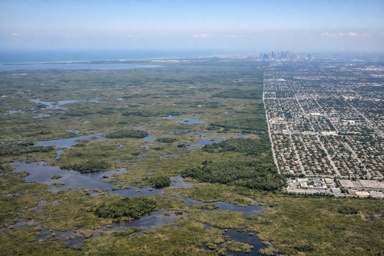
LEFTLeft side provides the most dramatic approach into Miami. Aircraft descending from the northwest typically cross the Everglades and approach from the west, giving left-side passengers views of the Everglades wetlands, Lake Okeechobee's distant expanse, and the transition to Miami's urban sprawl and Biscayne Bay before landing.
Landmarks on this routeAll landmarks →
Will your flight be in sunlight?
Pick a date and time in the Sun Map to watch the sun move across your whole flight.
About This Route
Which side of the plane should I sit on flying from Eglin Afb (VPS) to Miami International (MIA)?
Sit on the Left side of the plane for the best views on flights from Valparaiso to Miami. While takeoff favors the right side's immediate coastal views, the landing sequence on the left side—crossing the Everglades and approaching Miami's urban waterfront—provides greater visual variety and more distinctive landmarks. The Everglades' unique ecosystem and the contrast between wetlands and urban development create more memorable scenery than the relatively uniform Gulf coastline visible on the right during cruise.
What can I see during takeoff from Eglin Afb in Valparaiso?
During takeoff from Eglin Afb (VPS), sit on the Right side for the best views. Right side captures the immediate coastal geography of the Florida Panhandle during climb-out. Depending on runway usage (typically 12 or 30), right-side passengers see Choctawhatchee Bay, the barrier islands, and the Gulf of Mexico shoreline as the aircraft banks eastward toward Miami. Notable sights include: Choctawhatchee Bay, Santa Rosa Island, Destin beachfront, Gulf of Mexico coastline.
What can I see when landing at Miami International in Miami?
When landing at Miami International (MIA), sit on the Left side for the best views. Left side provides the most dramatic approach into Miami. Aircraft descending from the northwest typically cross the Everglades and approach from the west, giving left-side passengers views of the Everglades wetlands, Lake Okeechobee's distant expanse, and the transition to Miami's urban sprawl and Biscayne Bay before landing. Notable sights include: Everglades wetlands and sawgrass marshes, Lake Okeechobee (distant), Miami urban development, Biscayne Bay.
How long is the flight from Valparaiso to Miami?
The flight from Eglin Afb (VPS) to Miami International (MIA) takes about 1 hour 15 minutes. The shortest flight path between them is 499 miles (802 km); winds and air traffic control usually add a few percent.
What does the Valparaiso to Miami flight path pass over?
The flight path crosses the northern Gulf of Mexico at cruise altitude. Passengers see open water for most of the cruise phase, with the Florida peninsula appearing as a low, flat landmass on the horizon. The Panhandle's coastline (including Apalachicola Bay and the Big Bend region) may be visible on the left side during the initial cruise segment. As the aircraft approaches Miami, the transition from open Gulf to the Florida peninsula becomes apparent, with the Everglades' distinctive flat, water-logged terrain visible 30-40 miles out on approach.