While the left side wins the takeoff with Taal Volcano, the right side offers a more consistently rewarding experience: solid coastal views of Manila Bay and Corregidor at departure, and a genuinely striking skyline-and-mountain approach into KUL that the left side's flatter Port Klang view can't match.
Flight Path
The route crosses the open South China Sea for most of the cruise, passing near the northern tip of Palawan Island and over open water toward the Malay Peninsula, with no major landmarks visible until the Malaysian coastline comes into view on descent.
Great circle distance and headings ›Phase by phase
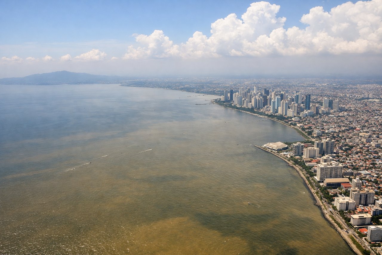
Takeoff from MNL
LEFTDeparting Manila on runway 24 (the typical southwest-facing configuration for this route) sends the aircraft on a track that keeps Taal Volcano's crater lake and the Laguna de Bay basin on the left side as it climbs out over Batangas. The right side only shows the flatter waters of Manila Bay by comparison.

Landing at KUL
RIGHTOn the descent into KUL under southwest monsoon routing (runway 32), the arrival path curls past the northern Klang Valley, putting the Kuala Lumpur skyline and the forested Titiwangsa foothills on the right side of the aircraft. The left side mostly faces the flatter Port Klang coastal plain, which is less visually distinctive.
Will your flight be in sunlight?
See exactly which side of the plane gets sun and shade at your departure time.
About This Route
Which side of the plane should I sit on flying from Ninoy Aquino International (MNL) to Kuala Lumpur International (KUL)?
Sit on the Right side of the plane for the best views on flights from Manila to Kuala Lumpur. While the left side wins the takeoff with Taal Volcano, the right side offers a more consistently rewarding experience: solid coastal views of Manila Bay and Corregidor at departure, and a genuinely striking skyline-and-mountain approach into KUL that the left side's flatter Port Klang view can't match.
What can I see during takeoff from Ninoy Aquino International in Manila?
During takeoff from Ninoy Aquino International (MNL), sit on the Left side for the best views. Departing Manila on runway 24 (the typical southwest-facing configuration for this route) sends the aircraft on a track that keeps Taal Volcano's crater lake and the Laguna de Bay basin on the left side as it climbs out over Batangas. The right side only shows the flatter waters of Manila Bay by comparison. Notable sights include: Taal Volcano and its crater lake, Laguna de Bay, Tagaytay Ridge, Batangas coastline.
What can I see when landing at Kuala Lumpur International in Kuala Lumpur?
When landing at Kuala Lumpur International (KUL), sit on the Right side for the best views. On the descent into KUL under southwest monsoon routing (runway 32), the arrival path curls past the northern Klang Valley, putting the Kuala Lumpur skyline and the forested Titiwangsa foothills on the right side of the aircraft. The left side mostly faces the flatter Port Klang coastal plain, which is less visually distinctive. Notable sights include: Kuala Lumpur skyline (Petronas Towers visible on clear days), Titiwangsa Range foothills, Klang River, oil palm plantations near KLIA.
How long is the flight from Manila to Kuala Lumpur?
The flight from Ninoy Aquino International (MNL) to Kuala Lumpur International (KUL) takes 3h 35m.
What does the Manila to Kuala Lumpur flight path pass over?
The route crosses the open South China Sea for most of the cruise, passing near the northern tip of Palawan Island and over open water toward the Malay Peninsula, with no major landmarks visible until the Malaysian coastline comes into view on descent.