Anchorage to Seattle is 1,442 miles (2,321 km), a flight of about 3 hours 25 minutes.
While the takeoff offers excellent Chugach Mountain views on the left, the landing approach on the right provides the most iconic and visually striking feature of the entire flight: Mount Rainier. The right side captures the journey's climactic moment and the most memorable scenery.
Flight Path
The flight path crosses the Inside Passage region of Southeast Alaska and British Columbia. Notable features include the Alaska Panhandle's coastal mountains and fjords, the Inside Passage waterways (visible as narrow channels between forested islands), and the transition from Alaska's rugged terrain into the Cascade Range system as you approach Washington. The flight typically maintains 25,000-35,000 feet altitude over open water and mountainous terrain, offering continuous views of the Pacific Northwest's dramatic geography.
Great circle distance and headings ›

Phase by phase
Takeoff from MRI
LEFTLeft side offers immediate views of the Chugach Mountains as you climb out from Merrill Field. The aircraft departs to the south, and the left wing points toward the dramatic peaks that frame Anchorage's eastern edge.
Landing at SEA
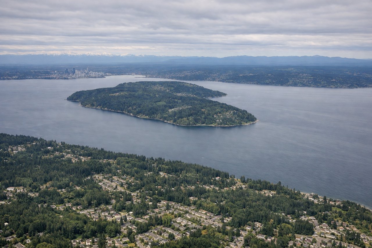
RIGHTRight side provides the best views during the descent into Seattle-Tacoma. The aircraft approaches from the north, and the right wing faces the Cascade Range and Mount Rainier, which dominates the eastern skyline. You'll also see Puget Sound and the Olympic Mountains to the west.
Landmarks on this routeAll landmarks →
Will your flight be in sunlight?
Pick a date and time in the Sun Map to watch the sun move across your whole flight.
About This Route
Which side of the plane should I sit on flying from Merrill Fld (MRI) to Seattle Tacoma International (SEA)?
Sit on the Right side of the plane for the best views on flights from Anchorage to Seattle. While the takeoff offers excellent Chugach Mountain views on the left, the landing approach on the right provides the most iconic and visually striking feature of the entire flight: Mount Rainier. The right side captures the journey's climactic moment and the most memorable scenery.
What can I see during takeoff from Merrill Fld in Anchorage?
During takeoff from Merrill Fld (MRI), sit on the Left side for the best views. Left side offers immediate views of the Chugach Mountains as you climb out from Merrill Field. The aircraft departs to the south, and the left wing points toward the dramatic peaks that frame Anchorage's eastern edge. Notable sights include: Chugach Mountains, Cook Inlet (western view), Anchorage downtown and port facilities, Turnagain Arm (southeastern water body).
What can I see when landing at Seattle Tacoma International in Seattle?
When landing at Seattle Tacoma International (SEA), sit on the Right side for the best views. Right side provides the best views during the descent into Seattle-Tacoma. The aircraft approaches from the north, and the right wing faces the Cascade Range and Mount Rainier, which dominates the eastern skyline. You'll also see Puget Sound and the Olympic Mountains to the west. Notable sights include: Mount Rainier (14,411 ft, visible from 80+ miles away), Cascade Range, Puget Sound, Olympic Mountains.
How long is the flight from Anchorage to Seattle?
The flight from Merrill Fld (MRI) to Seattle Tacoma International (SEA) takes about 3 hours 25 minutes. The shortest flight path between them is 1,442 miles (2,321 km); winds and air traffic control usually add a few percent.
What does the Anchorage to Seattle flight path pass over?
The flight path crosses the Inside Passage region of Southeast Alaska and British Columbia. Notable features include the Alaska Panhandle's coastal mountains and fjords, the Inside Passage waterways (visible as narrow channels between forested islands), and the transition from Alaska's rugged terrain into the Cascade Range system as you approach Washington. The flight typically maintains 25,000-35,000 feet altitude over open water and mountainous terrain, offering continuous views of the Pacific Northwest's dramatic geography.