Right side scores higher due to superior landing approach scenery—the Waianae Range, Pearl Harbor's distinctive geometry, and Honolulu's waterfront provide concentrated visual interest during descent and approach. Takeoff is comparable on both sides, but the landing sequence on the right significantly outweighs the left side's open-ocean monotony during the long cruise phase.
Flown MSO to HNL? Did we get it right?
Flight Path
Missoula to Honolulu is 3,010 miles (4,845 km), a flight of about 5 hours 15 minutes.
The flight path crosses the Pacific Ocean for approximately 4.5 hours with minimal landmarks. Notable geographic reference points include the California coast (visible during initial climb if departing runway 30 northwest), the open North Pacific basin, and the Hawaiian Islands chain appearing on the horizon approximately 30 minutes before descent into Honolulu. Oahu's windward cliffs and the Koolau Range become visible during the final descent phase.
Great circle distance and headings ›Phase by phase
Takeoff from MSO
RIGHTRight side captures the Missoula Valley floor and surrounding mountain ranges during climb-out. Depending on runway direction, climbs toward the Sapphire Range or Mission Mountains, offering immediate terrain drama. Left side faces open valley or forested terrain with less defined visual interest during initial climb.
Landing at HNL
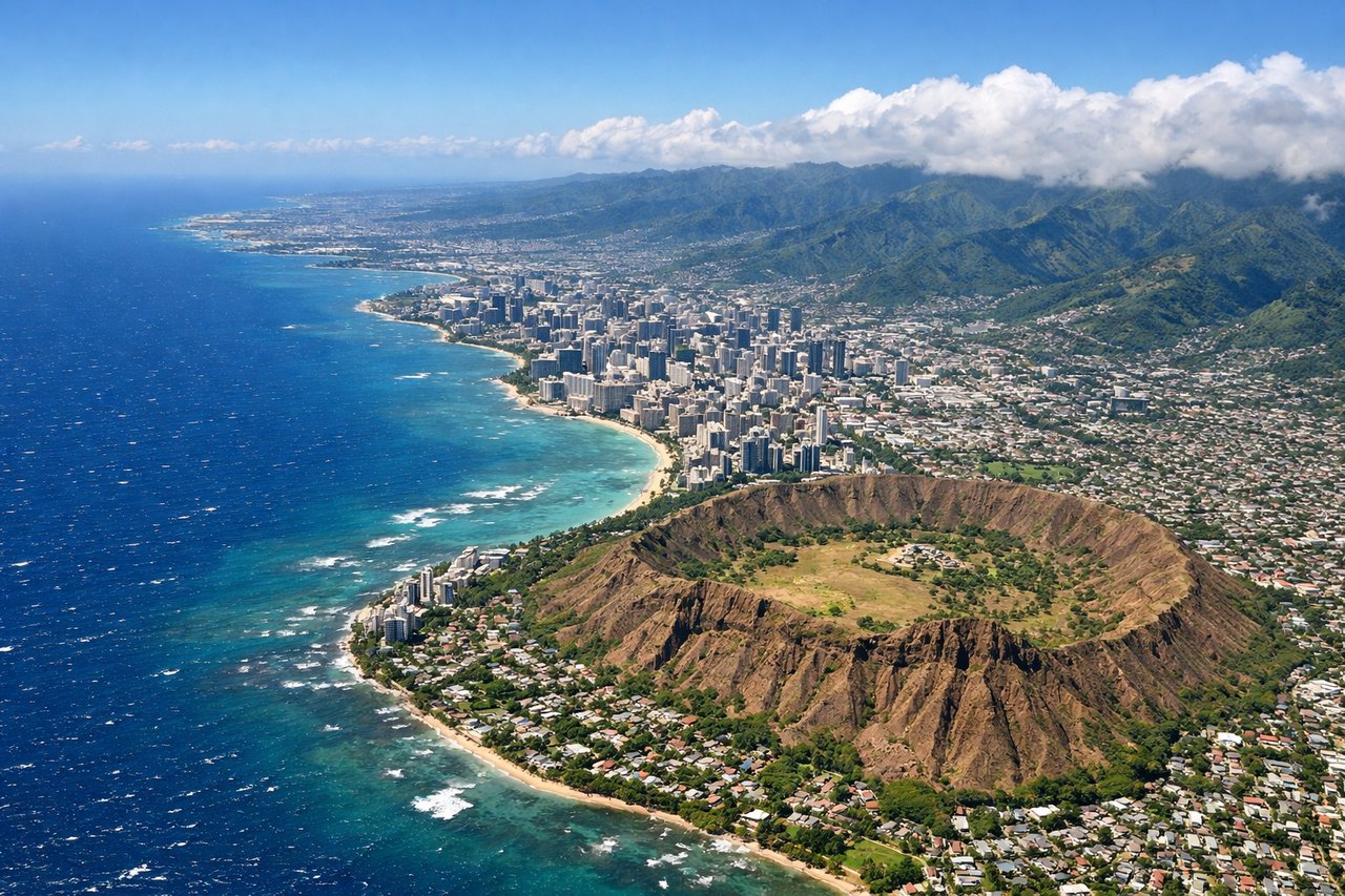
RIGHTRight side offers the most dramatic approach into Honolulu. Typical eastbound arrivals descend over the Pacific and turn toward the runway complex, providing views of the Waianae Range on the right, Pearl Harbor's distinctive geometry, and the urban Honolulu waterfront. Left side faces open ocean for most of the descent and approach.
Will your flight be in sunlight?
Pick a date and time in the Sun Map to watch the sun move across your whole flight.
About This Route
Which side of the plane should I sit on flying from Missoula Montana Airport (MSO) to Honolulu International (HNL)?
Sit on the Right side of the plane for the best views on flights from Missoula to Honolulu. Right side scores higher due to superior landing approach scenery—the Waianae Range, Pearl Harbor's distinctive geometry, and Honolulu's waterfront provide concentrated visual interest during descent and approach. Takeoff is comparable on both sides, but the landing sequence on the right significantly outweighs the left side's open-ocean monotony during the long cruise phase.
What can I see during takeoff from Missoula Montana Airport in Missoula?
During takeoff from Missoula Montana Airport (MSO), sit on the Right side for the best views. Right side captures the Missoula Valley floor and surrounding mountain ranges during climb-out. Depending on runway direction, climbs toward the Sapphire Range or Mission Mountains, offering immediate terrain drama. Left side faces open valley or forested terrain with less defined visual interest during initial climb. Notable sights include: Missoula city grid, Sapphire Range (southeast), Mission Mountains (north), Clark Fork River valley.
What can I see when landing at Honolulu International in Honolulu?
When landing at Honolulu International (HNL), sit on the Right side for the best views. Right side offers the most dramatic approach into Honolulu. Typical eastbound arrivals descend over the Pacific and turn toward the runway complex, providing views of the Waianae Range on the right, Pearl Harbor's distinctive geometry, and the urban Honolulu waterfront. Left side faces open ocean for most of the descent and approach. Notable sights include: Waianae Range (western Oahu), Pearl Harbor complex, Honolulu city skyline and waterfront, Diamond Head crater.
How long is the flight from Missoula to Honolulu?
The flight from Missoula Montana Airport (MSO) to Honolulu International (HNL) takes about 5 hours 15 minutes. The shortest flight path between them is 3,010 miles (4,845 km); winds and air traffic control usually add a few percent.
What does the Missoula to Honolulu flight path pass over?
The flight path crosses the Pacific Ocean for approximately 4.5 hours with minimal landmarks. Notable geographic reference points include the California coast (visible during initial climb if departing runway 30 northwest), the open North Pacific basin, and the Hawaiian Islands chain appearing on the horizon approximately 30 minutes before descent into Honolulu. Oahu's windward cliffs and the Koolau Range become visible during the final descent phase.