The east side wins because it offers dramatic mountain relief on both ends of the flight — the Sapphire Range near Missoula at takeoff and the steep Wasatch Front on approach into Salt Lake City — while the west side's Bitterroot and Great Salt Lake views, though scenic, are comparatively flatter and less immediate.
Flown MSO to SLC? Did we get it right?
Flight Path
Missoula to Salt Lake City is 436 miles (702 km), a flight of about 1 hour 10 minutes.
The route crosses the Bitterroot and Lemhi mountain ranges of central Idaho before descending toward the northern Wasatch Front and Salt Lake Valley.
Great circle distance and headings ›

Phase by phase
Takeoff from MSO
RIGHTDeparting Missoula, the right (east) side looks toward the Sapphire and Garnet Ranges rising directly from the valley floor, giving passengers a dramatic close-up of forested peaks during the initial climb. The left side sees the Bitterroot Range, which is scenic but slightly farther and often catches afternoon haze.
Landing at SLC
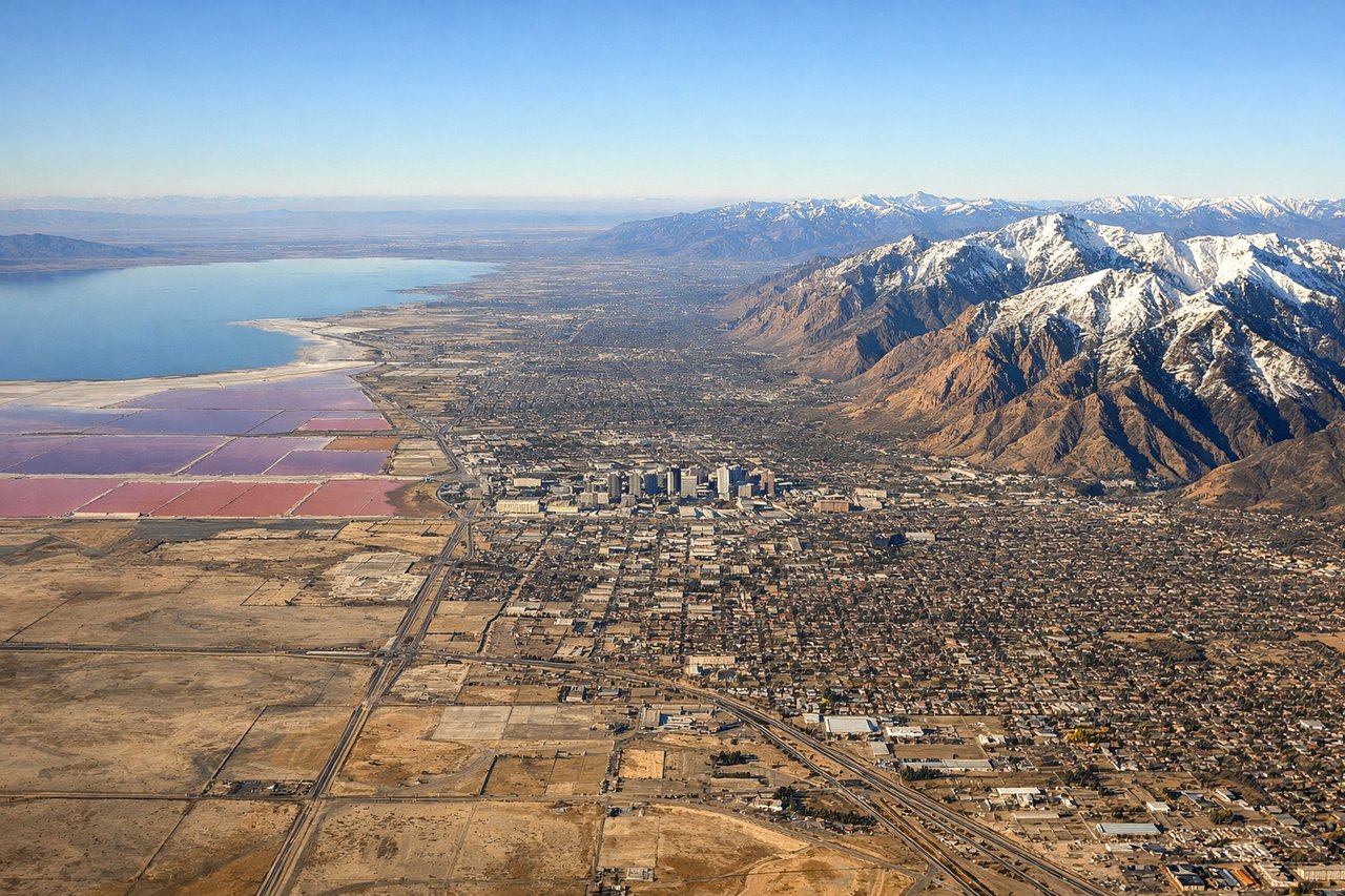
RIGHTOn approach into Salt Lake City, the runways run north-south and the east side offers a striking view of the Wasatch Range's steep front, with snow-capped peaks rising abruptly right at the edge of the valley. The west side shows the flatter Great Salt Lake and Oquirrh Mountains, which are interesting but less dramatic in relief.
Will your flight be in sunlight?
Pick a date and time in the Sun Map to watch the sun move across your whole flight.
About This Route
Which side of the plane should I sit on flying from Missoula Montana Airport (MSO) to Salt Lake City International (SLC)?
Sit on the Right side of the plane for the best views on flights from Missoula to Salt Lake City. The east side wins because it offers dramatic mountain relief on both ends of the flight — the Sapphire Range near Missoula at takeoff and the steep Wasatch Front on approach into Salt Lake City — while the west side's Bitterroot and Great Salt Lake views, though scenic, are comparatively flatter and less immediate.
What can I see during takeoff from Missoula Montana Airport in Missoula?
During takeoff from Missoula Montana Airport (MSO), sit on the Right side for the best views. Departing Missoula, the right (east) side looks toward the Sapphire and Garnet Ranges rising directly from the valley floor, giving passengers a dramatic close-up of forested peaks during the initial climb. The left side sees the Bitterroot Range, which is scenic but slightly farther and often catches afternoon haze. Notable sights include: Sapphire Range, Garnet Range, Missoula Valley floor, Clark Fork River.
What can I see when landing at Salt Lake City International in Salt Lake City?
When landing at Salt Lake City International (SLC), sit on the Right side for the best views. On approach into Salt Lake City, the runways run north-south and the east side offers a striking view of the Wasatch Range's steep front, with snow-capped peaks rising abruptly right at the edge of the valley. The west side shows the flatter Great Salt Lake and Oquirrh Mountains, which are interesting but less dramatic in relief. Notable sights include: Wasatch Range, Mount Olympus, Salt Lake Valley, Wasatch Front canyons.
How long is the flight from Missoula to Salt Lake City?
The flight from Missoula Montana Airport (MSO) to Salt Lake City International (SLC) takes about 1 hour 10 minutes. The shortest flight path between them is 436 miles (702 km); winds and air traffic control usually add a few percent.
What does the Missoula to Salt Lake City flight path pass over?
The route crosses the Bitterroot and Lemhi mountain ranges of central Idaho before descending toward the northern Wasatch Front and Salt Lake Valley.