Monterrey to Houston is 411 miles (662 km), a flight of about 1 hour 20 minutes.
Left side wins both ends of the flight. The Sierra Madre Oriental departure view is genuinely spectacular, and the Houston approach on the left delivers the skyline and Ship Channel. The right side offers little of note at either end.
Flight Path
The flight crosses the flat semi-arid brush country of Tamaulipas and southern Texas, passing over or near Laredo and the Rio Grande border crossing, then transitioning into the Gulf Coastal Plain of south Texas. The terrain is largely featureless scrubland and ranch land at altitude, with the Rio Grande visible as a thin ribbon near the US-Mexico border crossing zone around Laredo.
Great circle distance and headings ›Phase by phase
Takeoff from MTY
LEFTMTY's primary departure runway 28 sends aircraft northwest before turning north toward Houston. The left (south) side gives you the dramatic Sierra Madre Oriental range including Cerro de la Silla, Monterrey's iconic saddle-shaped mountain, right off your wing during the climbing turn. The city spreads across the valley floor on this side as well.
Landing at IAH
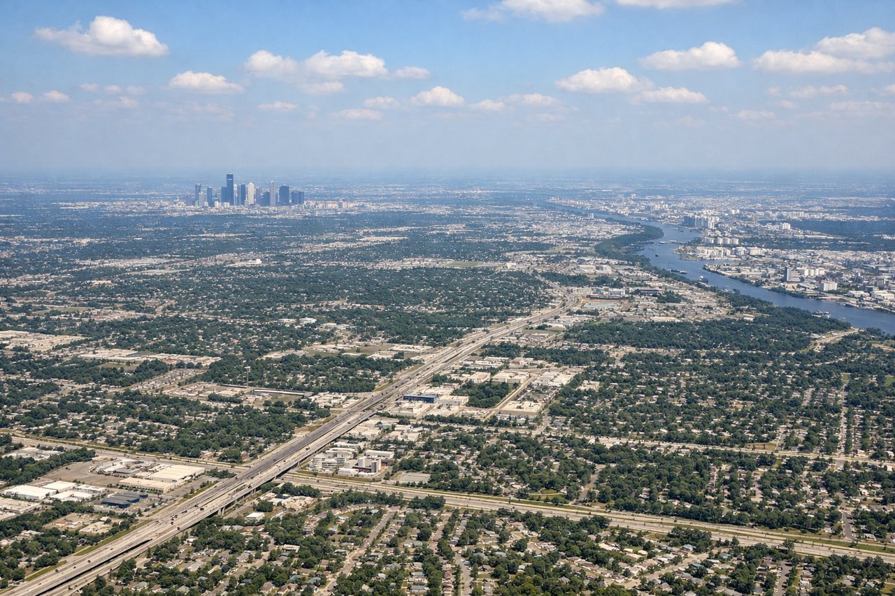
LEFTIAH typically uses runways 26L/26R or 27 for westerly arrivals, meaning the approach comes from the east over the Houston metro. The left (south) side gives a clear view of downtown Houston's skyline, the Ship Channel industrial complex, and the broad flat Gulf Coastal Plain spreading toward Galveston Bay. Right side faces north toward suburban sprawl with fewer distinctive features.
Will your flight be in sunlight?
Pick a date and time in the Sun Map to watch the sun move across your whole flight.
About This Route
Which side of the plane should I sit on flying from General Mariano Escobedo International (MTY) to George Bush Intcntl Houston (IAH)?
Sit on the Left side of the plane for the best views on flights from Monterrey to Houston. Left side wins both ends of the flight. The Sierra Madre Oriental departure view is genuinely spectacular, and the Houston approach on the left delivers the skyline and Ship Channel. The right side offers little of note at either end.
What can I see during takeoff from General Mariano Escobedo International in Monterrey?
During takeoff from General Mariano Escobedo International (MTY), sit on the Left side for the best views. MTY's primary departure runway 28 sends aircraft northwest before turning north toward Houston. The left (south) side gives you the dramatic Sierra Madre Oriental range including Cerro de la Silla, Monterrey's iconic saddle-shaped mountain, right off your wing during the climbing turn. The city spreads across the valley floor on this side as well. Notable sights include: Cerro de la Silla (saddle mountain southeast of city), Sierra Madre Oriental ridgelines, Monterrey urban valley and downtown core, Santa Catarina River corridor.
What can I see when landing at George Bush Intcntl Houston in Houston?
When landing at George Bush Intcntl Houston (IAH), sit on the Left side for the best views. IAH typically uses runways 26L/26R or 27 for westerly arrivals, meaning the approach comes from the east over the Houston metro. The left (south) side gives a clear view of downtown Houston's skyline, the Ship Channel industrial complex, and the broad flat Gulf Coastal Plain spreading toward Galveston Bay. Right side faces north toward suburban sprawl with fewer distinctive features. Notable sights include: Downtown Houston skyline, Houston Ship Channel and industrial port complex, Lake Houston to the northeast, suburban grid of the Houston metro.
How long is the flight from Monterrey to Houston?
The flight from General Mariano Escobedo International (MTY) to George Bush Intcntl Houston (IAH) takes about 1 hour 20 minutes. The shortest flight path between them is 411 miles (662 km); winds and air traffic control usually add a few percent.
What does the Monterrey to Houston flight path pass over?
The flight crosses the flat semi-arid brush country of Tamaulipas and southern Texas, passing over or near Laredo and the Rio Grande border crossing, then transitioning into the Gulf Coastal Plain of south Texas. The terrain is largely featureless scrubland and ranch land at altitude, with the Rio Grande visible as a thin ribbon near the US-Mexico border crossing zone around Laredo.