Monterrey to Phoenix is 888 miles (1,429 km), a flight of about 2 hours 15 minutes.
While the left side wins at takeoff for the Sierra Madre views, the right side delivers consistently throughout the flight: you get views of the Chihuahuan Desert transition, the Rio Grande corridor near the US border, and then the spectacular Phoenix basin arrival with Camelback Mountain and the city skyline. The landing sequence on the right is one of the more visually rewarding urban arrivals in the American Southwest.
Flight Path
The flight crosses the northern Chihuahuan Desert over Chihuahua state, then transits the US-Mexico border region near Ciudad Juarez and El Paso where the Rio Grande and Franklin Mountains are visible. Continuing northwest, the route passes over the Sonoran Desert of southern Arizona with the rugged Basin and Range topography — parallel north-south mountain ranges separated by flat desert valleys — including the Dos Cabezas Mountains and Dragoon Mountains visible below before the descent into the Phoenix basin.
Great circle distance and headings ›Phase by phase
Takeoff from MTY
LEFTDeparting Monterrey, aircraft typically use runway 29 heading northwest, placing the dramatic Sierra Madre Oriental on the left side. The Cerro de la Silla, Monterrey's iconic saddle-shaped peak, is clearly visible to the left as you climb out over the city.
Landing at PHX
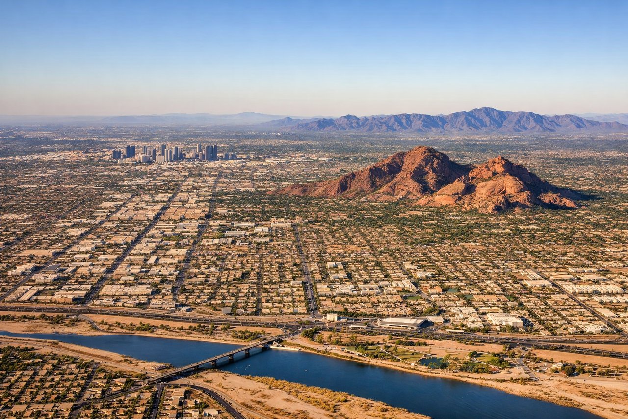
RIGHTPhoenix Sky Harbor primarily uses runways 25L/25R for westbound arrivals, meaning the approach comes from the east. The right side gives a clear view of downtown Phoenix, Camelback Mountain, and South Mountain Park as you descend over the Valley of the Sun.
Will your flight be in sunlight?
Pick a date and time in the Sun Map to watch the sun move across your whole flight.
About This Route
Which side of the plane should I sit on flying from General Mariano Escobedo International (MTY) to Phoenix Sky Harbor International (PHX)?
Sit on the Right side of the plane for the best views on flights from Monterrey to Phoenix. While the left side wins at takeoff for the Sierra Madre views, the right side delivers consistently throughout the flight: you get views of the Chihuahuan Desert transition, the Rio Grande corridor near the US border, and then the spectacular Phoenix basin arrival with Camelback Mountain and the city skyline. The landing sequence on the right is one of the more visually rewarding urban arrivals in the American Southwest.
What can I see during takeoff from General Mariano Escobedo International in Monterrey?
During takeoff from General Mariano Escobedo International (MTY), sit on the Left side for the best views. Departing Monterrey, aircraft typically use runway 29 heading northwest, placing the dramatic Sierra Madre Oriental on the left side. The Cerro de la Silla, Monterrey's iconic saddle-shaped peak, is clearly visible to the left as you climb out over the city. Notable sights include: Cerro de la Silla (saddle mountain east of city), Sierra Madre Oriental ridgelines, Monterrey urban grid and Santa Catarina River valley, Cerro de las Mitras to the northwest.
What can I see when landing at Phoenix Sky Harbor International in Phoenix?
When landing at Phoenix Sky Harbor International (PHX), sit on the Right side for the best views. Phoenix Sky Harbor primarily uses runways 25L/25R for westbound arrivals, meaning the approach comes from the east. The right side gives a clear view of downtown Phoenix, Camelback Mountain, and South Mountain Park as you descend over the Valley of the Sun. Notable sights include: Camelback Mountain (distinctive camel-profile ridge), downtown Phoenix skyline, South Mountain Park ridgeline to the south, Salt River bed and Tempe Town Lake.
How long is the flight from Monterrey to Phoenix?
The flight from General Mariano Escobedo International (MTY) to Phoenix Sky Harbor International (PHX) takes about 2 hours 15 minutes. The shortest flight path between them is 888 miles (1,429 km); winds and air traffic control usually add a few percent.
What does the Monterrey to Phoenix flight path pass over?
The flight crosses the northern Chihuahuan Desert over Chihuahua state, then transits the US-Mexico border region near Ciudad Juarez and El Paso where the Rio Grande and Franklin Mountains are visible. Continuing northwest, the route passes over the Sonoran Desert of southern Arizona with the rugged Basin and Range topography — parallel north-south mountain ranges separated by flat desert valleys — including the Dos Cabezas Mountains and Dragoon Mountains visible below before the descent into the Phoenix basin.