Right side scores 3.5 vs left's 2.5 due to superior terrain drama on both legs: Sierra Madre foothills during Monterrey departure and Santa Monica Mountains plus Los Angeles basin during LAX arrival. Left side offers only flat plains departing Mexico and extended ocean crossing on arrival, with minimal landmark density. The right side provides consistent visual interest across the full flight profile.
Flown MTY to LAX? Did we get it right?
Flight Path
Monterrey to Los Angeles is 1,230 miles (1,980 km), a flight of about 3 hours 5 minutes.
Durango-Chihuahua plateau (high desert terrain at cruise altitude), Sierra Madre Occidental ridgelines, Sonoran Desert floor, Colorado River valley near Arizona-California border, Mojave Desert basin
Great circle distance and headings ›Phase by phase
Takeoff from MTY
RIGHTRight side captures the Sierra Madre Oriental foothills immediately after departure from runway 12, with dramatic elevation gain visible within the first 10 minutes of climb. Left side departs over flat agricultural plains with minimal terrain interest.
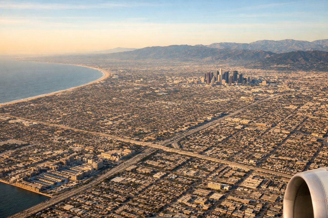
Landing at LAX
RIGHTRight side (north) provides extended views of the Southern California coast, Santa Monica Mountains, and the Los Angeles basin during the standard west-flow approach. Aircraft descending on runway 24R or 25L pass over the Pacific, then turn inland over Santa Monica Bay, offering continuous coastal and urban scenery. Left side (south) sees mostly ocean until final approach.
Will your flight be in sunlight?
Pick a date and time in the Sun Map to watch the sun move across your whole flight.
About This Route
Which side of the plane should I sit on flying from General Mariano Escobedo International (MTY) to Los Angeles International (LAX)?
Sit on the Right side of the plane for the best views on flights from Monterrey to Los Angeles. Right side scores 3.5 vs left's 2.5 due to superior terrain drama on both legs: Sierra Madre foothills during Monterrey departure and Santa Monica Mountains plus Los Angeles basin during LAX arrival. Left side offers only flat plains departing Mexico and extended ocean crossing on arrival, with minimal landmark density. The right side provides consistent visual interest across the full flight profile.
What can I see during takeoff from General Mariano Escobedo International in Monterrey?
During takeoff from General Mariano Escobedo International (MTY), sit on the Right side for the best views. Right side captures the Sierra Madre Oriental foothills immediately after departure from runway 12, with dramatic elevation gain visible within the first 10 minutes of climb. Left side departs over flat agricultural plains with minimal terrain interest. Notable sights include: Sierra Madre Oriental ridgelines, Barrio Antiguo (historic Monterrey center), Cerro de la Silla (iconic saddle-shaped peak) visible on right side during initial climb.
What can I see when landing at Los Angeles International in Los Angeles?
When landing at Los Angeles International (LAX), sit on the Right side for the best views. Right side (north) provides extended views of the Southern California coast, Santa Monica Mountains, and the Los Angeles basin during the standard west-flow approach. Aircraft descending on runway 24R or 25L pass over the Pacific, then turn inland over Santa Monica Bay, offering continuous coastal and urban scenery. Left side (south) sees mostly ocean until final approach. Notable sights include: Santa Monica Mountains, Santa Monica Bay with Long Beach harbor, downtown Los Angeles skyline, Palos Verdes Peninsula.
How long is the flight from Monterrey to Los Angeles?
The flight from General Mariano Escobedo International (MTY) to Los Angeles International (LAX) takes about 3 hours 5 minutes. The shortest flight path between them is 1,230 miles (1,980 km); winds and air traffic control usually add a few percent.
What does the Monterrey to Los Angeles flight path pass over?
Durango-Chihuahua plateau (high desert terrain at cruise altitude), Sierra Madre Occidental ridgelines, Sonoran Desert floor, Colorado River valley near Arizona-California border, Mojave Desert basin