While takeoff offers good Sierra Madre views on the right, the landing approach to PTY on the left provides more dramatic and geographically significant features: the Panama Canal, Gatun Lake, and the Bridge of the Americas are iconic landmarks visible only from the left side during standard approaches.
Flown MTY to PTY? Did we get it right?
Flight Path
Monterrey to Panama City is 1,783 miles (2,870 km), a flight of about 4 hours 5 minutes.
The flight path crosses the Yucatan Peninsula's northern edge, passing over the Gulf of Mexico and Caribbean waters. You'll see the Yucatan's flat, low-lying terrain with cenotes and lagoons visible from altitude. As you approach Central America, the terrain transitions to mountainous jungle—the Sierra de Chiapas and Guatemala highlands appear as forested ridges. The Caribbean coastline of Honduras and Nicaragua passes to the left (east) during cruise. Belize's barrier reef system may be visible as a lighter blue line along the coast if flying the southern route. The final descent crosses Lake Gatun and approaches from the northwest.
Great circle distance and headings ›Phase by phase
Takeoff from MTY
RIGHTMTY typically departs northbound or northeastbound. Right-side seats face toward the Sierra Madre Oriental and the sprawling Monterrey metropolitan area, offering clear views of the terrain you're climbing away from. Left side shows mostly inland plateau.
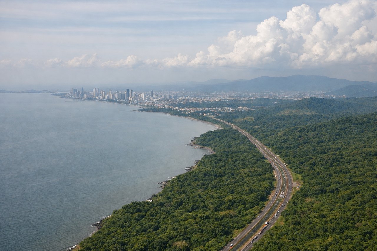
Landing at PTY
LEFTPTY typically lands from the northwest on Runway 03 or approaches from the Caribbean side. Left-side seats face toward the Panama Canal approach, the Bridge of the Americas, and Gatun Lake—the most dramatic geographic features on descent. Right side shows less distinctive terrain.
Will your flight be in sunlight?
Pick a date and time in the Sun Map to watch the sun move across your whole flight.
About This Route
Which side of the plane should I sit on flying from General Mariano Escobedo International (MTY) to Tocumen International (PTY)?
Sit on the Left side of the plane for the best views on flights from Monterrey to Panama City. While takeoff offers good Sierra Madre views on the right, the landing approach to PTY on the left provides more dramatic and geographically significant features: the Panama Canal, Gatun Lake, and the Bridge of the Americas are iconic landmarks visible only from the left side during standard approaches.
What can I see during takeoff from General Mariano Escobedo International in Monterrey?
During takeoff from General Mariano Escobedo International (MTY), sit on the Right side for the best views. MTY typically departs northbound or northeastbound. Right-side seats face toward the Sierra Madre Oriental and the sprawling Monterrey metropolitan area, offering clear views of the terrain you're climbing away from. Left side shows mostly inland plateau. Notable sights include: Sierra Madre Oriental (eastern escarpment), Barrio Antiguo district of central Monterrey, Cerro de la Silla (iconic saddle-shaped peak to the south), Macroplaza urban grid.
What can I see when landing at Tocumen International in Panama City?
When landing at Tocumen International (PTY), sit on the Left side for the best views. PTY typically lands from the northwest on Runway 03 or approaches from the Caribbean side. Left-side seats face toward the Panama Canal approach, the Bridge of the Americas, and Gatun Lake—the most dramatic geographic features on descent. Right side shows less distinctive terrain. Notable sights include: Panama Canal and Gatun Lake (massive artificial lake visible as blue expanse), Bridge of the Americas (spanning the canal entrance), Panama City skyline and Casco Viejo district, Caribbean coastline and islands.
How long is the flight from Monterrey to Panama City?
The flight from General Mariano Escobedo International (MTY) to Tocumen International (PTY) takes about 4 hours 5 minutes. The shortest flight path between them is 1,783 miles (2,870 km); winds and air traffic control usually add a few percent.
What does the Monterrey to Panama City flight path pass over?
The flight path crosses the Yucatan Peninsula's northern edge, passing over the Gulf of Mexico and Caribbean waters. You'll see the Yucatan's flat, low-lying terrain with cenotes and lagoons visible from altitude. As you approach Central America, the terrain transitions to mountainous jungle—the Sierra de Chiapas and Guatemala highlands appear as forested ridges. The Caribbean coastline of Honduras and Nicaragua passes to the left (east) during cruise. Belize's barrier reef system may be visible as a lighter blue line along the coast if flying the southern route. The final descent crosses Lake Gatun and approaches from the northwest.