Mexicali to San Francisco is 530 miles (853 km), a flight of about 1 hour 15 minutes.
The right side captures the most dramatic scenery during takeoff (Colorado River delta and Imperial Valley), while the left side during landing is excellent but brief. Right seats offer more sustained visual interest across the flight.
Flight Path
As you cruise northwest at altitude, you'll pass over the Salton Sea (a large inland lake visible from 25,000+ feet), then the San Jacinto Mountains and San Bernardino Mountains as you approach Southern California. The flight path takes you over the Mojave Desert region before descending toward the San Francisco Bay Area. The Sierra Nevada mountains may be visible to the east on very clear days, appearing as a distant ridge on the horizon.
Great circle distance and headings ›
.jpg?width=600)

Phase by phase
Takeoff from MXL
RIGHTRight-side seats offer immediate views of the Colorado River delta and the Imperial Valley's agricultural grid. The northbound departure path from Mexicali climbs over these distinctive features before turning northwest toward California.
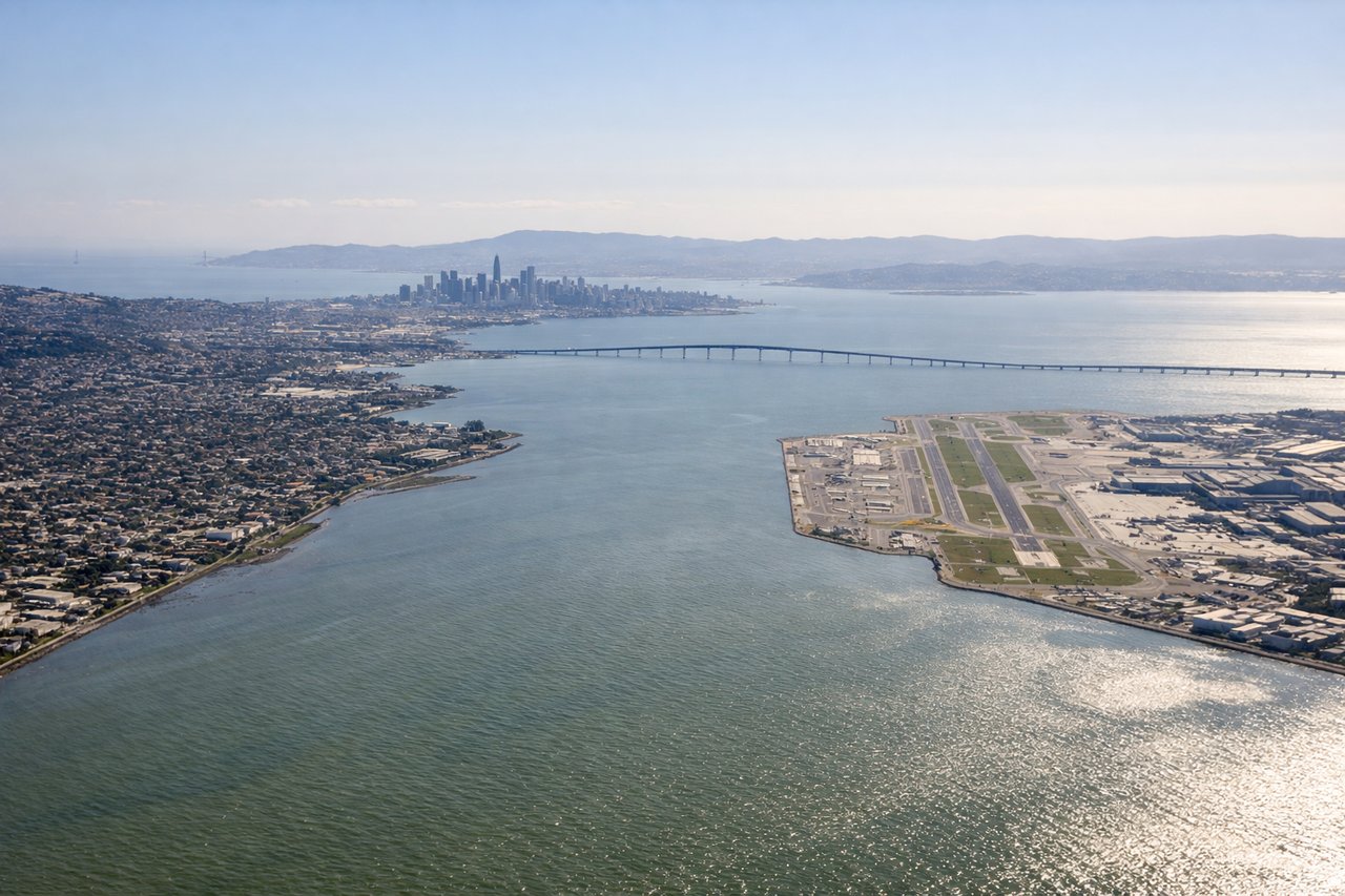
Landing at SFO
LEFTLeft-side seats provide excellent views during the final approach into SFO. You'll see the San Francisco Bay, the Golden Gate Strait, and the San Francisco Peninsula's urban landscape as you descend from the south.
Landmarks on this routeAll landmarks →
Will your flight be in sunlight?
Pick a date and time in the Sun Map to watch the sun move across your whole flight.
About This Route
Which side of the plane should I sit on flying from General Rodolfo Sanchez Taboada International (MXL) to San Francisco International (SFO)?
Sit on the Right side of the plane for the best views on flights from Mexicali to San Francisco. The right side captures the most dramatic scenery during takeoff (Colorado River delta and Imperial Valley), while the left side during landing is excellent but brief. Right seats offer more sustained visual interest across the flight.
What can I see during takeoff from General Rodolfo Sanchez Taboada International in Mexicali?
During takeoff from General Rodolfo Sanchez Taboada International (MXL), sit on the Right side for the best views. Right-side seats offer immediate views of the Colorado River delta and the Imperial Valley's agricultural grid. The northbound departure path from Mexicali climbs over these distinctive features before turning northwest toward California. Notable sights include: Colorado River delta (braided channels and wetlands), Imperial Valley agricultural fields (geometric irrigation patterns), Chocolate Mountains (low desert range to the east), Salton Sea (visible as you climb northward).
What can I see when landing at San Francisco International in San Francisco?
When landing at San Francisco International (SFO), sit on the Left side for the best views. Left-side seats provide excellent views during the final approach into SFO. You'll see the San Francisco Bay, the Golden Gate Strait, and the San Francisco Peninsula's urban landscape as you descend from the south. Notable sights include: San Francisco Bay (the broad water body), Golden Gate Strait (the narrow opening to the Pacific), San Francisco Peninsula urban grid, Marin Headlands (north side of the Golden Gate).
How long is the flight from Mexicali to San Francisco?
The flight from General Rodolfo Sanchez Taboada International (MXL) to San Francisco International (SFO) takes about 1 hour 15 minutes. The shortest flight path between them is 530 miles (853 km); winds and air traffic control usually add a few percent.
What does the Mexicali to San Francisco flight path pass over?
As you cruise northwest at altitude, you'll pass over the Salton Sea (a large inland lake visible from 25,000+ feet), then the San Jacinto Mountains and San Bernardino Mountains as you approach Southern California. The flight path takes you over the Mojave Desert region before descending toward the San Francisco Bay Area. The Sierra Nevada mountains may be visible to the east on very clear days, appearing as a distant ridge on the horizon.