San Francisco to Mexicali is 530 miles (853 km), a flight of about 1 hour 20 minutes.
Left side wins at both ends of the flight. During the cruise, the route tracks southeast over the Central Valley and Mojave Desert, and the left side also offers better views of the Tehachapi Mountains and the Salton Sea as the flight descends toward Mexicali.
Flight Path
The flight crosses the southern San Joaquin Valley, the Tehachapi Mountains where the Sierra Nevada meets the Transverse Ranges, the western Mojave Desert, and the Salton Sea — a large saline lake clearly visible from altitude — before descending over the Imperial Valley agricultural basin into Mexicali.
Great circle distance and headings ›
.jpg?width=600)

Phase by phase
Takeoff from SFO
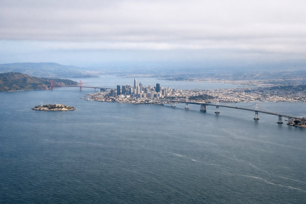
LEFTSFO typically departs south on runways 28L/28R heading west before turning southeast. A left-side seat captures San Francisco Bay, the city skyline, and the peninsula as the aircraft climbs and banks. The right side faces the open Pacific with little to see.
Landing at MXL
LEFTMXL sits just north of the US-Mexico border, and aircraft typically approach from the west or northwest. A left-side seat on approach looks south toward the Mexicali urban area, the Colorado River delta, and the agricultural patchwork of the Mexicali Valley. The right side faces open desert with less definition.
Landmarks on this routeAll landmarks →
Will your flight be in sunlight?
Pick a date and time in the Sun Map to watch the sun move across your whole flight.
About This Route
Which side of the plane should I sit on flying from San Francisco International (SFO) to General Rodolfo Sanchez Taboada International (MXL)?
Sit on the Left side of the plane for the best views on flights from San Francisco to Mexicali. Left side wins at both ends of the flight. During the cruise, the route tracks southeast over the Central Valley and Mojave Desert, and the left side also offers better views of the Tehachapi Mountains and the Salton Sea as the flight descends toward Mexicali.
What can I see during takeoff from San Francisco International in San Francisco?
During takeoff from San Francisco International (SFO), sit on the Left side for the best views. SFO typically departs south on runways 28L/28R heading west before turning southeast. A left-side seat captures San Francisco Bay, the city skyline, and the peninsula as the aircraft climbs and banks. The right side faces the open Pacific with little to see. Notable sights include: San Francisco Bay, SF city skyline and downtown, San Mateo Bridge, Santa Cruz Mountains.
What can I see when landing at General Rodolfo Sanchez Taboada International in Mexicali?
When landing at General Rodolfo Sanchez Taboada International (MXL), sit on the Left side for the best views. MXL sits just north of the US-Mexico border, and aircraft typically approach from the west or northwest. A left-side seat on approach looks south toward the Mexicali urban area, the Colorado River delta, and the agricultural patchwork of the Mexicali Valley. The right side faces open desert with less definition. Notable sights include: Mexicali urban grid, Colorado River delta and wetlands, Imperial Valley agricultural fields, Sierra de Cucapah mountains.
How long is the flight from San Francisco to Mexicali?
The flight from San Francisco International (SFO) to General Rodolfo Sanchez Taboada International (MXL) takes about 1 hour 20 minutes. The shortest flight path between them is 530 miles (853 km); winds and air traffic control usually add a few percent.
What does the San Francisco to Mexicali flight path pass over?
The flight crosses the southern San Joaquin Valley, the Tehachapi Mountains where the Sierra Nevada meets the Transverse Ranges, the western Mojave Desert, and the Salton Sea — a large saline lake clearly visible from altitude — before descending over the Imperial Valley agricultural basin into Mexicali.