The right side wins overall due to the spectacular Fijian island and reef scenery on departure, which is genuinely one of the most visually dramatic takeoff views in the Pacific. The landing views from the left are excellent but more familiar. For the bulk of the transpacific flight the views are open ocean regardless of side.
Flight Path
The great circle route from NAN to JFK tracks northeast across the central Pacific, passing north of Hawaii, crossing the US West Coast roughly over Northern California or Oregon, then traversing the continental US over Nevada, Utah, Colorado, the Great Plains, and the Midwest before descending into the Northeast. Mid-flight features include the Hawaiian Islands visible to the south if routing via that corridor, the Sierra Nevada and Rocky Mountain ranges visible during the continental crossing, and the Great Lakes region on approach to the East Coast.
Great circle distance and headings ›
.jpg?width=600)

.jpeg?width=600)
.jpg?width=600)
Phase by phase
Takeoff from NAN
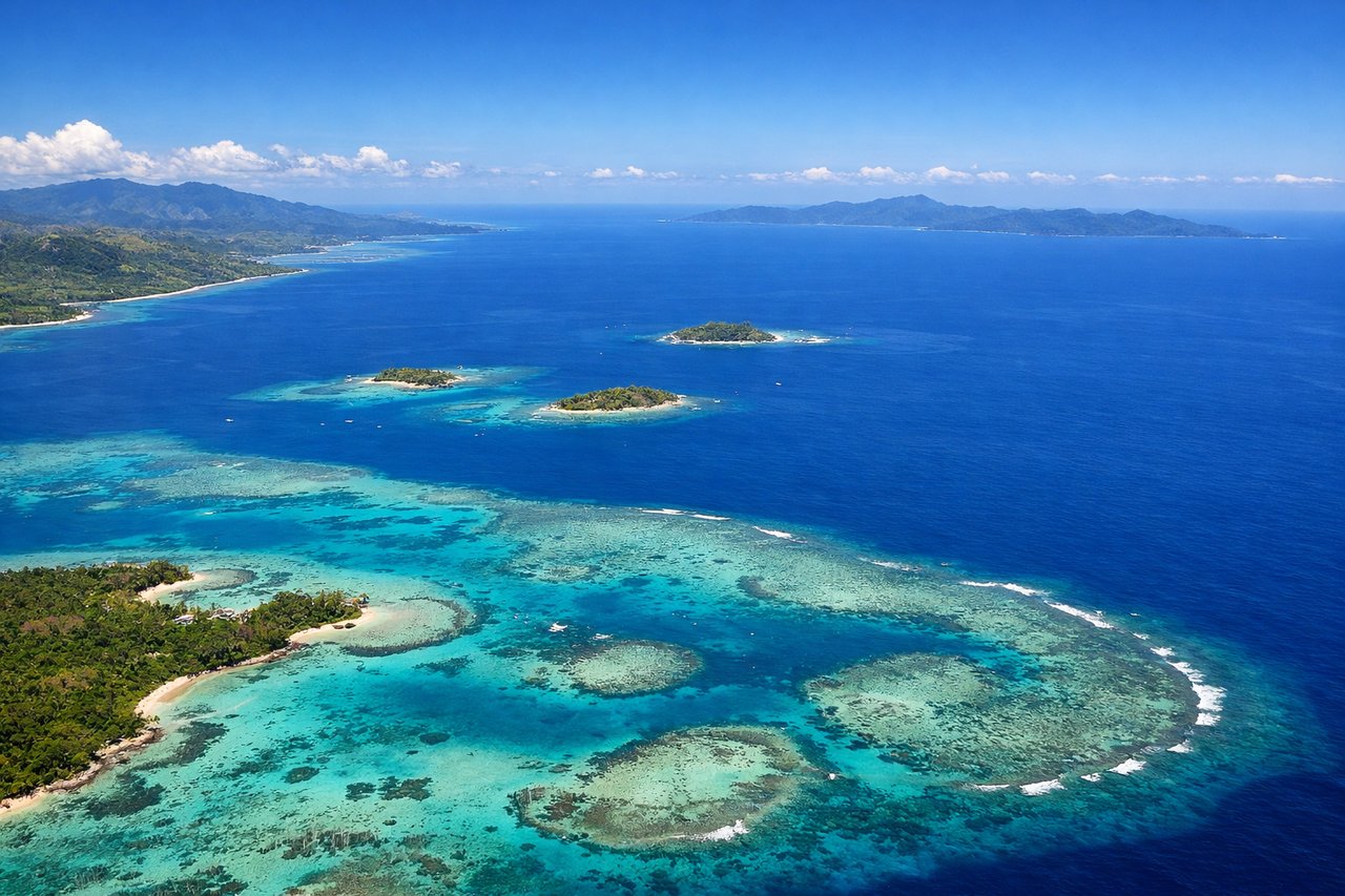
RIGHTNAN's primary runway 02/20 means departures heading roughly northeast give the right side views over the Mamanuca Islands and the Yasawa Island chain stretching northwest. The right side captures the vivid turquoise lagoons and reef systems of the Fijian archipelago as the aircraft climbs out over the Pacific.
Landing at JFK
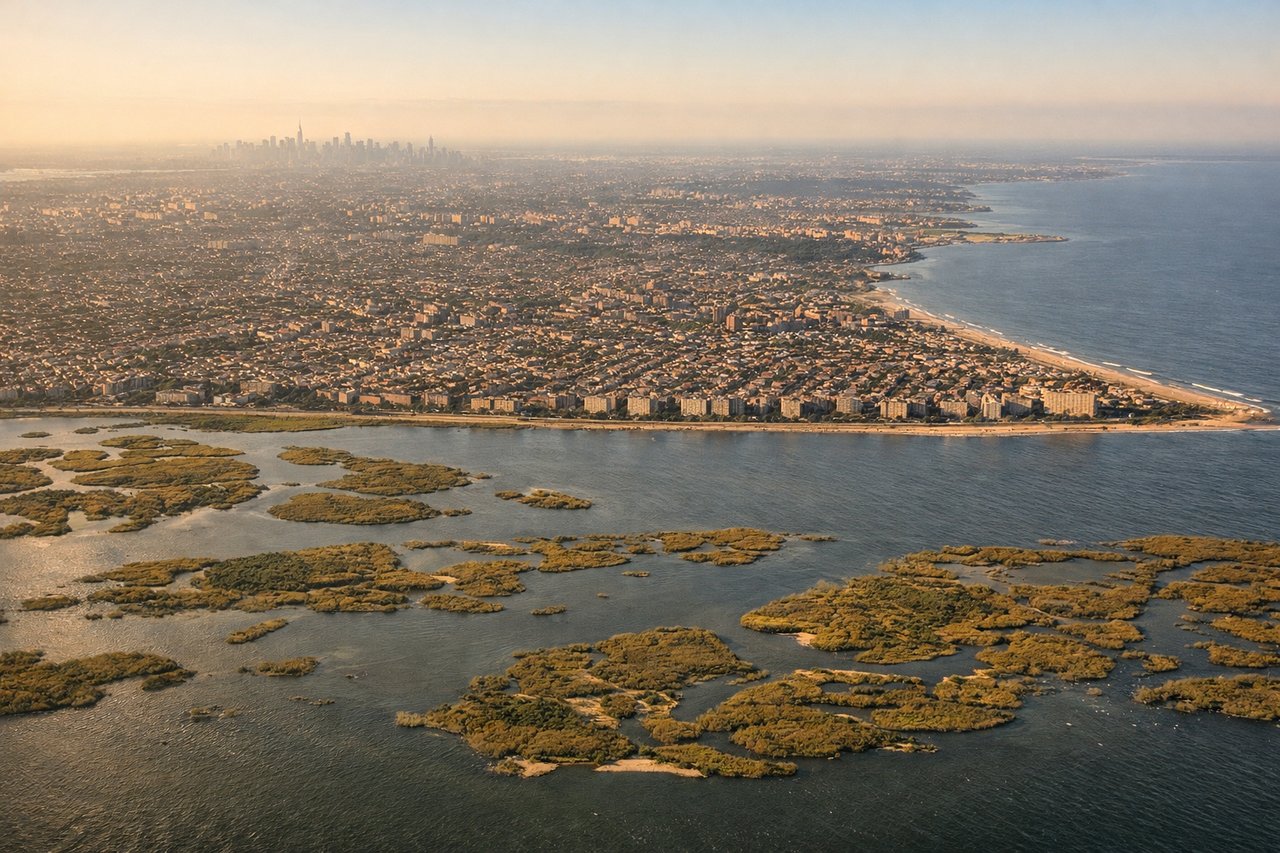
LEFTFlights from the Pacific typically approach JFK from the west or southwest, often over Long Island. The left side gives views of Lower Manhattan's skyline, the Verrazano-Narrows Bridge, and Jamaica Bay as the aircraft descends over the New York metro area.
Landmarks on this routeAll landmarks →
Will your flight be in sunlight?
See exactly which side of the plane gets sun and shade at your departure time.
About This Route
Which side of the plane should I sit on flying from Nadi International (NAN) to John F Kennedy International (JFK)?
Sit on the Right side of the plane for the best views on flights from Nandi to New York. The right side wins overall due to the spectacular Fijian island and reef scenery on departure, which is genuinely one of the most visually dramatic takeoff views in the Pacific. The landing views from the left are excellent but more familiar. For the bulk of the transpacific flight the views are open ocean regardless of side.
What can I see during takeoff from Nadi International in Nandi?
During takeoff from Nadi International (NAN), sit on the Right side for the best views. NAN's primary runway 02/20 means departures heading roughly northeast give the right side views over the Mamanuca Islands and the Yasawa Island chain stretching northwest. The right side captures the vivid turquoise lagoons and reef systems of the Fijian archipelago as the aircraft climbs out over the Pacific. Notable sights include: Mamanuca Islands reef lagoons, Yasawa Island chain, Viti Levu's interior highlands, Nadi Bay coastline.
What can I see when landing at John F Kennedy International in New York?
When landing at John F Kennedy International (JFK), sit on the Left side for the best views. Flights from the Pacific typically approach JFK from the west or southwest, often over Long Island. The left side gives views of Lower Manhattan's skyline, the Verrazano-Narrows Bridge, and Jamaica Bay as the aircraft descends over the New York metro area. Notable sights include: Lower Manhattan skyline, Jamaica Bay, Verrazano-Narrows Bridge, Long Island suburban grid.
How long is the flight from Nandi to New York?
The flight from Nadi International (NAN) to John F Kennedy International (JFK) takes Approximately 10-11 hours direct, though most routings connect via Honolulu or Los Angeles making total travel time 16-20 hours.
What does the Nandi to New York flight path pass over?
The great circle route from NAN to JFK tracks northeast across the central Pacific, passing north of Hawaii, crossing the US West Coast roughly over Northern California or Oregon, then traversing the continental US over Nevada, Utah, Colorado, the Great Plains, and the Midwest before descending into the Northeast. Mid-flight features include the Hawaiian Islands visible to the south if routing via that corridor, the Sierra Nevada and Rocky Mountain ranges visible during the continental crossing, and the Great Lakes region on approach to the East Coast.