The outbound climb from Nadi offers more dramatic and varied scenery—volcanic islands, reef patterns, and the Fiji archipelago—compared to the approach into Melbourne, which is primarily urban and suburban. The takeoff view is more geographically distinctive.
Flown NAN to MBW? Did we get it right?
Flight Path
Nandi to Melbourne is 2,399 miles (3,860 km), a flight of about 5 hours.
The flight path crosses the Tasman Sea, one of the world's largest open-ocean crossings. No significant landmarks are visible during the 2,000+ mile midpoint phase over open water. The route typically passes south of New Zealand's North Island (visible only on clear days as a distant landmass on the southern horizon around the 3-hour mark). The approach to Australia brings the Victorian coastline into view: the Gippsland Lakes region (a series of shallow lagoons) may be visible 60-80 miles east of Melbourne on clear days, followed by Port Phillip Bay as you descend toward Moorabbin.
Great circle distance and headings ›Phase by phase
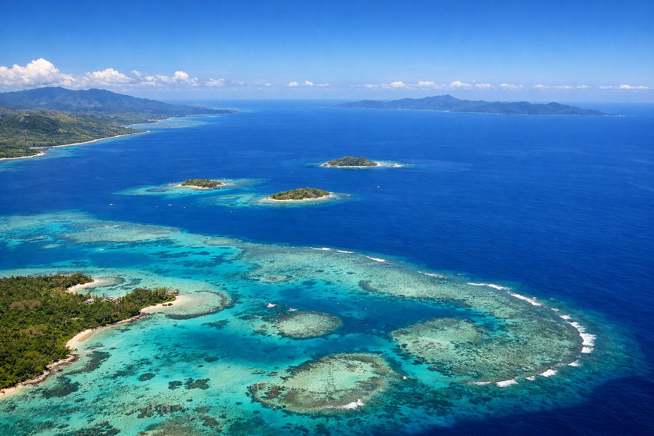
Takeoff from NAN
RIGHTRight-side seats capture the Fiji archipelago as you climb out westbound. You'll see Viti Levu's volcanic interior and the scattered islands of the Mamanuca Group receding beneath you, with the Coral Coast visible along the southern shore.
Landing at MBW
LEFTLeft-side seats on descent into Melbourne offer views of Port Phillip Bay, the Dandenong Ranges inland, and the city's sprawl. You'll see the bay's distinctive shape and the green ridge of the Dandenongs rising south of the urban area before final approach.
Will your flight be in sunlight?
Pick a date and time in the Sun Map to watch the sun move across your whole flight.
About This Route
Which side of the plane should I sit on flying from Nadi International (NAN) to Melbourne Moorabbin (MBW)?
Sit on the Right side of the plane for the best views on flights from Nandi to Melbourne. The outbound climb from Nadi offers more dramatic and varied scenery—volcanic islands, reef patterns, and the Fiji archipelago—compared to the approach into Melbourne, which is primarily urban and suburban. The takeoff view is more geographically distinctive.
What can I see during takeoff from Nadi International in Nandi?
During takeoff from Nadi International (NAN), sit on the Right side for the best views. Right-side seats capture the Fiji archipelago as you climb out westbound. You'll see Viti Levu's volcanic interior and the scattered islands of the Mamanuca Group receding beneath you, with the Coral Coast visible along the southern shore. Notable sights include: Viti Levu (main island with central highlands), Mamanuca Islands (small island chain west of Nadi), Coral Coast (southern coastline), Nadi Bay.
What can I see when landing at Melbourne Moorabbin in Melbourne?
When landing at Melbourne Moorabbin (MBW), sit on the Left side for the best views. Left-side seats on descent into Melbourne offer views of Port Phillip Bay, the Dandenong Ranges inland, and the city's sprawl. You'll see the bay's distinctive shape and the green ridge of the Dandenongs rising south of the urban area before final approach. Notable sights include: Port Phillip Bay (large enclosed bay), Dandenong Ranges (forested hills southeast of city), Melbourne CBD (urban grid visible from altitude), Yarra River (winding through city).
How long is the flight from Nandi to Melbourne?
The flight from Nadi International (NAN) to Melbourne Moorabbin (MBW) takes about 5 hours. The shortest flight path between them is 2,399 miles (3,860 km); winds and air traffic control usually add a few percent.
What does the Nandi to Melbourne flight path pass over?
The flight path crosses the Tasman Sea, one of the world's largest open-ocean crossings. No significant landmarks are visible during the 2,000+ mile midpoint phase over open water. The route typically passes south of New Zealand's North Island (visible only on clear days as a distant landmass on the southern horizon around the 3-hour mark). The approach to Australia brings the Victorian coastline into view: the Gippsland Lakes region (a series of shallow lagoons) may be visible 60-80 miles east of Melbourne on clear days, followed by Port Phillip Bay as you descend toward Moorabbin.