The right side wins because it captures the two most scenic moments of an otherwise ocean-dominated route: Fiji's reef-studded Mamanuca Islands during departure and Victoria's Gippsland coast, Port Phillip Bay, and Melbourne's skyline during arrival.
Flown NAN to MEL? Did we get it right?
Flight Path
Nandi to Melbourne is 2,402 miles (3,866 km), a flight of about 4 hours 55 minutes.
The mid-flight cruise is almost entirely over open Pacific and Tasman Sea waters with no land visible, until the Australian coastline near Gippsland comes into view during descent.
Great circle distance and headings ›Phase by phase
Takeoff from NAN
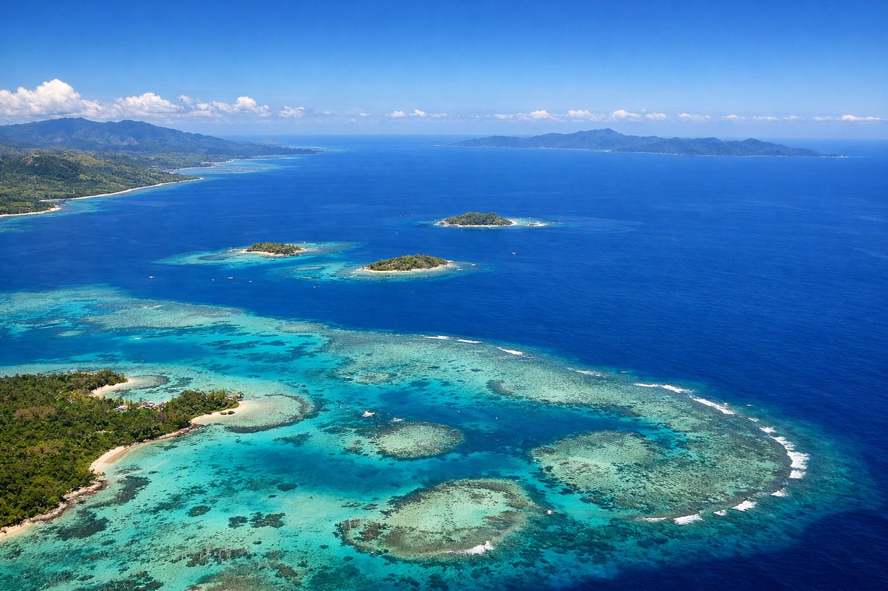
RIGHTClimbing out of Nadi on runway 20, the aircraft banks toward its southwest routing and passes over the turquoise lagoons and reef-fringed Mamanuca Islands just off Viti Levu's west coast. The left side mostly shows the island's forested interior peaks, which are quickly lost in cloud and haze.
Landing at MEL
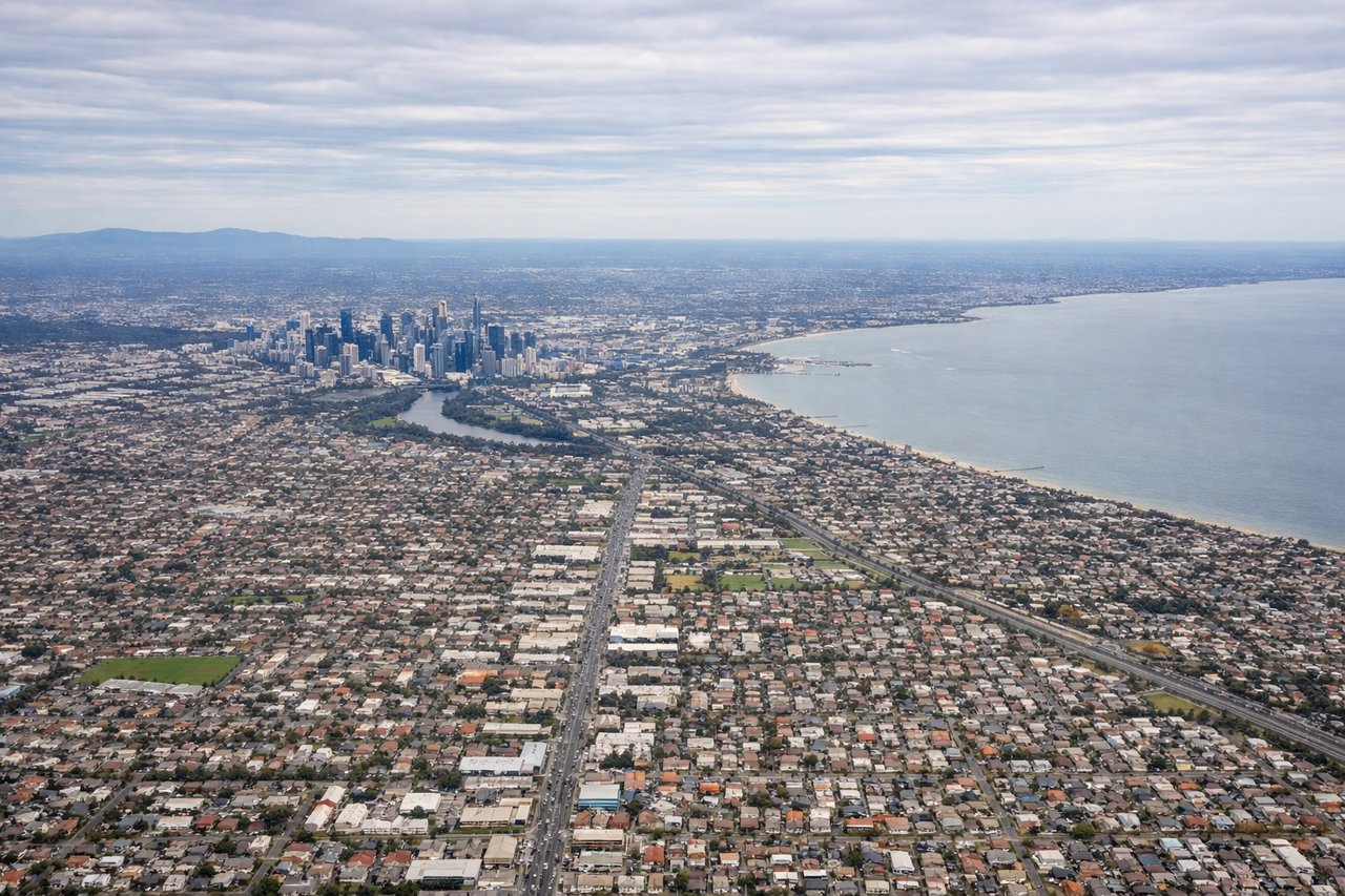
RIGHTArriving from the northeast, the descent path crosses Gippsland and curves past Wilsons Promontory before lining up over Port Phillip Bay, giving right-side passengers a view of the bay, the You Yangs hills, and Melbourne's skyline on final approach. The left side during this phase mostly overlooks flatter farmland with fewer distinct landmarks.
Will your flight be in sunlight?
Pick a date and time in the Sun Map to watch the sun move across your whole flight.
About This Route
Which side of the plane should I sit on flying from Nadi International (NAN) to Melbourne International (MEL)?
Sit on the Right side of the plane for the best views on flights from Nandi to Melbourne. The right side wins because it captures the two most scenic moments of an otherwise ocean-dominated route: Fiji's reef-studded Mamanuca Islands during departure and Victoria's Gippsland coast, Port Phillip Bay, and Melbourne's skyline during arrival.
What can I see during takeoff from Nadi International in Nandi?
During takeoff from Nadi International (NAN), sit on the Right side for the best views. Climbing out of Nadi on runway 20, the aircraft banks toward its southwest routing and passes over the turquoise lagoons and reef-fringed Mamanuca Islands just off Viti Levu's west coast. The left side mostly shows the island's forested interior peaks, which are quickly lost in cloud and haze. Notable sights include: Mamanuca Islands, Malolo Island, fringing coral reefs, Nadi coastline.
What can I see when landing at Melbourne International in Melbourne?
When landing at Melbourne International (MEL), sit on the Right side for the best views. Arriving from the northeast, the descent path crosses Gippsland and curves past Wilsons Promontory before lining up over Port Phillip Bay, giving right-side passengers a view of the bay, the You Yangs hills, and Melbourne's skyline on final approach. The left side during this phase mostly overlooks flatter farmland with fewer distinct landmarks. Notable sights include: Wilsons Promontory, Port Phillip Bay, You Yangs hills, Melbourne CBD skyline.
How long is the flight from Nandi to Melbourne?
The flight from Nadi International (NAN) to Melbourne International (MEL) takes about 4 hours 55 minutes. The shortest flight path between them is 2,402 miles (3,866 km); winds and air traffic control usually add a few percent.
What does the Nandi to Melbourne flight path pass over?
The mid-flight cruise is almost entirely over open Pacific and Tasman Sea waters with no land visible, until the Australian coastline near Gippsland comes into view during descent.