Both sides face nearly identical open-ocean cruise scenery, but the right side edges ahead because the Hawaii approach delivers a rare, dramatic combination of volcanic terrain, reef water, and city skyline right before touchdown, slightly outweighing the departure-side Fuji view.
Flight Path
Vast open North Pacific Ocean with no landmasses; the flight crosses the International Date Line roughly midway between Japan and Hawaii.
Great circle distance and headings ›


Phase by phase
Takeoff from NGO
LEFTClimbing out from Centrair over Ise Bay, the flight path curves east along Japan's southern coast, putting Mt. Fuji and the Japanese Alps on the north (left) side of the aircraft before the long ocean crossing begins.
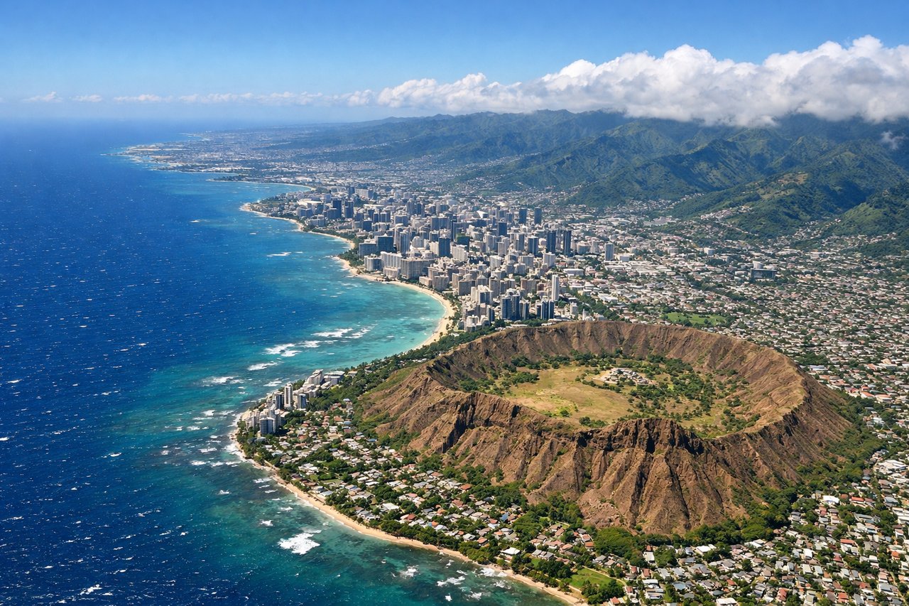
Landing at HNL
RIGHTArrivals into HNL typically approach from the west over Pearl Harbor before turning east to land on the Reef Runway, keeping Waikiki, Diamond Head, and the Honolulu skyline visible on the south (right) side during the final descent.
Landmarks on this routeAll landmarks →
Will your flight be in sunlight?
See exactly which side of the plane gets sun and shade at your departure time.
About This Route
Which side of the plane should I sit on flying from Chubu Centrair International Airport (NGO) to Honolulu International (HNL)?
Sit on the Right side of the plane for the best views on flights from Nagoya to Honolulu. Both sides face nearly identical open-ocean cruise scenery, but the right side edges ahead because the Hawaii approach delivers a rare, dramatic combination of volcanic terrain, reef water, and city skyline right before touchdown, slightly outweighing the departure-side Fuji view.
What can I see during takeoff from Chubu Centrair International Airport in Nagoya?
During takeoff from Chubu Centrair International Airport (NGO), sit on the Left side for the best views. Climbing out from Centrair over Ise Bay, the flight path curves east along Japan's southern coast, putting Mt. Fuji and the Japanese Alps on the north (left) side of the aircraft before the long ocean crossing begins. Notable sights include: Ise Bay, Shizuoka coastline, Mt. Fuji, Japanese Alps foothills.
What can I see when landing at Honolulu International in Honolulu?
When landing at Honolulu International (HNL), sit on the Right side for the best views. Arrivals into HNL typically approach from the west over Pearl Harbor before turning east to land on the Reef Runway, keeping Waikiki, Diamond Head, and the Honolulu skyline visible on the south (right) side during the final descent. Notable sights include: Pearl Harbor, Honolulu skyline, Diamond Head, Waikiki Beach.
How long is the flight from Nagoya to Honolulu?
The flight from Chubu Centrair International Airport (NGO) to Honolulu International (HNL) takes 7h 50m.
What does the Nagoya to Honolulu flight path pass over?
Vast open North Pacific Ocean with no landmasses; the flight crosses the International Date Line roughly midway between Japan and Hawaii.