Right side scores higher due to superior departure scenery (Reef Runway ocean takeoff with Diamond Head and Honolulu waterfront) and a more visually interesting approach (Ise Bay's complex coastline and Nagoya's industrial waterfront). Left side faces inland terrain on both ends with less dramatic landmarks. The cruise phase over the Pacific is equally unremarkable on both sides, but the bookend sequences favor the right.
Flown HNL to NGO? Did we get it right?
Flight Path
Honolulu to Nagoya is 4,018 miles (6,467 km), a flight of about 6 hours 45 minutes.
North Pacific open ocean (5+ hours of featureless water), occasional cumulus cloud formations, no visible land features between Hawaii and Japan. The flight path crosses the International Date Line and passes north of the Mariana Islands (not visible at cruise altitude). Approach to Japan brings views of the Izu Peninsula's volcanic ridges and Suruga Bay before descending into the Nagoya region.
Great circle distance and headings ›Phase by phase
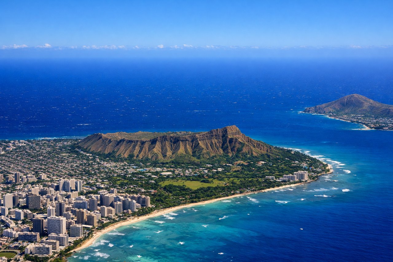
Takeoff from HNL
RIGHTRight side captures the Reef Runway departure over the Pacific, with views of Honolulu's urban waterfront, Diamond Head crater, and the Waianae Range receding inland. Left side faces the city and mountains but misses the dramatic ocean departure sequence.
Landing at NGO
RIGHTRight side offers the approach into Nagoya from the south over Ise Bay, with views of the bay's complex coastline, industrial waterfront, and the city's urban sprawl. Left side faces inland terrain with fewer distinctive landmarks during the descent and approach.
Will your flight be in sunlight?
Pick a date and time in the Sun Map to watch the sun move across your whole flight.
About This Route
Which side of the plane should I sit on flying from Honolulu International (HNL) to Chubu Centrair International Airport (NGO)?
Sit on the Right side of the plane for the best views on flights from Honolulu to Nagoya. Right side scores higher due to superior departure scenery (Reef Runway ocean takeoff with Diamond Head and Honolulu waterfront) and a more visually interesting approach (Ise Bay's complex coastline and Nagoya's industrial waterfront). Left side faces inland terrain on both ends with less dramatic landmarks. The cruise phase over the Pacific is equally unremarkable on both sides, but the bookend sequences favor the right.
What can I see during takeoff from Honolulu International in Honolulu?
During takeoff from Honolulu International (HNL), sit on the Right side for the best views. Right side captures the Reef Runway departure over the Pacific, with views of Honolulu's urban waterfront, Diamond Head crater, and the Waianae Range receding inland. Left side faces the city and mountains but misses the dramatic ocean departure sequence. Notable sights include: Diamond Head volcanic crater, Honolulu harbor and waterfront, Waianae mountain range, Pacific Ocean extending northeast.
What can I see when landing at Chubu Centrair International Airport in Nagoya?
When landing at Chubu Centrair International Airport (NGO), sit on the Right side for the best views. Right side offers the approach into Nagoya from the south over Ise Bay, with views of the bay's complex coastline, industrial waterfront, and the city's urban sprawl. Left side faces inland terrain with fewer distinctive landmarks during the descent and approach. Notable sights include: Ise Bay with its intricate shoreline and shipping channels, Nagoya's industrial waterfront and port facilities, Kiso River delta, Nobi Plain urban development.
How long is the flight from Honolulu to Nagoya?
The flight from Honolulu International (HNL) to Chubu Centrair International Airport (NGO) takes about 6 hours 45 minutes. The shortest flight path between them is 4,018 miles (6,467 km); winds and air traffic control usually add a few percent.
What does the Honolulu to Nagoya flight path pass over?
North Pacific open ocean (5+ hours of featureless water), occasional cumulus cloud formations, no visible land features between Hawaii and Japan. The flight path crosses the International Date Line and passes north of the Mariana Islands (not visible at cruise altitude). Approach to Japan brings views of the Izu Peninsula's volcanic ridges and Suruga Bay before descending into the Nagoya region.