The left side captures the dramatic Tokyo Bay departure and, critically, offers better views of the Siberian river systems and Lake Baikal during the cruise portion of the polar-adjacent routing. The Helsinki arrival on the right is strong, but the cumulative left-side geography across the full flight edges it out.
Flight Path
The route tracks northwestward over Hokkaido, crosses Sakhalin Island and the Russian Far East, then transits the vast Siberian taiga over Yakutia. Lake Baikal may be visible depending on exact routing — it appears as an enormous elongated dark blue body of water in an otherwise featureless forested plain. The flight then crosses western Siberia, the Ural Mountains (a low, broad ridge barely distinguishable from altitude), and the Baltic states before descending into Finland.
Great circle distance and headings ›

Phase by phase
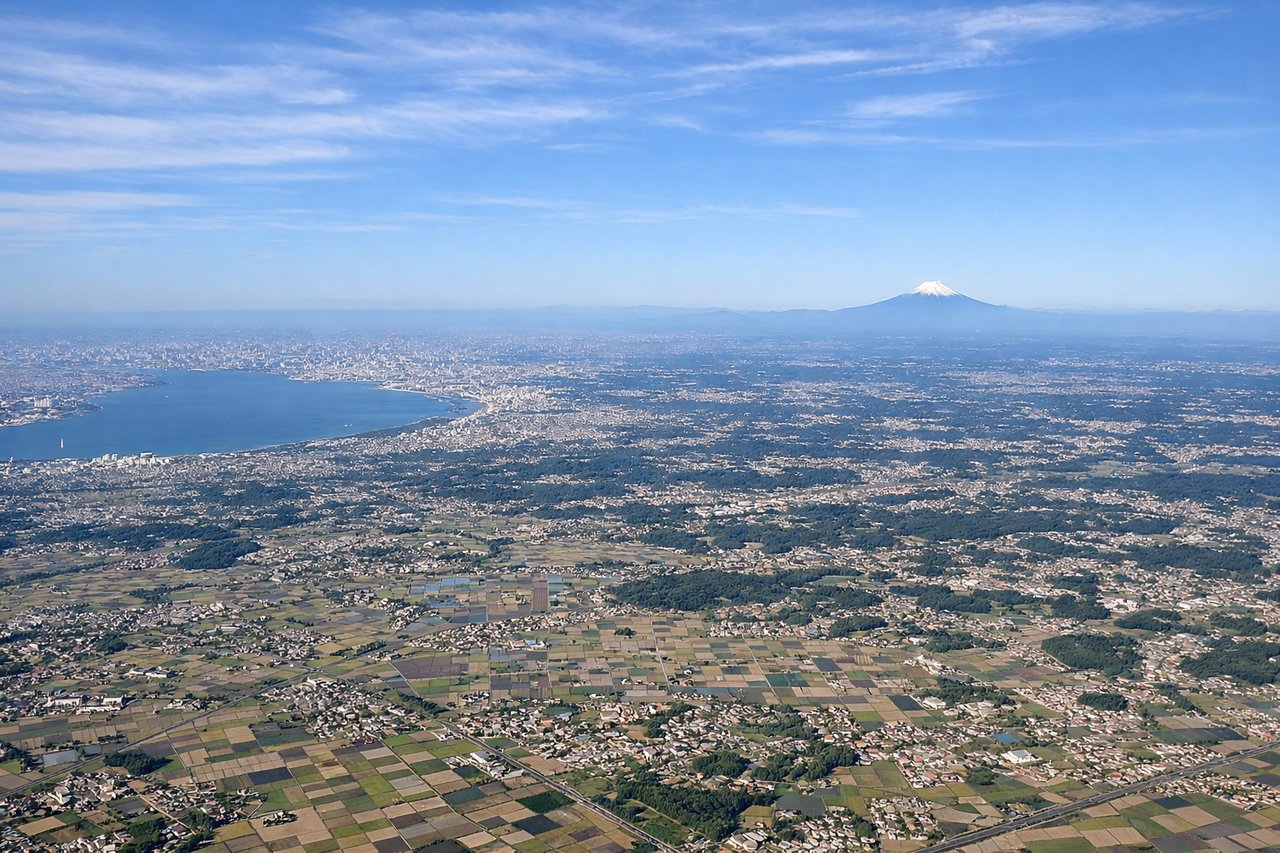
Takeoff from NRT
LEFTNRT departures on runway 34L/34R head roughly northward, placing Tokyo Bay and the urban sprawl of greater Tokyo on the left (west) side. You get a clear view of the bay's geometry and the dense city grid stretching toward the horizon.
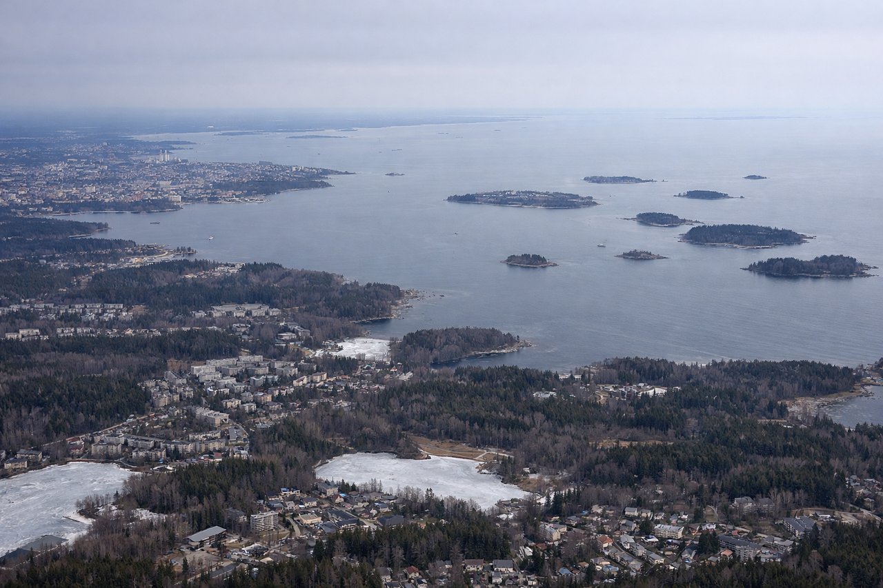
Landing at HEL
RIGHTHelsinki Vantaa typically uses runways 22L/22R or 04R/04L depending on wind. On the common southwesterly approach (runway 22), the right side faces southeast, giving views over the Helsinki city peninsula, the South Harbor, and the island-studded Gulf of Finland archipelago. This is the more visually interesting side.
Landmarks on this routeAll landmarks →
Will your flight be in sunlight?
See exactly which side of the plane gets sun and shade at your departure time.
About This Route
Which side of the plane should I sit on flying from New Tokyo International (NRT) to Helsinki Vantaa (HEL)?
Sit on the Left side of the plane for the best views on flights from Tokyo to Helsinki. The left side captures the dramatic Tokyo Bay departure and, critically, offers better views of the Siberian river systems and Lake Baikal during the cruise portion of the polar-adjacent routing. The Helsinki arrival on the right is strong, but the cumulative left-side geography across the full flight edges it out.
What can I see during takeoff from New Tokyo International in Tokyo?
During takeoff from New Tokyo International (NRT), sit on the Left side for the best views. NRT departures on runway 34L/34R head roughly northward, placing Tokyo Bay and the urban sprawl of greater Tokyo on the left (west) side. You get a clear view of the bay's geometry and the dense city grid stretching toward the horizon. Notable sights include: Tokyo Bay, Chiba urban grid, Tokyo city center skyline in the distance, Narita city below.
What can I see when landing at Helsinki Vantaa in Helsinki?
When landing at Helsinki Vantaa (HEL), sit on the Right side for the best views. Helsinki Vantaa typically uses runways 22L/22R or 04R/04L depending on wind. On the common southwesterly approach (runway 22), the right side faces southeast, giving views over the Helsinki city peninsula, the South Harbor, and the island-studded Gulf of Finland archipelago. This is the more visually interesting side. Notable sights include: Helsinki city peninsula and South Harbor, Gulf of Finland archipelago, Suomenlinna sea fortress island, Helsinki urban grid.
How long is the flight from Tokyo to Helsinki?
The flight from New Tokyo International (NRT) to Helsinki Vantaa (HEL) takes Approximately 9.5 to 10.5 hours.
What does the Tokyo to Helsinki flight path pass over?
The route tracks northwestward over Hokkaido, crosses Sakhalin Island and the Russian Far East, then transits the vast Siberian taiga over Yakutia. Lake Baikal may be visible depending on exact routing — it appears as an enormous elongated dark blue body of water in an otherwise featureless forested plain. The flight then crosses western Siberia, the Ural Mountains (a low, broad ridge barely distinguishable from altitude), and the Baltic states before descending into Finland.