The left side wins at takeoff with Fuji and Tokyo Bay, but the right side delivers the spectacular Port Phillip Bay arrival into Melbourne, which is one of the more visually rewarding urban approaches in the Southern Hemisphere. Over the mid-flight ocean crossing there is little to differentiate sides, so the Melbourne arrival tips the balance to the right.
Flown NRT to MEL? Did we get it right?
Flight Path
Tokyo to Melbourne is 5,082 miles (8,179 km), a flight of about 9 hours 30 minutes.
The route tracks south-southwest from Narita, crossing the Philippine Sea and passing east of the Philippines. It then crosses the Coral Sea east of Queensland, passing over or near the Great Barrier Reef region at altitude before descending over New South Wales and into Victoria. The Tasman Sea crossing and the flat Murray-Darling basin are the dominant mid-flight features, with the Australian coastline appearing roughly an hour before landing.
Great circle distance and headings ›

Phase by phase
Takeoff from NRT
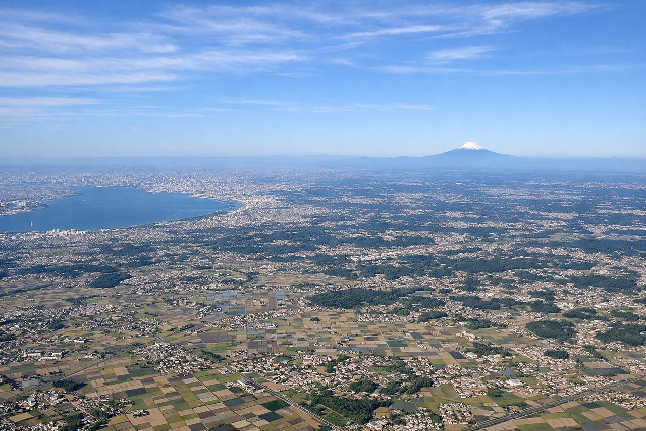
LEFTNRT departures heading south on runway 16L/16R put Tokyo Bay and the Boso Peninsula on the left side. You get a clear view of the bay's broad expanse and the urban sprawl of greater Tokyo receding to the northwest. Mount Fuji, roughly 100km to the southwest, appears as a distant snow-capped cone on the horizon as the aircraft turns south.
Landing at MEL
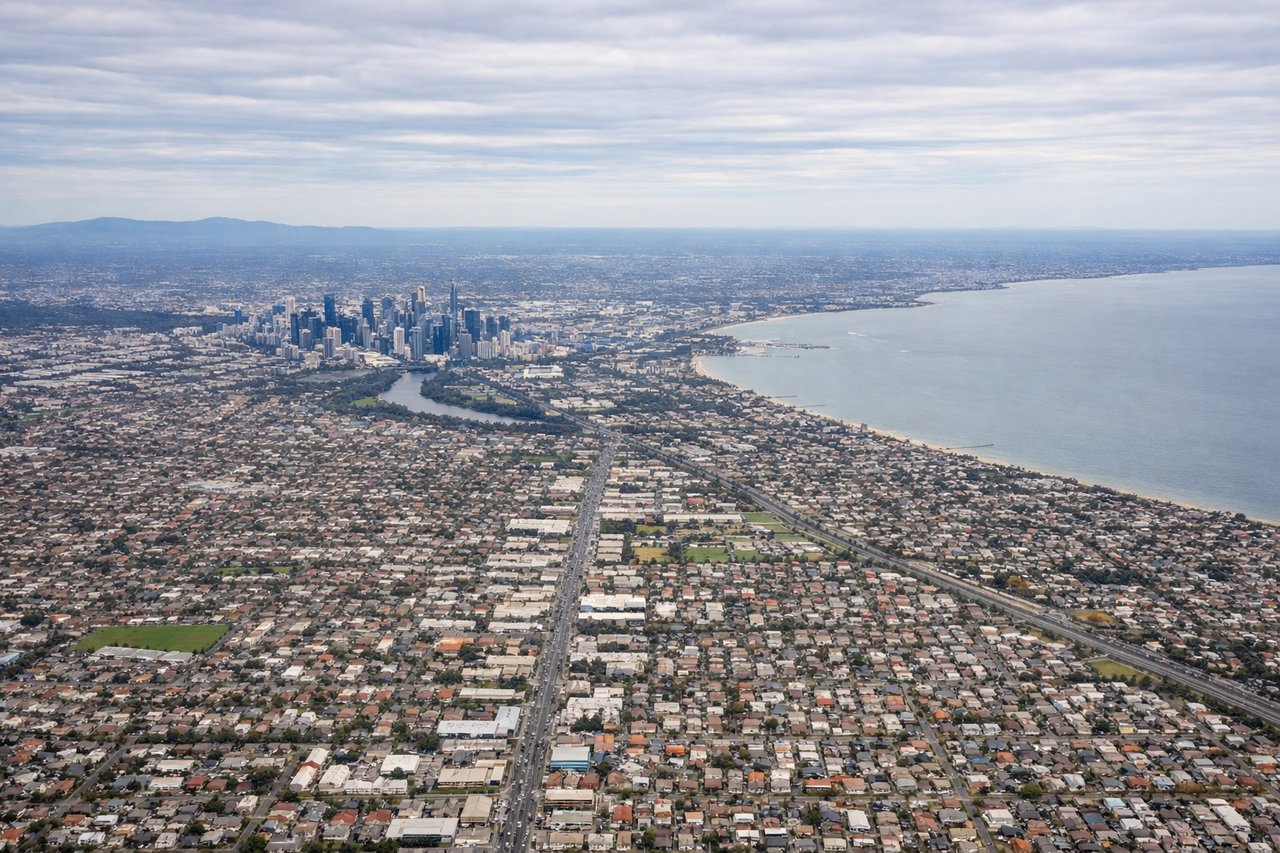
RIGHTMelbourne Airport (YMML) approaches from the north on runway 34 put Port Phillip Bay on the right side during descent. You get a sweeping view of the bay's distinctive horseshoe shape, the Mornington Peninsula, and the Melbourne CBD skyline clustered at the bay's northern end. The Dandenong Ranges are visible to the east on the left side but the bay view is far more dramatic.
Will your flight be in sunlight?
Pick a date and time in the Sun Map to watch the sun move across your whole flight.
About This Route
Which side of the plane should I sit on flying from New Tokyo International (NRT) to Melbourne International (MEL)?
Sit on the Right side of the plane for the best views on flights from Tokyo to Melbourne. The left side wins at takeoff with Fuji and Tokyo Bay, but the right side delivers the spectacular Port Phillip Bay arrival into Melbourne, which is one of the more visually rewarding urban approaches in the Southern Hemisphere. Over the mid-flight ocean crossing there is little to differentiate sides, so the Melbourne arrival tips the balance to the right.
What can I see during takeoff from New Tokyo International in Tokyo?
During takeoff from New Tokyo International (NRT), sit on the Left side for the best views. NRT departures heading south on runway 16L/16R put Tokyo Bay and the Boso Peninsula on the left side. You get a clear view of the bay's broad expanse and the urban sprawl of greater Tokyo receding to the northwest. Mount Fuji, roughly 100km to the southwest, appears as a distant snow-capped cone on the horizon as the aircraft turns south. Notable sights include: Tokyo Bay, Mount Fuji (distant, southwest horizon), Boso Peninsula coastline, Chiba urban grid.
What can I see when landing at Melbourne International in Melbourne?
When landing at Melbourne International (MEL), sit on the Right side for the best views. Melbourne Airport (YMML) approaches from the north on runway 34 put Port Phillip Bay on the right side during descent. You get a sweeping view of the bay's distinctive horseshoe shape, the Mornington Peninsula, and the Melbourne CBD skyline clustered at the bay's northern end. The Dandenong Ranges are visible to the east on the left side but the bay view is far more dramatic. Notable sights include: Port Phillip Bay, Melbourne CBD skyline, Mornington Peninsula, Werribee plains.
How long is the flight from Tokyo to Melbourne?
The flight from New Tokyo International (NRT) to Melbourne International (MEL) takes about 9 hours 30 minutes. The shortest flight path between them is 5,082 miles (8,179 km); winds and air traffic control usually add a few percent.
What does the Tokyo to Melbourne flight path pass over?
The route tracks south-southwest from Narita, crossing the Philippine Sea and passing east of the Philippines. It then crosses the Coral Sea east of Queensland, passing over or near the Great Barrier Reef region at altitude before descending over New South Wales and into Victoria. The Tasman Sea crossing and the flat Murray-Darling basin are the dominant mid-flight features, with the Australian coastline appearing roughly an hour before landing.