Oakland to Kona is 2,377 miles (3,825 km), a flight of about 5 hours 15 minutes.
While the takeoff offers Bay Area geography, the landing provides more dramatic and visually distinctive volcanic scenery. The Kona coast's dark lava fields and ocean views are more striking than the relatively flat East Bay departure.
Flight Path
The flight path crosses the Pacific Ocean for roughly 2,000 miles. After clearing the California coast, you'll be over open ocean with no visible landmarks. As you approach Hawaii, the Big Island's profile becomes visible—Mauna Kea and Mauna Loa dominate the skyline as massive, snow-capped volcanic peaks (visible from 30,000+ feet on clear days). The descent toward Kona brings the western lava fields and Hualalai volcano into view.
Great circle distance and headings ›

Phase by phase
Takeoff from OAK
LEFTLeft side offers views of the San Francisco Bay and surrounding geography as the aircraft climbs southwestward. You'll see the bay's eastern shoreline, the Oakland Hills, and the broader Bay Area topography receding beneath you.
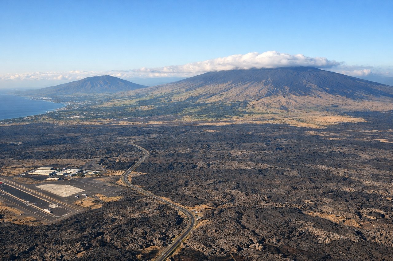
Landing at KOA
RIGHTRight side provides views of the Big Island's western coast and volcanic landscape as you descend toward Kona. You'll see the Kona coast's dark lava fields, the ocean, and the island's volcanic terrain in detail during final approach.
Landmarks on this routeAll landmarks →
Will your flight be in sunlight?
Pick a date and time in the Sun Map to watch the sun move across your whole flight.
About This Route
Which side of the plane should I sit on flying from Metropolitan Oakland International (OAK) to Kona International At Keahole (KOA)?
Sit on the Right side of the plane for the best views on flights from Oakland to Kona. While the takeoff offers Bay Area geography, the landing provides more dramatic and visually distinctive volcanic scenery. The Kona coast's dark lava fields and ocean views are more striking than the relatively flat East Bay departure.
What can I see during takeoff from Metropolitan Oakland International in Oakland?
During takeoff from Metropolitan Oakland International (OAK), sit on the Left side for the best views. Left side offers views of the San Francisco Bay and surrounding geography as the aircraft climbs southwestward. You'll see the bay's eastern shoreline, the Oakland Hills, and the broader Bay Area topography receding beneath you. Notable sights include: San Francisco Bay, Oakland Hills, Mount Diablo (distant, southeast), Livermore Valley.
What can I see when landing at Kona International At Keahole in Kona?
When landing at Kona International At Keahole (KOA), sit on the Right side for the best views. Right side provides views of the Big Island's western coast and volcanic landscape as you descend toward Kona. You'll see the Kona coast's dark lava fields, the ocean, and the island's volcanic terrain in detail during final approach. Notable sights include: Kona coast lava fields, Pacific Ocean, Hualalai volcano slopes, Kailua-Kona town.
How long is the flight from Oakland to Kona?
The flight from Metropolitan Oakland International (OAK) to Kona International At Keahole (KOA) takes about 5 hours 15 minutes. The shortest flight path between them is 2,377 miles (3,825 km); winds and air traffic control usually add a few percent.
What does the Oakland to Kona flight path pass over?
The flight path crosses the Pacific Ocean for roughly 2,000 miles. After clearing the California coast, you'll be over open ocean with no visible landmarks. As you approach Hawaii, the Big Island's profile becomes visible—Mauna Kea and Mauna Loa dominate the skyline as massive, snow-capped volcanic peaks (visible from 30,000+ feet on clear days). The descent toward Kona brings the western lava fields and Hualalai volcano into view.