Oakland to Seattle is 672 miles (1,082 km), a flight of about 1 hour 55 minutes.
The right side delivers a near-continuous view of the Cascade volcanic chain during cruise — Mount Shasta, Mount McLoughlin, and eventually Mount Rainier on approach — while the left side cruise view is mostly flat Sacramento and Willamette Valley farmland, only picking up interest again with Puget Sound near landing.
Flight Path
Sacramento Valley, Mount Shasta and the southern Cascades, Rogue Valley of southern Oregon, Willamette Valley, and the Cascade foothills of southern Washington before descending toward Puget Sound
Great circle distance and headings ›


Phase by phase
Takeoff from OAK
LEFTDeparting OAK on the westerly runway, the initial climb and turn north put San Francisco Bay right outside the left windows, with the city skyline, Bay Bridge, and Golden Gate visible across the water before the aircraft settles north. The right side only shows the East Bay hills, which is far less distinctive.
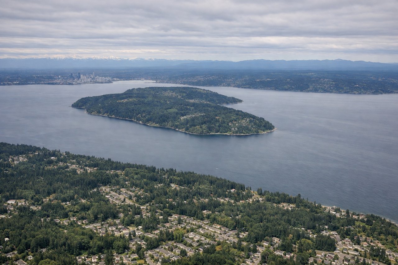
Landing at SEA
RIGHTOn the descent into SEA from the south, the approach path runs west of the Cascade foothills, putting Mount Rainier's snow-capped summit clearly visible off the right side before the final turn to the runway. The left side mainly shows Puget Sound water and the distant, lower-profile Olympic Mountains.
Landmarks on this routeAll landmarks →
Will your flight be in sunlight?
Pick a date and time in the Sun Map to watch the sun move across your whole flight.
About This Route
Which side of the plane should I sit on flying from Metropolitan Oakland International (OAK) to Seattle Tacoma International (SEA)?
Sit on the Right side of the plane for the best views on flights from Oakland to Seattle. The right side delivers a near-continuous view of the Cascade volcanic chain during cruise — Mount Shasta, Mount McLoughlin, and eventually Mount Rainier on approach — while the left side cruise view is mostly flat Sacramento and Willamette Valley farmland, only picking up interest again with Puget Sound near landing.
What can I see during takeoff from Metropolitan Oakland International in Oakland?
During takeoff from Metropolitan Oakland International (OAK), sit on the Left side for the best views. Departing OAK on the westerly runway, the initial climb and turn north put San Francisco Bay right outside the left windows, with the city skyline, Bay Bridge, and Golden Gate visible across the water before the aircraft settles north. The right side only shows the East Bay hills, which is far less distinctive. Notable sights include: San Francisco skyline, Bay Bridge, Golden Gate Bridge, San Francisco Bay.
What can I see when landing at Seattle Tacoma International in Seattle?
When landing at Seattle Tacoma International (SEA), sit on the Right side for the best views. On the descent into SEA from the south, the approach path runs west of the Cascade foothills, putting Mount Rainier's snow-capped summit clearly visible off the right side before the final turn to the runway. The left side mainly shows Puget Sound water and the distant, lower-profile Olympic Mountains. Notable sights include: Mount Rainier, Cascade foothills, Puyallup River valley, Puget Sound lowlands.
How long is the flight from Oakland to Seattle?
The flight from Metropolitan Oakland International (OAK) to Seattle Tacoma International (SEA) takes about 1 hour 55 minutes. The shortest flight path between them is 672 miles (1,082 km); winds and air traffic control usually add a few percent.
What does the Oakland to Seattle flight path pass over?
Sacramento Valley, Mount Shasta and the southern Cascades, Rogue Valley of southern Oregon, Willamette Valley, and the Cascade foothills of southern Washington before descending toward Puget Sound