Seattle to Oakland is 672 miles (1,082 km), a flight of about 2 hours 10 minutes.
The left side wins overall because the SEA-OAK route tracks almost directly beneath the Cascade volcanic chain, giving passengers a rare procession of named peaks - Rainier, St. Helens, Hood, and eventually Shasta - visible one after another through the cruise phase. That sustained mountain drama outweighs the shorter, though excellent, bay view on landing.
Flight Path
Around the midpoint the flight passes over southern Oregon and into northern California, tracking near the Cascade-Siskiyou transition with Mount Shasta's volcanic cone often visible ahead before the terrain flattens into the northern Sacramento Valley.
Great circle distance and headings ›


Phase by phase
Takeoff from SEA
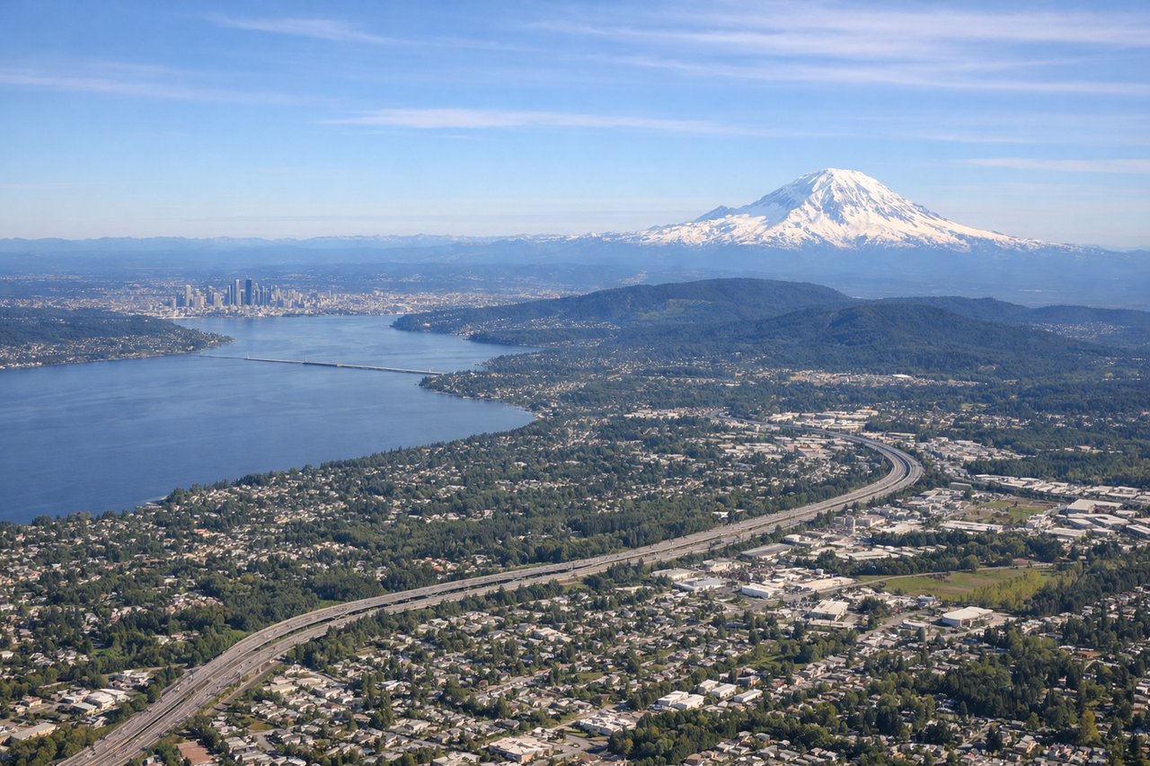
LEFTDeparting SEA to the south, Mount Rainier dominates the eastern skyline almost immediately after liftoff, with the forested Cascade foothills and Tacoma's harbor spreading out below. It's one of the most photographed climb-out views in North America.
Landing at OAK
RIGHTOn approach into Oakland from the north, the turn toward the westerly runways swings the aircraft out over San Francisco Bay, putting the San Francisco skyline, the Bay Bridge, and Alcatraz Island in clear view on the right side. It's a classic Bay Area arrival shot.
Landmarks on this routeAll landmarks →
Will your flight be in sunlight?
Pick a date and time in the Sun Map to watch the sun move across your whole flight.
About This Route
Which side of the plane should I sit on flying from Seattle Tacoma International (SEA) to Metropolitan Oakland International (OAK)?
Sit on the Left side of the plane for the best views on flights from Seattle to Oakland. The left side wins overall because the SEA-OAK route tracks almost directly beneath the Cascade volcanic chain, giving passengers a rare procession of named peaks - Rainier, St. Helens, Hood, and eventually Shasta - visible one after another through the cruise phase. That sustained mountain drama outweighs the shorter, though excellent, bay view on landing.
What can I see during takeoff from Seattle Tacoma International in Seattle?
During takeoff from Seattle Tacoma International (SEA), sit on the Left side for the best views. Departing SEA to the south, Mount Rainier dominates the eastern skyline almost immediately after liftoff, with the forested Cascade foothills and Tacoma's harbor spreading out below. It's one of the most photographed climb-out views in North America. Notable sights include: Mount Rainier, Tacoma and Commencement Bay, Cascade foothills, Mount St. Helens in the distance.
What can I see when landing at Metropolitan Oakland International in Oakland?
When landing at Metropolitan Oakland International (OAK), sit on the Right side for the best views. On approach into Oakland from the north, the turn toward the westerly runways swings the aircraft out over San Francisco Bay, putting the San Francisco skyline, the Bay Bridge, and Alcatraz Island in clear view on the right side. It's a classic Bay Area arrival shot. Notable sights include: San Francisco skyline, Golden Gate Bridge, Bay Bridge, Alcatraz Island.
How long is the flight from Seattle to Oakland?
The flight from Seattle Tacoma International (SEA) to Metropolitan Oakland International (OAK) takes about 2 hours 10 minutes. The shortest flight path between them is 672 miles (1,082 km); winds and air traffic control usually add a few percent.
What does the Seattle to Oakland flight path pass over?
Around the midpoint the flight passes over southern Oregon and into northern California, tracking near the Cascade-Siskiyou transition with Mount Shasta's volcanic cone often visible ahead before the terrain flattens into the northern Sacramento Valley.