While takeoff offers bay views, the landing descent provides more sustained and dramatic scenery of the Santa Cruz Mountains and Santa Clara Valley. The right side captures the most visually distinctive features of this short route.
Flown OAK to SJC? Did we get it right?
Flight Path
Oakland to San Jose is 29 miles (47 km), a flight of about 15 minutes.
San Francisco Bay (southern portion), Hayward/Fremont area, Coyote Creek marshlands, transition from East Bay hills to Santa Cruz Mountains
Great circle distance and headings ›Phase by phase
Takeoff from OAK
LEFTLeft side offers immediate views of the San Francisco Bay shoreline, the Oakland Hills ridge, and the East Bay urban sprawl. Right side faces inland toward less visually distinctive terrain.
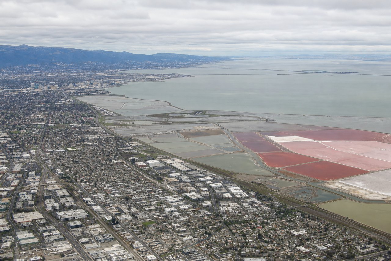
Landing at SJC
RIGHTRight side provides views of the Santa Cruz Mountains, the southern San Francisco Bay shoreline, and the Santa Clara Valley as the aircraft descends into San Jose. Left side faces the East Bay hills with less distinctive scenery for this approach.
Will your flight be in sunlight?
Pick a date and time in the Sun Map to watch the sun move across your whole flight.
About This Route
Which side of the plane should I sit on flying from Metropolitan Oakland International (OAK) to Norman Y Mineta San Jose International (SJC)?
Sit on the Right side of the plane for the best views on flights from Oakland to San Jose. While takeoff offers bay views, the landing descent provides more sustained and dramatic scenery of the Santa Cruz Mountains and Santa Clara Valley. The right side captures the most visually distinctive features of this short route.
What can I see during takeoff from Metropolitan Oakland International in Oakland?
During takeoff from Metropolitan Oakland International (OAK), sit on the Left side for the best views. Left side offers immediate views of the San Francisco Bay shoreline, the Oakland Hills ridge, and the East Bay urban sprawl. Right side faces inland toward less visually distinctive terrain. Notable sights include: San Francisco Bay (western boundary), Oakland Hills (eastern ridge), Hayward/Fremont urban corridor (south), Mount Diablo (distant, 50+ miles southeast on horizon).
What can I see when landing at Norman Y Mineta San Jose International in San Jose?
When landing at Norman Y Mineta San Jose International (SJC), sit on the Right side for the best views. Right side provides views of the Santa Cruz Mountains, the southern San Francisco Bay shoreline, and the Santa Clara Valley as the aircraft descends into San Jose. Left side faces the East Bay hills with less distinctive scenery for this approach. Notable sights include: Santa Cruz Mountains (western ridge), San Francisco Bay southern arm (Coyote Creek and marshlands), Santa Clara Valley urban grid, Diablo Range foothills (eastern background).
How long is the flight from Oakland to San Jose?
The flight from Metropolitan Oakland International (OAK) to Norman Y Mineta San Jose International (SJC) takes about 15 minutes. The shortest flight path between them is 29 miles (47 km); winds and air traffic control usually add a few percent.
What does the Oakland to San Jose flight path pass over?
San Francisco Bay (southern portion), Hayward/Fremont area, Coyote Creek marshlands, transition from East Bay hills to Santa Cruz Mountains