While the right side wins at takeoff for Okinawa's reef and coastal views, the left side delivers the more dramatic payoff: the full panorama of central Tokyo on approach to Haneda is one of the most visually striking urban arrivals in Asia. Left also gives views of the Ryukyu island chain and Pacific coastline of Kyushu during the cruise portion.
Flight Path
The flight tracks northeast over the Ryukyu island chain — Amami Oshima is clearly visible as a large forested island roughly an hour in. The route then crosses the Tokara Strait and the southern tip of Kyushu, where Kagoshima Bay and the active volcano Sakurajima are visible on the left side. The final portion crosses Shikoku and the Kii Peninsula before descending over the Kanto Plain toward Tokyo Bay.
Great circle distance and headings ›

Phase by phase
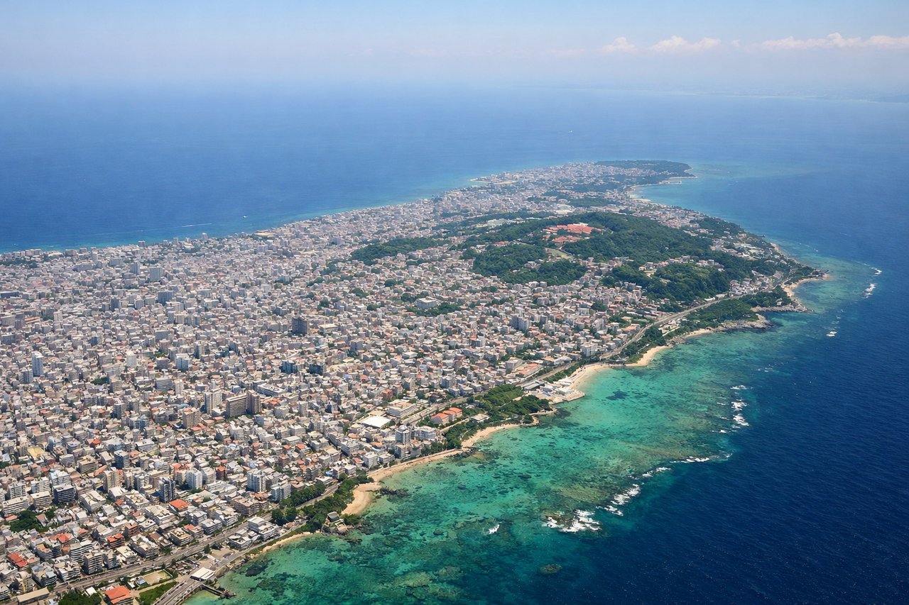
Takeoff from OKA
RIGHTNaha Airport's primary departure runway 18 heads south, then aircraft turn northeast toward Tokyo. The right side gives you views over Naha city, the historic Shuri Castle area, and the southern Okinawa coastline with its distinctive turquoise reef systems. The left side faces mostly open East China Sea.
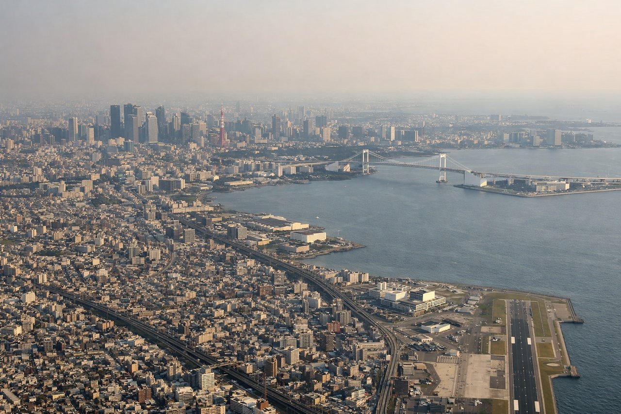
Landing at HND
LEFTHaneda Airport sits on reclaimed land on Tokyo Bay's western shore. Runway 34L approaches from the south over the bay, and the left side gives a direct view of central Tokyo — the dense skyscraper clusters of Shinjuku and Shibuya, Tokyo Tower, and the broader Kanto Plain stretching inland. The right side faces mostly Tokyo Bay water.
Landmarks on this routeAll landmarks →
Will your flight be in sunlight?
See exactly which side of the plane gets sun and shade at your departure time.
About This Route
Which side of the plane should I sit on flying from Naha (OKA) to Tokyo International (HND)?
Sit on the Left side of the plane for the best views on flights from Naha to Tokyo. While the right side wins at takeoff for Okinawa's reef and coastal views, the left side delivers the more dramatic payoff: the full panorama of central Tokyo on approach to Haneda is one of the most visually striking urban arrivals in Asia. Left also gives views of the Ryukyu island chain and Pacific coastline of Kyushu during the cruise portion.
What can I see during takeoff from Naha in Naha?
During takeoff from Naha (OKA), sit on the Right side for the best views. Naha Airport's primary departure runway 18 heads south, then aircraft turn northeast toward Tokyo. The right side gives you views over Naha city, the historic Shuri Castle area, and the southern Okinawa coastline with its distinctive turquoise reef systems. The left side faces mostly open East China Sea. Notable sights include: Shuri Castle district, southern Okinawa reef systems, Naha urban waterfront, Kerama Islands to the southwest.
What can I see when landing at Tokyo International in Tokyo?
When landing at Tokyo International (HND), sit on the Left side for the best views. Haneda Airport sits on reclaimed land on Tokyo Bay's western shore. Runway 34L approaches from the south over the bay, and the left side gives a direct view of central Tokyo — the dense skyscraper clusters of Shinjuku and Shibuya, Tokyo Tower, and the broader Kanto Plain stretching inland. The right side faces mostly Tokyo Bay water. Notable sights include: Tokyo Tower, Shinjuku skyscraper cluster, Tokyo Bay waterfront, Rainbow Bridge.
How long is the flight from Naha to Tokyo?
The flight from Naha (OKA) to Tokyo International (HND) takes Approximately 2 hours 20 minutes.
What does the Naha to Tokyo flight path pass over?
The flight tracks northeast over the Ryukyu island chain — Amami Oshima is clearly visible as a large forested island roughly an hour in. The route then crosses the Tokara Strait and the southern tip of Kyushu, where Kagoshima Bay and the active volcano Sakurajima are visible on the left side. The final portion crosses Shikoku and the Kii Peninsula before descending over the Kanto Plain toward Tokyo Bay.